Davis Mountain Topo Map Montana
To zoom in, hover over the map of Davis Mountain
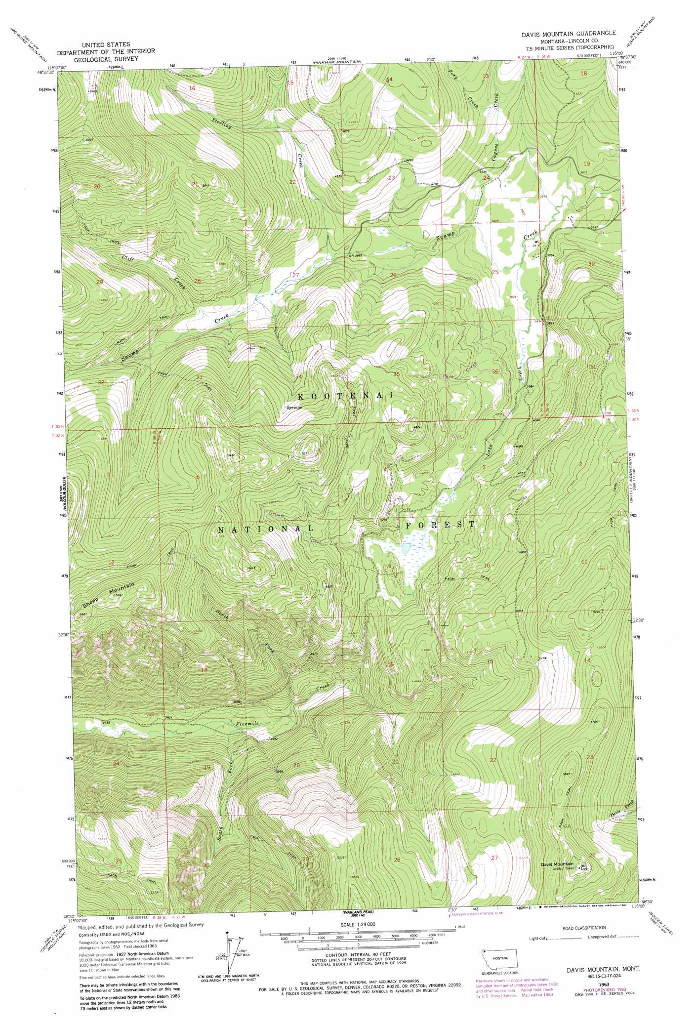
USGS Topo Quad 48115e1 - 1:24,000 scale
| Topo Map Name: | Davis Mountain |
| USGS Topo Quad ID: | 48115e1 |
| Print Size: | ca. 21 1/4" wide x 27" high |
| Southeast Coordinates: | 48.5° N latitude / 115° W longitude |
| Map Center Coordinates: | 48.5625° N latitude / 115.0625° W longitude |
| U.S. State: | MT |
| Filename: | o48115e1.jpg |
| Download Map JPG Image: | Davis Mountain topo map 1:24,000 scale |
| Map Type: | Topographic |
| Topo Series: | 7.5´ |
| Map Scale: | 1:24,000 |
| Source of Map Images: | United States Geological Survey (USGS) |
| Alternate Map Versions: |
Davis Mountain MT 1963, updated 1966 Download PDF Buy paper map Davis Mountain MT 1963, updated 1984 Download PDF Buy paper map Davis Mountain MT 1997, updated 2000 Download PDF Buy paper map Davis Mountain MT 2011 Download PDF Buy paper map Davis Mountain MT 2014 Download PDF Buy paper map |
| FStopo: | US Forest Service topo Davis Mountain is available: Download FStopo PDF Download FStopo TIF |
1:24,000 Topo Quads surrounding Davis Mountain
Webb Mountain |
Beartrap Mountain |
Eureka South |
Fortine |
Mount Marston |
Inch Mountain |
Mcguire Mountain |
Pinkham Mountain |
Edna Mountain |
Stryker |
Ural |
Volcour |
Davis Mountain |
Skillet Mountain |
Sunday Mountain |
Alexander Mountain |
Cripple Horse Mountain |
Warland Peak |
Bowen Lake |
Dunsire Point |
Tony Peak |
Richards Mountain |
Wolf Prairie |
Horse Hill |
Sylvia Lake |
> Back to 48115e1 at 1:100,000 scale
> Back to 48114a1 at 1:250,000 scale
> Back to U.S. Topo Maps home
Davis Mountain topo map: Gazetteer
Davis Mountain: Streams
Cayuse Creek elevation 1171m 3841′Cliff Creek elevation 1236m 4055′
Grimm Creek elevation 1264m 4146′
Lake Creek elevation 1166m 3825′
North Fork Fivemile Creek elevation 916m 3005′
Park Creek elevation 1178m 3864′
Pony Creek elevation 1233m 4045′
South Fork Fivemile Creek elevation 866m 2841′
Sterling Creek elevation 1216m 3989′
Davis Mountain: Summits
Davis Mountain elevation 1844m 6049′Sheep Mountain elevation 1750m 5741′
Davis Mountain: Wells
33N26W30ABAB01 Well elevation 1182m 3877′Davis Mountain digital topo map on disk
Buy this Davis Mountain topo map showing relief, roads, GPS coordinates and other geographical features, as a high-resolution digital map file on DVD: