Fort Green Topo Map Florida
To zoom in, hover over the map of Fort Green
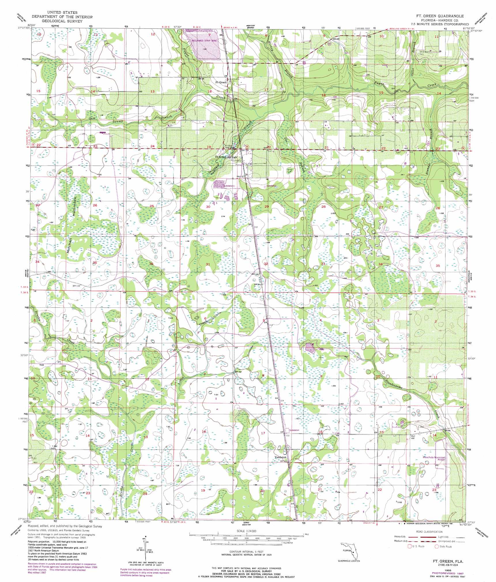
USGS Topo Quad 27081e8 - 1:24,000 scale
| Topo Map Name: | Fort Green |
| USGS Topo Quad ID: | 27081e8 |
| Print Size: | ca. 21 1/4" wide x 27" high |
| Southeast Coordinates: | 27.5° N latitude / 81.875° W longitude |
| Map Center Coordinates: | 27.5625° N latitude / 81.9375° W longitude |
| U.S. State: | FL |
| Filename: | O27081E8.jpg |
| Download Map JPG Image: | Fort Green topo map 1:24,000 scale |
| Map Type: | Topographic |
| Topo Series: | 7.5´ |
| Map Scale: | 1:24,000 |
| Source of Map Images: | United States Geological Survey (USGS) |
| Alternate Map Versions: |
Ft. Green FL 1955, updated 1956 Download PDF Buy paper map Ft. Green FL 1955, updated 1956 Download PDF Buy paper map Fort Green FL 1955, updated 1987 Download PDF Buy paper map Fort Green FL 2012 Download PDF Buy paper map Fort Green FL 2015 Download PDF Buy paper map |
1:24,000 Topo Quads surrounding Fort Green
Lithia |
Keysville |
Bradley Junction |
Homeland |
Alturas |
Fort Lonesome |
Duette Ne |
Baird |
Bowling Green |
Bereah |
Keentown |
Duette |
Fort Green |
Wauchula |
Griffins Corner |
Myakka City Nw |
Myakka Head |
Ona |
Zolfo Springs |
Sweetwater |
Myakka City |
Edgeville |
Limestone |
Gardner |
Crewsville Sw |
> Back to 27081e1 at 1:100,000 scale
> Back to 27080a1 at 1:250,000 scale
> Back to U.S. Topo Maps home
Fort Green topo map: Gazetteer
Fort Green: Airports
Wauchula Municipal Airport elevation 32m 104′Fort Green: Islands
Mitchell Hammock elevation 36m 118′Fort Green: Populated Places
Fort Green elevation 35m 114′Fort Green Springs elevation 35m 114′
Vandolah elevation 30m 98′
Fort Green: Post Offices
Fort Green Post Office elevation 32m 104′Fort Green: Streams
Doe Branch elevation 27m 88′Gum Swamp Branch elevation 28m 91′
Hickey Branch elevation 26m 85′
Lettis Creek elevation 27m 88′
Olive Branch elevation 23m 75′
Plunder Branch elevation 23m 75′
Shirttail Branch elevation 26m 85′
Fort Green digital topo map on disk
Buy this Fort Green topo map showing relief, roads, GPS coordinates and other geographical features, as a high-resolution digital map file on DVD: