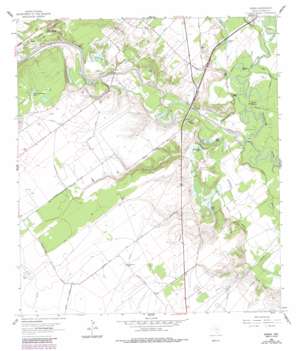
Raisin Topo Map Texas
To zoom in, hover over the map of Raisin
USGS Topo Quad 28097f1 - 1:24,000 scale
| Topo Map Name: | Raisin |
| USGS Topo Quad ID: | 28097f1 |
| Print Size: | ca. 21 1/4" wide x 27" high |
| Southeast Coordinates: | 28.625° N latitude / 97° W longitude |
| Map Center Coordinates: | 28.6875° N latitude / 97.0625° W longitude |
| U.S. State: | TX |
| Filename: | o28097f1.jpg |
| Download Map JPG Image: | Raisin topo map 1:24,000 scale |
| Map Type: | Topographic |
| Topo Series: | 7.5´ |
| Map Scale: | 1:24,000 |
| Source of Map Images: | United States Geological Survey (USGS) |
| Alternate Map Versions: |
Raisin TX 1962, updated 1964 Download PDF Buy paper map Raisin TX 1962, updated 1979 Download PDF Buy paper map Raisin TX 1962, updated 1987 Download PDF Buy paper map Raisin TX 2010 Download PDF Buy paper map Raisin TX 2013 Download PDF Buy paper map Raisin TX 2016 Download PDF Buy paper map |
1:24,000 Topo Quads surrounding Raisin
> Back to 28097e1 at 1:100,000 scale
> Back to 28096a1 at 1:250,000 scale
> Back to U.S. Topo Maps home
Raisin topo map: Gazetteer
Raisin: Guts
Sand Bayou elevation 8m 26′Raisin: Lakes
Adler Lake elevation 7m 22′Bass Lake elevation 10m 32′
Hog Lake elevation 17m 55′
Mary Lake elevation 11m 36′
McDonough Lake elevation 8m 26′
Mill Lake elevation 8m 26′
Sand Lake elevation 21m 68′
Shell and Trigger Lake elevation 33m 108′
Stubbs Lake elevation 10m 32′
Terrell Lake elevation 13m 42′
Warden Lake elevation 11m 36′
Raisin: Oilfields
Coleto Creek Oil Field elevation 13m 42′Cologne Oil Field elevation 33m 108′
Raisin: Populated Places
Raisin elevation 31m 101′Raisin: Streams
Boggy Creek elevation 14m 45′Coleto Creek elevation 5m 16′
Court Branch elevation 14m 45′
Dry Creek elevation 6m 19′
McDonough Bayou elevation 6m 19′
New River elevation 7m 22′
Samson Bayou elevation 8m 26′
Raisin: Summits
Indian Mound elevation 15m 49′Raisin digital topo map on disk
Buy this Raisin topo map showing relief, roads, GPS coordinates and other geographical features, as a high-resolution digital map file on DVD:


