Schroeder Topo Map Texas
To zoom in, hover over the map of Schroeder
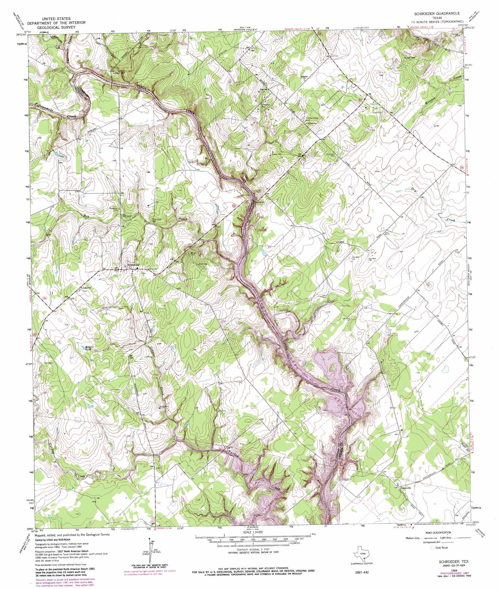
USGS Topo Quad 28097g2 - 1:24,000 scale
| Topo Map Name: | Schroeder |
| USGS Topo Quad ID: | 28097g2 |
| Print Size: | ca. 21 1/4" wide x 27" high |
| Southeast Coordinates: | 28.75° N latitude / 97.125° W longitude |
| Map Center Coordinates: | 28.8125° N latitude / 97.1875° W longitude |
| U.S. State: | TX |
| Filename: | o28097g2.jpg |
| Download Map JPG Image: | Schroeder topo map 1:24,000 scale |
| Map Type: | Topographic |
| Topo Series: | 7.5´ |
| Map Scale: | 1:24,000 |
| Source of Map Images: | United States Geological Survey (USGS) |
| Alternate Map Versions: |
Schroeder TX 1964, updated 1965 Download PDF Buy paper map Schroeder TX 1964, updated 1985 Download PDF Buy paper map Schroeder TX 1964, updated 1987 Download PDF Buy paper map Schroeder TX 2010 Download PDF Buy paper map Schroeder TX 2013 Download PDF Buy paper map Schroeder TX 2016 Download PDF Buy paper map |
1:24,000 Topo Quads surrounding Schroeder
Blackwell Lake |
Cuero |
Verhelle |
Fordtran |
Peck Branch |
Yorktown East |
Meyersville |
Mission Valley |
Nursery |
Inez Nw |
Weesatche |
Ander |
Schroeder |
Victoria West |
Victoria East |
Goliad |
Hensley Lake |
Fannin |
Raisin |
Bloomington |
Melo |
Live Oak Lake |
Lott Lake |
Mcfaddin |
Bloomington Sw |
> Back to 28097e1 at 1:100,000 scale
> Back to 28096a1 at 1:250,000 scale
> Back to U.S. Topo Maps home
Schroeder topo map: Gazetteer
Schroeder: Populated Places
Coletoville elevation 39m 127′Schroeder elevation 50m 164′
Schroeder: Reservoirs
Kilgore Tank elevation 50m 164′Schroeder: Streams
Fifteenmile Creek elevation 32m 104′Gobbler Creek elevation 30m 98′
Hog Thief Creek elevation 30m 98′
Johns Creek elevation 36m 118′
Twelvemile Creek elevation 32m 104′
Schroeder digital topo map on disk
Buy this Schroeder topo map showing relief, roads, GPS coordinates and other geographical features, as a high-resolution digital map file on DVD: