Meyersville Topo Map Texas
To zoom in, hover over the map of Meyersville
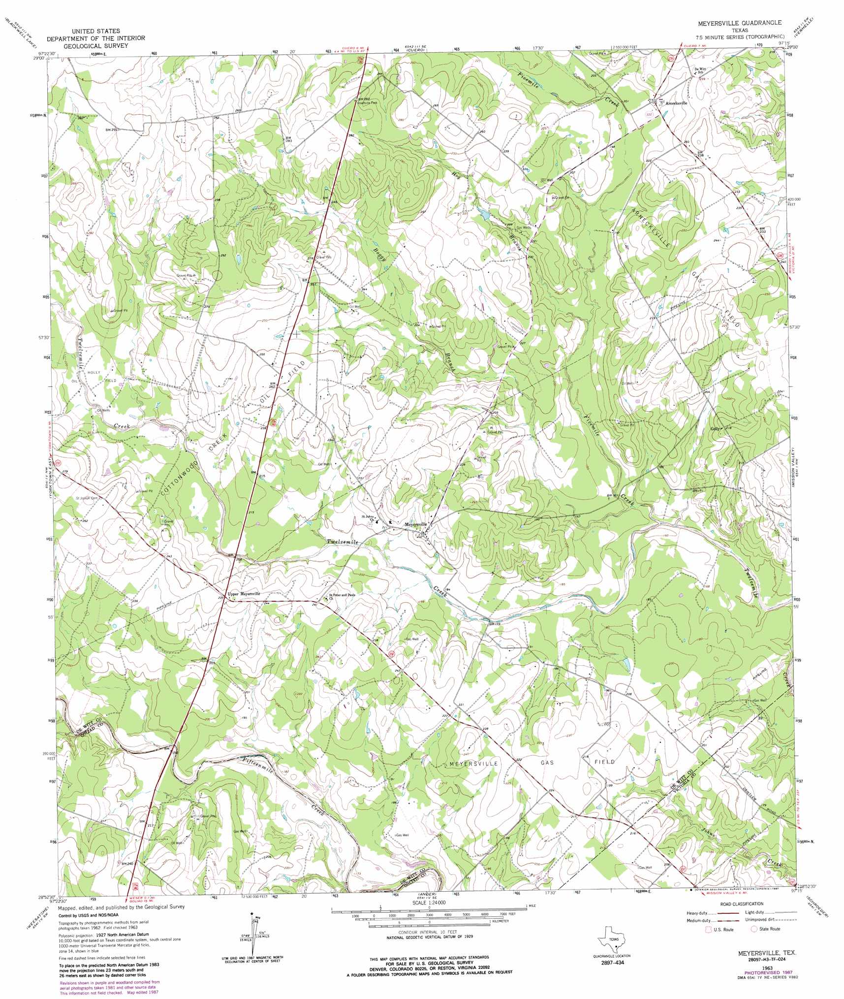
USGS Topo Quad 28097h3 - 1:24,000 scale
| Topo Map Name: | Meyersville |
| USGS Topo Quad ID: | 28097h3 |
| Print Size: | ca. 21 1/4" wide x 27" high |
| Southeast Coordinates: | 28.875° N latitude / 97.25° W longitude |
| Map Center Coordinates: | 28.9375° N latitude / 97.3125° W longitude |
| U.S. State: | TX |
| Filename: | o28097h3.jpg |
| Download Map JPG Image: | Meyersville topo map 1:24,000 scale |
| Map Type: | Topographic |
| Topo Series: | 7.5´ |
| Map Scale: | 1:24,000 |
| Source of Map Images: | United States Geological Survey (USGS) |
| Alternate Map Versions: |
Meyersville TX 1963, updated 1965 Download PDF Buy paper map Meyersville TX 1963, updated 1987 Download PDF Buy paper map Meyersville TX 2010 Download PDF Buy paper map Meyersville TX 2013 Download PDF Buy paper map Meyersville TX 2016 Download PDF Buy paper map |
1:24,000 Topo Quads surrounding Meyersville
Sample |
Westhoff |
Concrete |
Edgar |
Terryville |
New Davy |
Blackwell Lake |
Cuero |
Verhelle |
Fordtran |
Yorktown West |
Yorktown East |
Meyersville |
Mission Valley |
Nursery |
Runge Se |
Weesatche |
Ander |
Schroeder |
Victoria West |
Charco |
Goliad |
Hensley Lake |
Fannin |
Raisin |
> Back to 28097e1 at 1:100,000 scale
> Back to 28096a1 at 1:250,000 scale
> Back to U.S. Topo Maps home
Meyersville topo map: Gazetteer
Meyersville: Oilfields
Arneckeville Gas Field elevation 77m 252′Cottonwood Creek Oil Field elevation 76m 249′
Holly Oil Field elevation 65m 213′
Meyersville Gas Field elevation 67m 219′
Meyersville: Populated Places
Arneckeville elevation 65m 213′Golly elevation 66m 216′
Meyersville elevation 70m 229′
Upper Meyersville elevation 73m 239′
Meyersville: Streams
Boggy Branch elevation 54m 177′Fivemile Creek elevation 46m 150′
Hog Branch elevation 55m 180′
Hoosier Creek elevation 51m 167′
Meyersville digital topo map on disk
Buy this Meyersville topo map showing relief, roads, GPS coordinates and other geographical features, as a high-resolution digital map file on DVD: