Yorktown East Topo Map Texas
To zoom in, hover over the map of Yorktown East
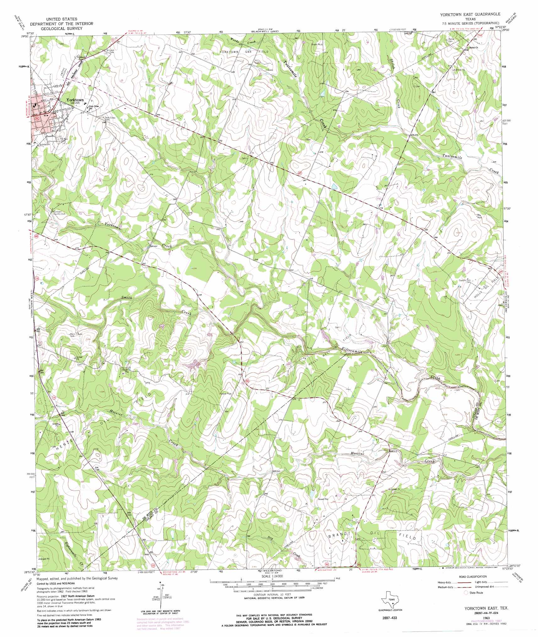
USGS Topo Quad 28097h4 - 1:24,000 scale
| Topo Map Name: | Yorktown East |
| USGS Topo Quad ID: | 28097h4 |
| Print Size: | ca. 21 1/4" wide x 27" high |
| Southeast Coordinates: | 28.875° N latitude / 97.375° W longitude |
| Map Center Coordinates: | 28.9375° N latitude / 97.4375° W longitude |
| U.S. State: | TX |
| Filename: | o28097h4.jpg |
| Download Map JPG Image: | Yorktown East topo map 1:24,000 scale |
| Map Type: | Topographic |
| Topo Series: | 7.5´ |
| Map Scale: | 1:24,000 |
| Source of Map Images: | United States Geological Survey (USGS) |
| Alternate Map Versions: |
Yorktown East TX 1963, updated 1965 Download PDF Buy paper map Yorktown East TX 1963, updated 1987 Download PDF Buy paper map Yorktown East TX 2010 Download PDF Buy paper map Yorktown East TX 2013 Download PDF Buy paper map Yorktown East TX 2016 Download PDF Buy paper map |
1:24,000 Topo Quads surrounding Yorktown East
Bald Mound |
Sample |
Westhoff |
Concrete |
Edgar |
Garfield |
New Davy |
Blackwell Lake |
Cuero |
Verhelle |
Runge |
Yorktown West |
Yorktown East |
Meyersville |
Mission Valley |
Choate |
Runge Se |
Weesatche |
Ander |
Schroeder |
Berclair Nw |
Charco |
Goliad |
Hensley Lake |
Fannin |
> Back to 28097e1 at 1:100,000 scale
> Back to 28096a1 at 1:250,000 scale
> Back to U.S. Topo Maps home
Yorktown East topo map: Gazetteer
Yorktown East: Airports
Yorktown Airport elevation 72m 236′Yorktown East: Oilfields
Brandt Oil Field elevation 86m 282′Henze Oil Field elevation 89m 291′
Holly West Oil Field elevation 70m 229′
Yorktown Gas Field elevation 90m 295′
Yorktown East: Streams
Cottonwood Creek elevation 81m 265′Shiloh Creek elevation 70m 229′
Smith Creek elevation 61m 200′
Woods Creek elevation 78m 255′
Yorktown Creek elevation 61m 200′
Yorktown East digital topo map on disk
Buy this Yorktown East topo map showing relief, roads, GPS coordinates and other geographical features, as a high-resolution digital map file on DVD: