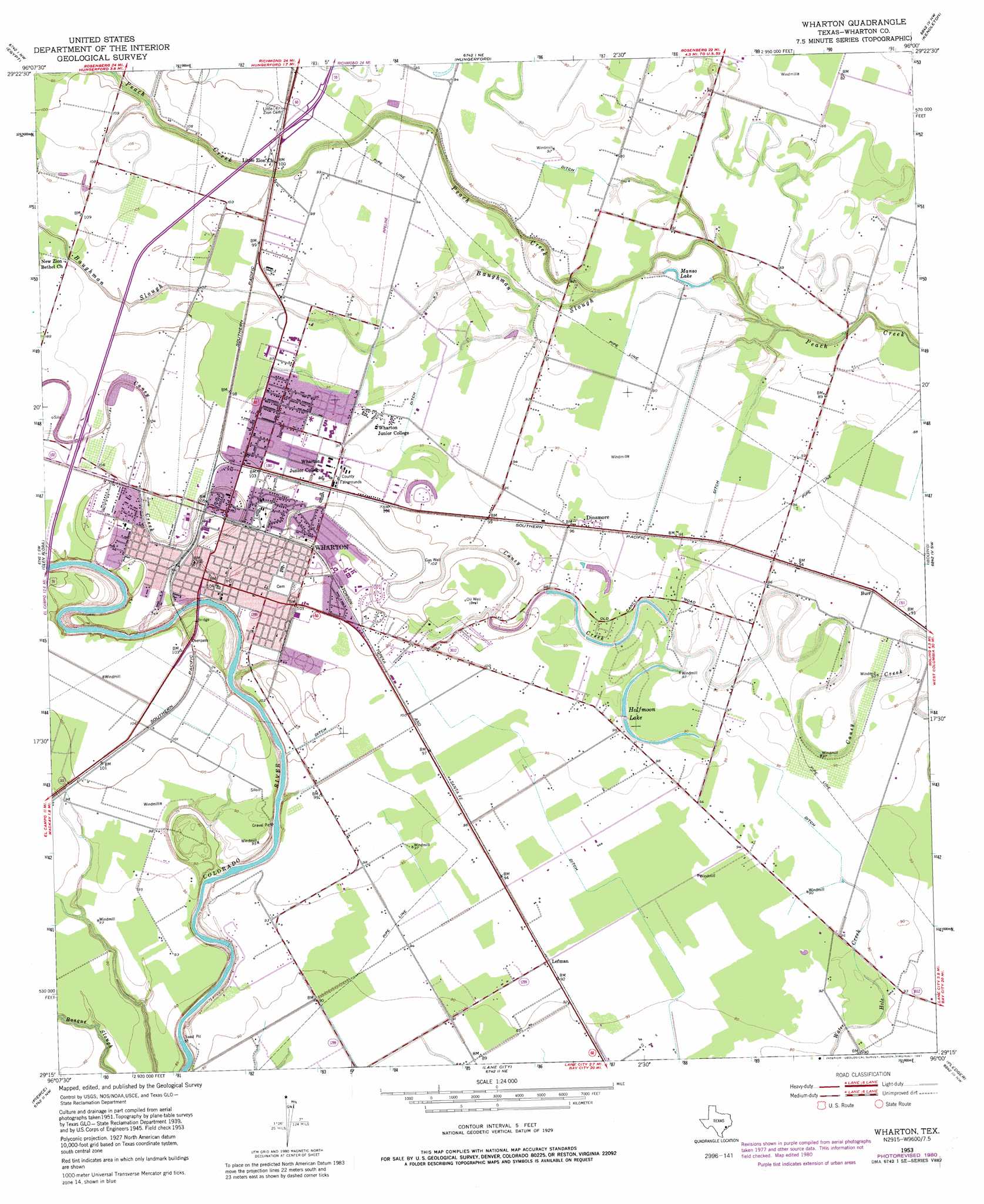
Wharton Topo Map Texas
To zoom in, hover over the map of Wharton
USGS Topo Quad 29096c1 - 1:24,000 scale
| Topo Map Name: | Wharton |
| USGS Topo Quad ID: | 29096c1 |
| Print Size: | ca. 21 1/4" wide x 27" high |
| Southeast Coordinates: | 29.25° N latitude / 96° W longitude |
| Map Center Coordinates: | 29.3125° N latitude / 96.0625° W longitude |
| U.S. State: | TX |
| Filename: | o29096c1.jpg |
| Download Map JPG Image: | Wharton topo map 1:24,000 scale |
| Map Type: | Topographic |
| Topo Series: | 7.5´ |
| Map Scale: | 1:24,000 |
| Source of Map Images: | United States Geological Survey (USGS) |
| Alternate Map Versions: |
Wharton TX 1953, updated 1954 Download PDF Buy paper map Wharton TX 1953, updated 1977 Download PDF Buy paper map Wharton TX 1953, updated 1981 Download PDF Buy paper map Wharton TX 1953, updated 1981 Download PDF Buy paper map Wharton TX 2010 Download PDF Buy paper map Wharton TX 2013 Download PDF Buy paper map Wharton TX 2016 Download PDF Buy paper map |
1:24,000 Topo Quads surrounding Wharton
Eagle Lake |
Lissie |
East Bernard |
Orchard |
Richmond |
Bonus |
Egypt |
Hungerford |
Kendleton |
Needville |
New Taiton |
Glen Flora |
Wharton |
Boling |
Guy |
El Campo |
Pierce |
Lane City |
Pledger |
Danciger |
El Campo Se |
Danevang |
Lane City Se |
Van Vleck |
Ashwood |
> Back to 29096a1 at 1:100,000 scale
> Back to 29096a1 at 1:250,000 scale
> Back to U.S. Topo Maps home
Wharton topo map: Gazetteer
Wharton: Airports
Gulf Coast Medical Center Heliport elevation 31m 101′Lackey Aviation Airport elevation 28m 91′
Shanks Ag Strip elevation 27m 88′
Wharton: Bridges
Colorado River Bridge elevation 19m 62′Texas and New Orleans Railroad Bridge elevation 24m 78′
Wharton: Lakes
Halfmoon Lake elevation 27m 88′Manso Lake elevation 26m 85′
Wharton: Parks
Croom Park elevation 30m 98′Harris Park elevation 26m 85′
Wharton: Populated Places
Burr elevation 29m 95′Dinsmore elevation 29m 95′
Lefman elevation 28m 91′
Wharton elevation 31m 101′
Wharton: Streams
Baughman Slough elevation 25m 82′Wharton digital topo map on disk
Buy this Wharton topo map showing relief, roads, GPS coordinates and other geographical features, as a high-resolution digital map file on DVD: