Eagle Lake Topo Map Texas
To zoom in, hover over the map of Eagle Lake
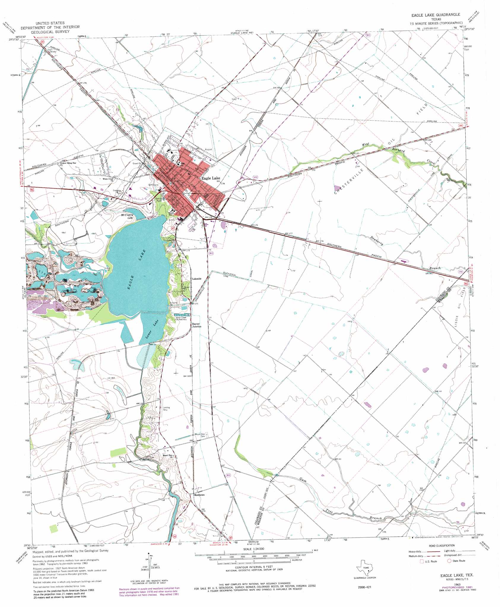
USGS Topo Quad 29096e3 - 1:24,000 scale
| Topo Map Name: | Eagle Lake |
| USGS Topo Quad ID: | 29096e3 |
| Print Size: | ca. 21 1/4" wide x 27" high |
| Southeast Coordinates: | 29.5° N latitude / 96.25° W longitude |
| Map Center Coordinates: | 29.5625° N latitude / 96.3125° W longitude |
| U.S. State: | TX |
| Filename: | o29096e3.jpg |
| Download Map JPG Image: | Eagle Lake topo map 1:24,000 scale |
| Map Type: | Topographic |
| Topo Series: | 7.5´ |
| Map Scale: | 1:24,000 |
| Source of Map Images: | United States Geological Survey (USGS) |
| Alternate Map Versions: |
Eagle Lake TX 1963, updated 1965 Download PDF Buy paper map Eagle Lake TX 1963, updated 1983 Download PDF Buy paper map Eagle Lake TX 2010 Download PDF Buy paper map Eagle Lake TX 2013 Download PDF Buy paper map Eagle Lake TX 2016 Download PDF Buy paper map |
1:24,000 Topo Quads surrounding Eagle Lake
Frelsburg |
Bernardo |
Cat Spring |
Sealy |
San Felipe |
Columbus |
Alleyton |
Eagle Lake Ne |
Rexville |
Wallis |
Rock Island |
Altair |
Eagle Lake |
Lissie |
East Bernard |
Sheridan Ne |
Garwood |
Bonus |
Egypt |
Hungerford |
Sheridan Se |
Hahn |
New Taiton |
Glen Flora |
Wharton |
> Back to 29096e1 at 1:100,000 scale
> Back to 29096a1 at 1:250,000 scale
> Back to U.S. Topo Maps home
Eagle Lake topo map: Gazetteer
Eagle Lake: Airports
Eagle Lake Airport elevation 56m 183′Eagle Lake Community Hospital Heliport elevation 51m 167′
Eagle Lake: Oilfields
Chesterville Oil Field elevation 50m 164′Eagle Lake: Parks
Municipal Park elevation 50m 164′Eagle Lake: Populated Places
Eagle Lake elevation 53m 173′Lakeside elevation 52m 170′
Rayner Junction elevation 52m 170′
Eagle Lake: Reservoirs
Eagle Lake elevation 46m 150′Lower Lake elevation 46m 150′
McCreary Lake elevation 47m 154′
Eagle Lake digital topo map on disk
Buy this Eagle Lake topo map showing relief, roads, GPS coordinates and other geographical features, as a high-resolution digital map file on DVD: