East Bernard Topo Map Texas
To zoom in, hover over the map of East Bernard
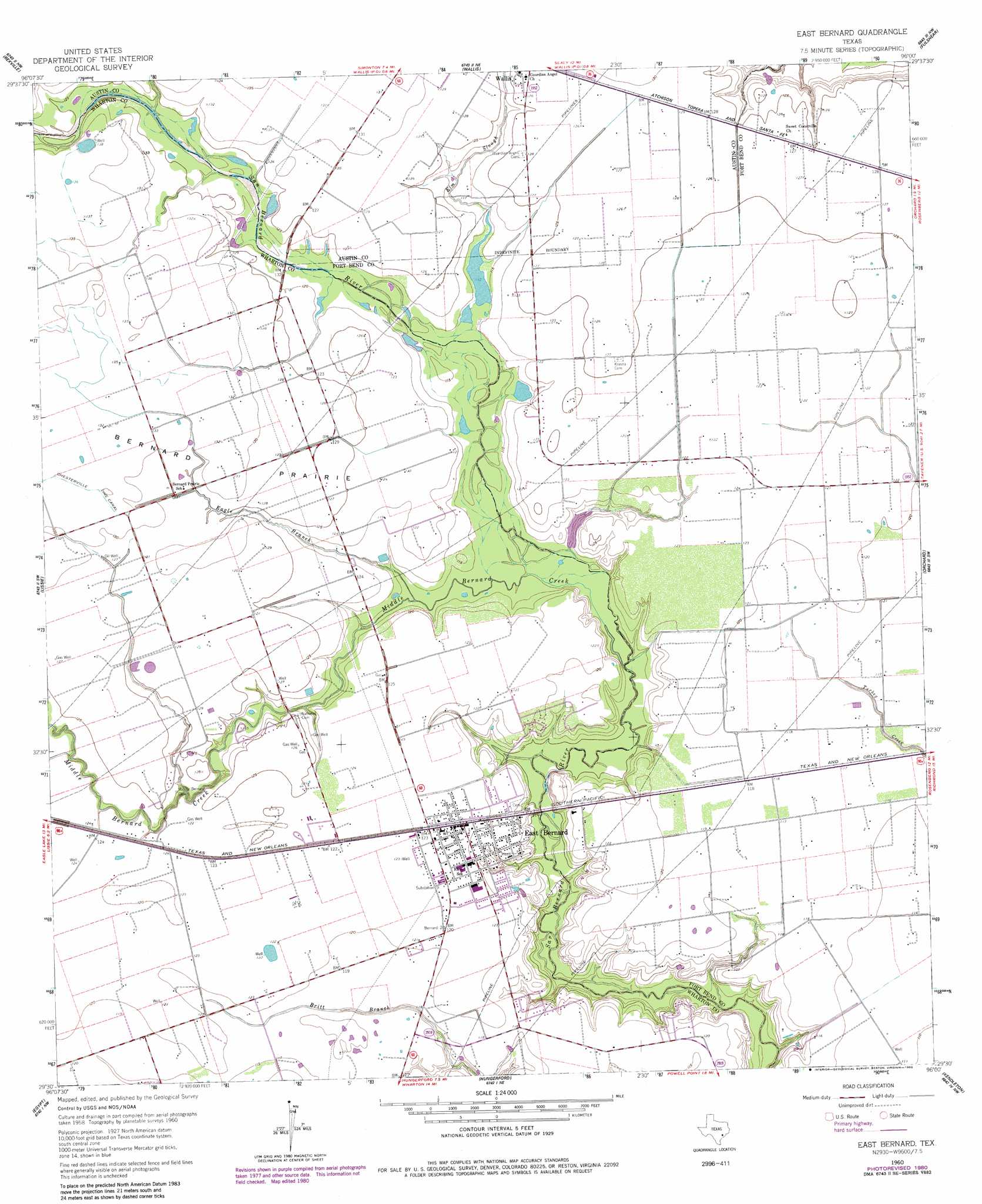
USGS Topo Quad 29096e1 - 1:24,000 scale
| Topo Map Name: | East Bernard |
| USGS Topo Quad ID: | 29096e1 |
| Print Size: | ca. 21 1/4" wide x 27" high |
| Southeast Coordinates: | 29.5° N latitude / 96° W longitude |
| Map Center Coordinates: | 29.5625° N latitude / 96.0625° W longitude |
| U.S. State: | TX |
| Filename: | o29096e1.jpg |
| Download Map JPG Image: | East Bernard topo map 1:24,000 scale |
| Map Type: | Topographic |
| Topo Series: | 7.5´ |
| Map Scale: | 1:24,000 |
| Source of Map Images: | United States Geological Survey (USGS) |
| Alternate Map Versions: |
East Bernard TX 1960, updated 1961 Download PDF Buy paper map East Bernard TX 1960, updated 1961 Download PDF Buy paper map East Bernard TX 1960, updated 1980 Download PDF Buy paper map East Bernard TX 2010 Download PDF Buy paper map East Bernard TX 2013 Download PDF Buy paper map East Bernard TX 2016 Download PDF Buy paper map |
1:24,000 Topo Quads surrounding East Bernard
Cat Spring |
Sealy |
San Felipe |
Brookshire |
Katy |
Eagle Lake Ne |
Rexville |
Wallis |
Fulshear |
Richmond Ne |
Eagle Lake |
Lissie |
East Bernard |
Orchard |
Richmond |
Bonus |
Egypt |
Hungerford |
Kendleton |
Needville |
New Taiton |
Glen Flora |
Wharton |
Boling |
Guy |
> Back to 29096e1 at 1:100,000 scale
> Back to 29096a1 at 1:250,000 scale
> Back to U.S. Topo Maps home
East Bernard topo map: Gazetteer
East Bernard: Dams
Penny Lake Dam elevation 31m 101′East Bernard: Flats
Bernard Prairie elevation 40m 131′East Bernard: Populated Places
East Bernard elevation 38m 124′East Bernard: Reservoirs
Penny Lake elevation 31m 101′East Bernard: Streams
Eagle Branch elevation 32m 104′Elm Slough elevation 35m 114′
Middle Bernard Creek elevation 30m 98′
East Bernard digital topo map on disk
Buy this East Bernard topo map showing relief, roads, GPS coordinates and other geographical features, as a high-resolution digital map file on DVD: