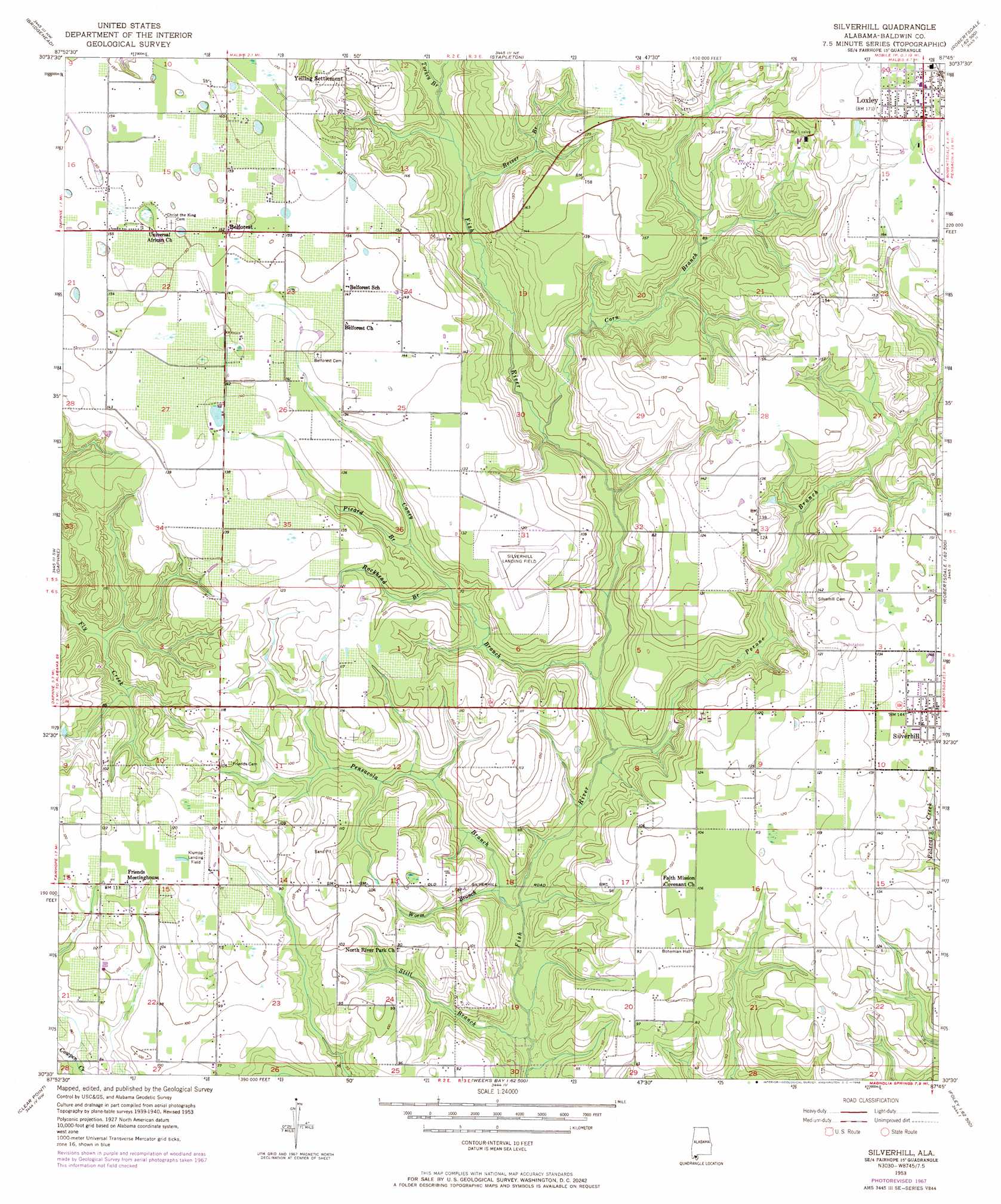
Silverhill Topo Map Alabama
To zoom in, hover over the map of Silverhill
USGS Topo Quad 30087e7 - 1:24,000 scale
| Topo Map Name: | Silverhill |
| USGS Topo Quad ID: | 30087e7 |
| Print Size: | ca. 21 1/4" wide x 27" high |
| Southeast Coordinates: | 30.5° N latitude / 87.75° W longitude |
| Map Center Coordinates: | 30.5625° N latitude / 87.8125° W longitude |
| U.S. State: | AL |
| Filename: | o30087e7.jpg |
| Download Map JPG Image: | Silverhill topo map 1:24,000 scale |
| Map Type: | Topographic |
| Topo Series: | 7.5´ |
| Map Scale: | 1:24,000 |
| Source of Map Images: | United States Geological Survey (USGS) |
| Alternate Map Versions: |
Silverhill AL 1953, updated 1955 Download PDF Buy paper map Silverhill AL 1953, updated 1968 Download PDF Buy paper map Silverhill AL 2011 Download PDF Buy paper map Silverhill AL 2014 Download PDF Buy paper map |
1:24,000 Topo Quads surrounding Silverhill
Chickasaw |
Hurricane |
Bay Minette South |
Dogwood Creek |
Enon |
Mobile |
Bridgehead |
Stapleton |
Steelwood Lake |
Gateswood |
Hollingers Island |
Daphne |
Silverhill |
Robertsdale |
Elsanor |
Bellefontaine |
Point Clear |
Magnolia Springs |
Foley |
Elberta |
Little Dauphin Island |
Little Point Clear |
Bon Secour Bay |
Gulf Shores |
Orange Beach |
> Back to 30087e1 at 1:100,000 scale
> Back to 30086a1 at 1:250,000 scale
> Back to U.S. Topo Maps home
Silverhill topo map: Gazetteer
Silverhill: Bridges
Fish River Bridge (historical) elevation 6m 19′Lowells Bridge (historical) elevation 3m 9′
Milesteads Bridge (historical) elevation 11m 36′
Silverhill: Dams
MacCartees Lake Dam elevation 22m 72′Silverhill: Populated Places
Belforest elevation 46m 150′Loxley elevation 52m 170′
Silverhill elevation 44m 144′
Yelling Settlement elevation 44m 144′
Silverhill: Reservoirs
MacCartees Lake elevation 22m 72′Silverhill: Streams
Beiser Branch elevation 21m 68′Caney Branch elevation 9m 29′
Corn Branch elevation 16m 52′
Pensacola Branch elevation 3m 9′
Perone Branch elevation 6m 19′
Picard Branch elevation 24m 78′
Rockhead Branch elevation 20m 65′
Still Branch elevation 3m 9′
Turkey Branch elevation 22m 72′
Worm Branch elevation 8m 26′
Silverhill digital topo map on disk
Buy this Silverhill topo map showing relief, roads, GPS coordinates and other geographical features, as a high-resolution digital map file on DVD:
Gulf Coast (LA, MS, AL, FL) & Southwestern Georgia
Buy digital topo maps: Gulf Coast (LA, MS, AL, FL) & Southwestern Georgia
 & Southwestern Georgia map DVD")