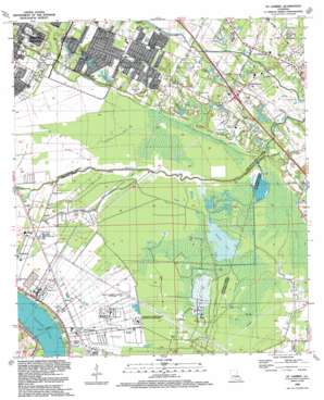
Saint Gabriel Topo Map Louisiana
To zoom in, hover over the map of Saint Gabriel
USGS Topo Quad 30091c1 - 1:24,000 scale
| Topo Map Name: | Saint Gabriel |
| USGS Topo Quad ID: | 30091c1 |
| Print Size: | ca. 21 1/4" wide x 27" high |
| Southeast Coordinates: | 30.25° N latitude / 91° W longitude |
| Map Center Coordinates: | 30.3125° N latitude / 91.0625° W longitude |
| U.S. State: | LA |
| Filename: | o30091c1.jpg |
| Download Map JPG Image: | Saint Gabriel topo map 1:24,000 scale |
| Map Type: | Topographic |
| Topo Series: | 7.5´ |
| Map Scale: | 1:24,000 |
| Source of Map Images: | United States Geological Survey (USGS) |
| Alternate Map Versions: |
St. Gabriel LA 1953, updated 1954 Download PDF Buy paper map St. Gabriel LA 1963, updated 1964 Download PDF Buy paper map St. Gabriel LA 1963, updated 1967 Download PDF Buy paper map St. Gabriel LA 1963, updated 1971 Download PDF Buy paper map St. Gabriel LA 1963, updated 1972 Download PDF Buy paper map St. Gabriel LA 1963, updated 1981 Download PDF Buy paper map St. Gabriel LA 1963, updated 1989 Download PDF Buy paper map St. Gabriel LA 1992, updated 1992 Download PDF Buy paper map St. Gabriel LA 1995, updated 1998 Download PDF Buy paper map Saint Gabriel LA 2012 Download PDF Buy paper map Saint Gabriel LA 2015 Download PDF Buy paper map |
1:24,000 Topo Quads surrounding Saint Gabriel
> Back to 30091a1 at 1:100,000 scale
> Back to 30090a1 at 1:250,000 scale
> Back to U.S. Topo Maps home
Saint Gabriel topo map: Gazetteer
Saint Gabriel: Airports
East Field Heliport elevation 4m 13′Hummingbird Field elevation 9m 29′
Interstate Landing Strip elevation 1m 3′
Saint Gabriel: Crossings
Interchange 166 elevation 6m 19′Saint Gabriel: Dams
Highland Lakes Dam elevation 6m 19′Saint Gabriel: Lakes
Spanish Lake elevation 1m 3′Saint Gabriel: Oilfields
Burtville Oil Field elevation 5m 16′Saint Gabriel Gas and Oil Field elevation 2m 6′
Saint Gabriel Gas and Oil Field elevation 2m 6′
Willow Glen Oil Field elevation 4m 13′
Saint Gabriel: Parks
Gentilly Court Park elevation 4m 13′Highland Road Park elevation 5m 16′
Meadow Park elevation 5m 16′
Saint Gabriel: Populated Places
Autumn Run elevation 5m 16′Barkley Place elevation 9m 29′
Bayou Paul elevation 5m 16′
Bluebonnet Ridge elevation 11m 36′
Briarcliff elevation 10m 32′
Briarwood Estates elevation 9m 29′
Brookhollow Glen elevation 10m 32′
Brousard Plaza elevation 5m 16′
Brown (historical) elevation 6m 19′
Castille elevation 9m 29′
Castle Ridge Estates elevation 5m 16′
Chatsworth Acres elevation 12m 39′
Foreman elevation 7m 22′
Highland Community elevation 8m 26′
Highland Crossing elevation 8m 26′
Highland Estates elevation 5m 16′
Highland Lakes elevation 10m 32′
Highlandia elevation 10m 32′
Hydell elevation 5m 16′
Iberville elevation 5m 16′
Iberville Terrace elevation 12m 39′
Kleinpeter elevation 7m 22′
Lafitte Hill elevation 7m 22′
Lakeland Terrace elevation 10m 32′
Lakeside elevation 10m 32′
Meadow Park elevation 7m 22′
Montan Estates elevation 8m 26′
Oak Hills elevation 11m 36′
Oak Hills Place elevation 11m 36′
Oakbrook elevation 10m 32′
Oakley elevation 6m 19′
Perkins South elevation 11m 36′
Perkins Village elevation 10m 32′
Quail Hollow elevation 11m 36′
Quail Ridge elevation 11m 36′
Rhodes elevation 6m 19′
Round Oak elevation 9m 29′
Saint Gabriel elevation 7m 22′
Siegen elevation 8m 26′
Terra Haute elevation 11m 36′
The Highlands elevation 10m 32′
The Myrtles elevation 10m 32′
The Shire elevation 11m 36′
Village Saint George elevation 11m 36′
Westchester elevation 11m 36′
Wildwood elevation 11m 36′
Willow Glen elevation 6m 19′
Saint Gabriel: Post Offices
Saint Gabriel Post Office elevation 6m 19′Saint Gabriel: Reservoirs
Highland Lakes elevation 6m 19′Saint Gabriel: Streams
Alligator Bayou elevation 3m 9′Bayou Braud elevation 1m 3′
Bayou Fountain elevation 3m 9′
Bayou Paul elevation 1m 3′
Selene Bayou elevation 2m 6′
Ward Creek elevation 1m 3′
Saint Gabriel: Swamps
Bluff Swamp elevation 1m 3′Saint Gabriel digital topo map on disk
Buy this Saint Gabriel topo map showing relief, roads, GPS coordinates and other geographical features, as a high-resolution digital map file on DVD:


