Lone Star Topo Map Louisiana
To zoom in, hover over the map of Lone Star
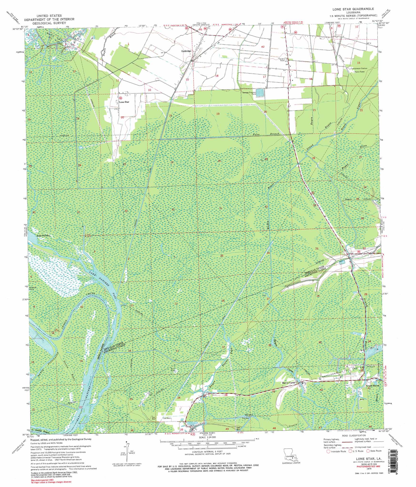
USGS Topo Quad 30091a2 - 1:24,000 scale
| Topo Map Name: | Lone Star |
| USGS Topo Quad ID: | 30091a2 |
| Print Size: | ca. 21 1/4" wide x 27" high |
| Southeast Coordinates: | 30° N latitude / 91.125° W longitude |
| Map Center Coordinates: | 30.0625° N latitude / 91.1875° W longitude |
| U.S. State: | LA |
| Filename: | o30091a2.jpg |
| Download Map JPG Image: | Lone Star topo map 1:24,000 scale |
| Map Type: | Topographic |
| Topo Series: | 7.5´ |
| Map Scale: | 1:24,000 |
| Source of Map Images: | United States Geological Survey (USGS) |
| Alternate Map Versions: |
Lone Star LA 1974, updated 1975 Download PDF Buy paper map Lone Star LA 1974, updated 1989 Download PDF Buy paper map Lone Star LA 1974, updated 1989 Download PDF Buy paper map Lone Star LA 2012 Download PDF Buy paper map Lone Star LA 2015 Download PDF Buy paper map |
1:24,000 Topo Quads surrounding Lone Star
Grosse Tete Sw |
Addis |
Plaquemine |
Saint Gabriel |
Prairieville |
Grand River |
Bayou Sorrel |
White Castle |
Carville |
Gonzales |
Lake Chicot |
Pigeon |
Lone Star |
Belle Rose |
Donaldsonville |
Centerville Nw |
Centerville Ne |
Pierre Part |
Napoleonville |
Madewood |
Centerville |
Tiger Island |
Napoleonville Sw |
Grassy Lake |
Labadieville |
> Back to 30091a1 at 1:100,000 scale
> Back to 30090a1 at 1:250,000 scale
> Back to U.S. Topo Maps home
Lone Star topo map: Gazetteer
Lone Star: Bays
Bay Natchez elevation 0m 0′Lone Star: Canals
False Branch Bayou elevation 2m 6′Muddy Bayou elevation 1m 3′
Lone Star: Channels
Lake Natchez Pass elevation 0m 0′Lone Star: Guts
Bayou Bijou elevation 1m 3′Bayou Choupique elevation 1m 3′
Bayou Crouix elevation 0m 0′
Lone Star: Oilfields
Grand Bayou Oil and Gas Field elevation 1m 3′Natchez Bay Gas Field elevation 1m 3′
Lone Star: Populated Places
Bayou Corne elevation 2m 6′Goldridge elevation 3m 9′
Grand Bayou elevation 1m 3′
Lone Star elevation 2m 6′
Lone Star: Streams
Bayou Black elevation 2m 6′Bayou Corne elevation 1m 3′
Bayou Crouix elevation 1m 3′
Bayou Sigur elevation 1m 3′
Bayou Tigre elevation 0m 0′
Chopin Chute elevation 1m 3′
Possum Bayou elevation 0m 0′
Lone Star digital topo map on disk
Buy this Lone Star topo map showing relief, roads, GPS coordinates and other geographical features, as a high-resolution digital map file on DVD: