Breaux Bridge Topo Map Louisiana
To zoom in, hover over the map of Breaux Bridge
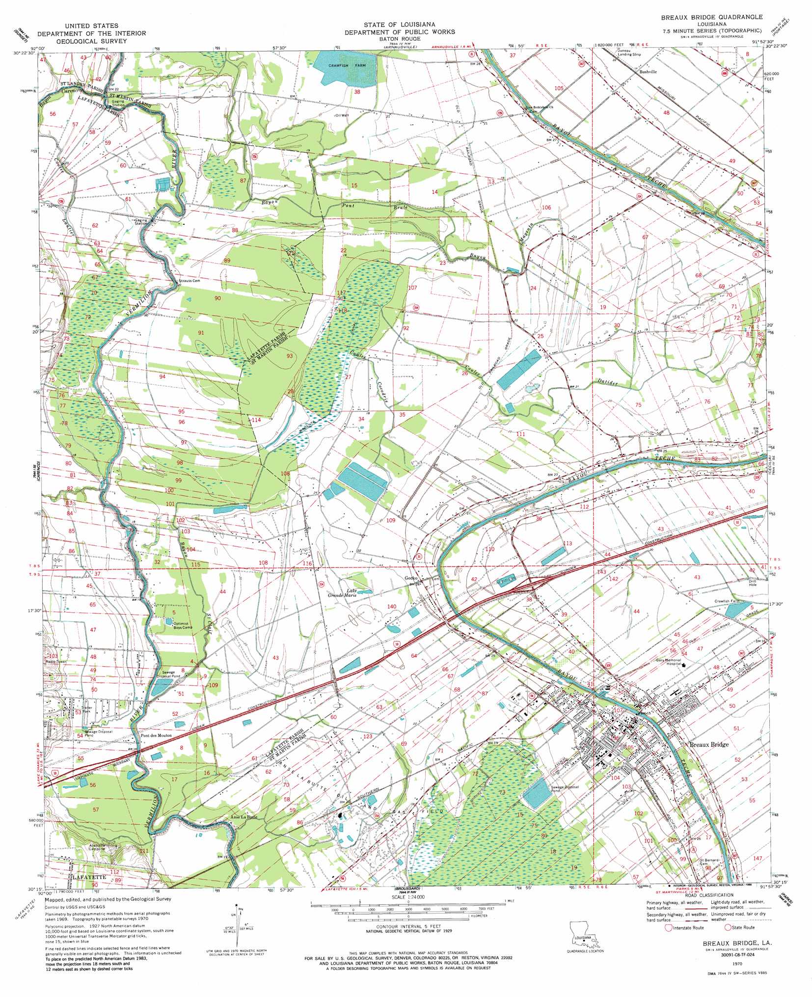
USGS Topo Quad 30091c8 - 1:24,000 scale
| Topo Map Name: | Breaux Bridge |
| USGS Topo Quad ID: | 30091c8 |
| Print Size: | ca. 21 1/4" wide x 27" high |
| Southeast Coordinates: | 30.25° N latitude / 91.875° W longitude |
| Map Center Coordinates: | 30.3125° N latitude / 91.9375° W longitude |
| U.S. State: | LA |
| Filename: | o30091c8.jpg |
| Download Map JPG Image: | Breaux Bridge topo map 1:24,000 scale |
| Map Type: | Topographic |
| Topo Series: | 7.5´ |
| Map Scale: | 1:24,000 |
| Source of Map Images: | United States Geological Survey (USGS) |
| Alternate Map Versions: |
Breaux Bridge LA 1970, updated 1972 Download PDF Buy paper map Breaux Bridge LA 1970, updated 1986 Download PDF Buy paper map Breaux Bridge LA 1970, updated 1986 Download PDF Buy paper map Breaux Bridge LA 1998, updated 2000 Download PDF Buy paper map Breaux Bridge LA 2012 Download PDF Buy paper map Breaux Bridge LA 2015 Download PDF Buy paper map |
1:24,000 Topo Quads surrounding Breaux Bridge
Lawtell |
Opelousas |
Port Barre |
Krotz Springs |
Lottie |
Church Point |
Sunset |
Arnaudville |
Portage |
Maringouin Nw |
Mire |
Carencro |
Breaux Bridge |
Cecilia |
Butte La Rose |
Duson |
Lafayette |
Broussard |
Parks |
Catahoula |
Leroy |
Milton |
Youngsville |
New Iberia North |
Loreauville |
> Back to 30091a1 at 1:100,000 scale
> Back to 30090a1 at 1:250,000 scale
> Back to U.S. Topo Maps home
Breaux Bridge topo map: Gazetteer
Breaux Bridge: Airports
Geralds Airstrip elevation 6m 19′Juneau Landing Strip elevation 6m 19′
Breaux Bridge: Bridges
Poche Bridge elevation 3m 9′Tontons Bridge elevation 6m 19′
Breaux Bridge: Canals
Magenta Canal elevation 2m 6′Breaux Bridge: Crossings
Interchange 109 elevation 7m 22′Breaux Bridge: Dams
Louisiana Noname 49 Dam elevation 3m 9′Breaux Bridge: Lakes
Lake Grande Marie elevation 5m 16′Breaux Bridge: Oilfields
Anse La Butte Oil and Gas Field elevation 5m 16′East Anse La Butte Oil Field elevation 6m 19′
Breaux Bridge: Parks
Brown Memorial Park elevation 5m 16′Breaux Bridge: Populated Places
Anse La Butte elevation 3m 9′Breaux Bridge elevation 7m 22′
Bushville elevation 7m 22′
DeClouet elevation 7m 22′
Gecko elevation 4m 13′
Pont Brulee (historical) elevation 6m 19′
Pont Des Mouton elevation 5m 16′
Breaux Bridge: Streams
Bayou Carencro elevation 4m 13′Bayou Magenta elevation 3m 9′
Bayou Pont Brule elevation 3m 9′
Bayou Saint Clair elevation 1m 3′
Coulee Cocodrie elevation 2m 6′
Coulee Datider elevation 2m 6′
Francois Coulee elevation 1m 3′
Breaux Bridge digital topo map on disk
Buy this Breaux Bridge topo map showing relief, roads, GPS coordinates and other geographical features, as a high-resolution digital map file on DVD: