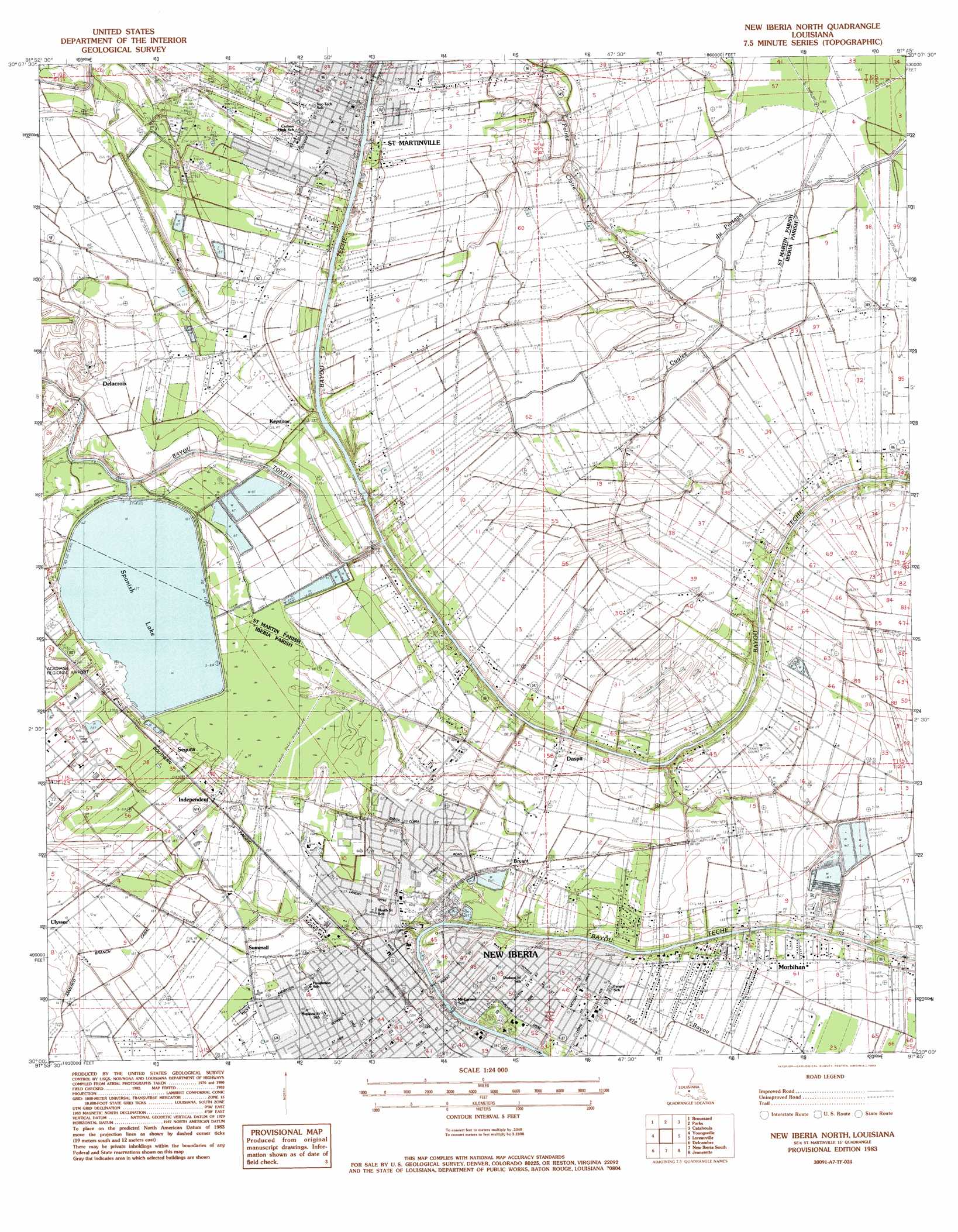
New Iberia North Topo Map Louisiana
To zoom in, hover over the map of New Iberia North
USGS Topo Quad 30091a7 - 1:24,000 scale
| Topo Map Name: | New Iberia North |
| USGS Topo Quad ID: | 30091a7 |
| Print Size: | ca. 21 1/4" wide x 27" high |
| Southeast Coordinates: | 30° N latitude / 91.75° W longitude |
| Map Center Coordinates: | 30.0625° N latitude / 91.8125° W longitude |
| U.S. State: | LA |
| Filename: | o30091a7.jpg |
| Download Map JPG Image: | New Iberia North topo map 1:24,000 scale |
| Map Type: | Topographic |
| Topo Series: | 7.5´ |
| Map Scale: | 1:24,000 |
| Source of Map Images: | United States Geological Survey (USGS) |
| Alternate Map Versions: |
New Iberia North LA 1983, updated 1983 Download PDF Buy paper map New Iberia North LA 2012 Download PDF Buy paper map New Iberia North LA 2015 Download PDF Buy paper map |
1:24,000 Topo Quads surrounding New Iberia North
Carencro |
Breaux Bridge |
Cecilia |
Butte La Rose |
Cow Bayou |
Lafayette |
Broussard |
Parks |
Catahoula |
Lake Mongoulois |
Milton |
Youngsville |
New Iberia North |
Loreauville |
Jackass Bay |
Abbeville East |
Delcambre |
New Iberia South |
Jeanerette |
Charenton |
Hebert Lake |
Tigre Lagoon |
Weeks |
Kemper |
Franklin |
> Back to 30091a1 at 1:100,000 scale
> Back to 30090a1 at 1:250,000 scale
> Back to U.S. Topo Maps home
New Iberia North topo map: Gazetteer
New Iberia North: Airports
Dauterive Hospital Heliport elevation 5m 16′New Iberia North: Dams
Keystone Lock and Dam elevation 3m 9′Sediment Pond Dam elevation 8m 26′
Spanish Lake Dam elevation 2m 6′
New Iberia North: Guts
Bayou La Chute elevation 2m 6′New Iberia North: Lakes
Spanish Lake elevation 2m 6′New Iberia North: Oilfields
Loreauville Gas Field elevation 5m 16′New Iberia North: Parks
Bouligny Plaza elevation 5m 16′Evangeline Oak Park elevation 4m 13′
New Iberia City Park elevation 5m 16′
Saint Martinville Historic District elevation 7m 22′
South Side Park elevation 4m 13′
West End Park elevation 5m 16′
New Iberia North: Populated Places
Cinco (historical) elevation 7m 22′Coopersville elevation 5m 16′
Daspit elevation 2m 6′
Delacroix elevation 5m 16′
Georgetown elevation 6m 19′
Independent elevation 6m 19′
Keystone elevation 7m 22′
Leesburg elevation 5m 16′
Morbihan elevation 6m 19′
New Iberia elevation 5m 16′
Segura elevation 9m 29′
Sumerall elevation 6m 19′
New Iberia North: Post Offices
New Iberia Post Office elevation 6m 19′Saint Martinville Post Office elevation 7m 22′
New Iberia North: Reservoirs
Sediment Pond elevation 8m 26′New Iberia North: Streams
Pointe Claire Coulee elevation 1m 3′New Iberia North digital topo map on disk
Buy this New Iberia North topo map showing relief, roads, GPS coordinates and other geographical features, as a high-resolution digital map file on DVD: