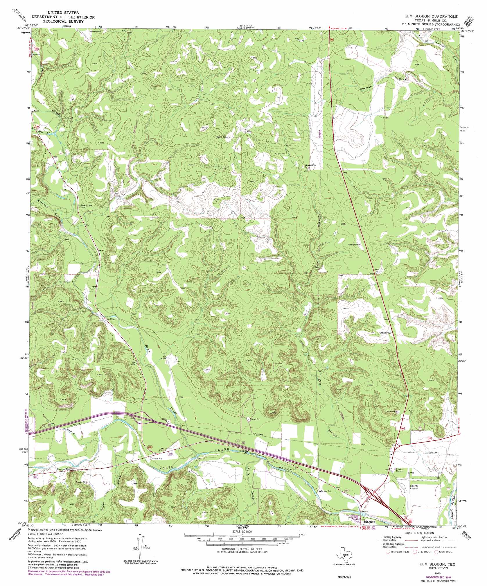
Elm Slough Topo Map Texas
To zoom in, hover over the map of Elm Slough
USGS Topo Quad 30099e7 - 1:24,000 scale
| Topo Map Name: | Elm Slough |
| USGS Topo Quad ID: | 30099e7 |
| Print Size: | ca. 21 1/4" wide x 27" high |
| Southeast Coordinates: | 30.5° N latitude / 99.75° W longitude |
| Map Center Coordinates: | 30.5625° N latitude / 99.8125° W longitude |
| U.S. State: | TX |
| Filename: | o30099e7.jpg |
| Download Map JPG Image: | Elm Slough topo map 1:24,000 scale |
| Map Type: | Topographic |
| Topo Series: | 7.5´ |
| Map Scale: | 1:24,000 |
| Source of Map Images: | United States Geological Survey (USGS) |
| Alternate Map Versions: |
Elm Slough TX 1970, updated 1973 Download PDF Buy paper map Elm Slough TX 1970, updated 1987 Download PDF Buy paper map Elm Slough TX 2010 Download PDF Buy paper map Elm Slough TX 2012 Download PDF Buy paper map Elm Slough TX 2016 Download PDF Buy paper map |
1:24,000 Topo Quads surrounding Elm Slough
Fort Mckavett |
San Augustine Draw |
Spoon Draw |
East Elm Creek |
Hext |
Mckegan Draw Ne |
Rust Ranch |
Julio Draw |
Brewer Hollow |
London |
Mckegan Draw |
Stark Creek |
Elm Slough |
Big Draw |
Yates |
Roosevelt |
Bailey Creek |
Junction |
Segovia |
Tobe Branch |
Hill Ranch |
Telegraph |
Junction Se |
Allen Creek |
Mudge Draw |
> Back to 30099e1 at 1:100,000 scale
> Back to 30098a1 at 1:250,000 scale
> Back to U.S. Topo Maps home
Elm Slough topo map: Gazetteer
Elm Slough: Airports
Kimble County Airport elevation 524m 1719′Elm Slough: Streams
Bear Creek elevation 524m 1719′Elm Slough elevation 513m 1683′
Falls Creek elevation 516m 1692′
Nixon Creek elevation 529m 1735′
West Bear Creek elevation 572m 1876′
Elm Slough: Valleys
Earwood Draw elevation 555m 1820′Ox Hollow elevation 530m 1738′
Elm Slough digital topo map on disk
Buy this Elm Slough topo map showing relief, roads, GPS coordinates and other geographical features, as a high-resolution digital map file on DVD: