London Topo Map Texas
To zoom in, hover over the map of London
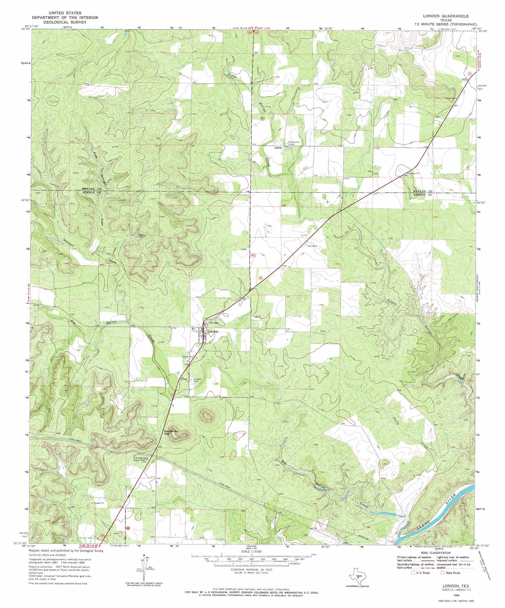
USGS Topo Quad 30099f5 - 1:24,000 scale
| Topo Map Name: | London |
| USGS Topo Quad ID: | 30099f5 |
| Print Size: | ca. 21 1/4" wide x 27" high |
| Southeast Coordinates: | 30.625° N latitude / 99.5° W longitude |
| Map Center Coordinates: | 30.6875° N latitude / 99.5625° W longitude |
| U.S. State: | TX |
| Filename: | o30099f5.jpg |
| Download Map JPG Image: | London topo map 1:24,000 scale |
| Map Type: | Topographic |
| Topo Series: | 7.5´ |
| Map Scale: | 1:24,000 |
| Source of Map Images: | United States Geological Survey (USGS) |
| Alternate Map Versions: |
London TX 1968, updated 1971 Download PDF Buy paper map London TX 2010 Download PDF Buy paper map London TX 2012 Download PDF Buy paper map London TX 2016 Download PDF Buy paper map |
1:24,000 Topo Quads surrounding London
Menard |
Chapman Draw |
Robbers Roost |
Calf Creek |
Katemcy |
Spoon Draw |
East Elm Creek |
Hext |
Long Mountain |
Grit |
Julio Draw |
Brewer Hollow |
London |
Sheep Run Creek |
Turtle Creek |
Elm Slough |
Big Draw |
Yates |
Monument Mountain |
Monument Mountain Se |
Junction |
Segovia |
Tobe Branch |
Noxville |
The Falls |
> Back to 30099e1 at 1:100,000 scale
> Back to 30098a1 at 1:250,000 scale
> Back to U.S. Topo Maps home
London topo map: Gazetteer
London: Gaps
Reichenau Gap elevation 529m 1735′London: Populated Places
London elevation 518m 1699′Saline elevation 544m 1784′
London: Streams
Big Saline Creek elevation 452m 1482′Pecan Creek elevation 546m 1791′
London: Valleys
Frog Springs Draw elevation 548m 1797′Walton Draw elevation 525m 1722′
London digital topo map on disk
Buy this London topo map showing relief, roads, GPS coordinates and other geographical features, as a high-resolution digital map file on DVD: