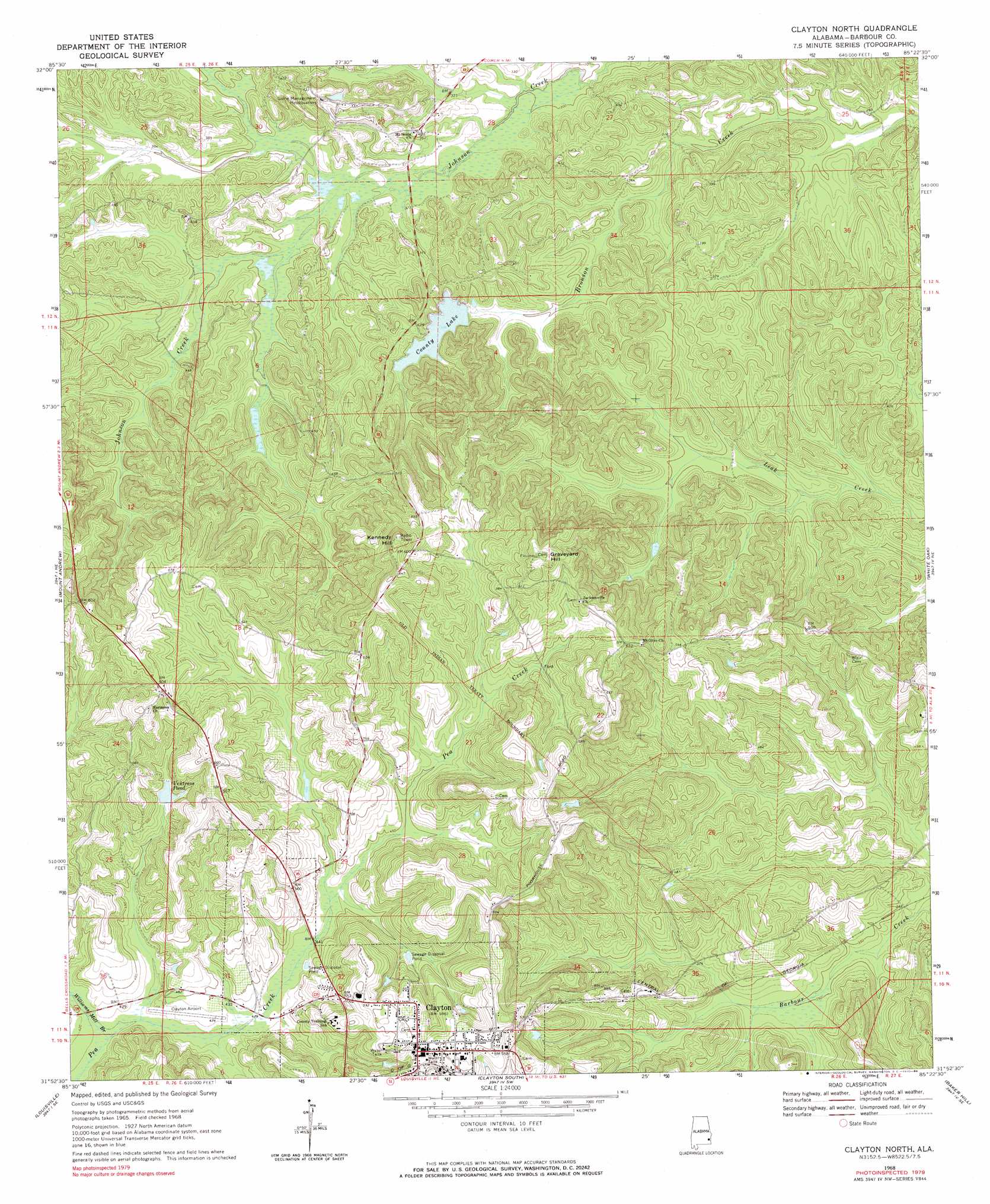
Clayton North Topo Map Alabama
To zoom in, hover over the map of Clayton North
USGS Topo Quad 31085h4 - 1:24,000 scale
| Topo Map Name: | Clayton North |
| USGS Topo Quad ID: | 31085h4 |
| Print Size: | ca. 21 1/4" wide x 27" high |
| Southeast Coordinates: | 31.875° N latitude / 85.375° W longitude |
| Map Center Coordinates: | 31.9375° N latitude / 85.4375° W longitude |
| U.S. State: | AL |
| Filename: | o31085h4.jpg |
| Download Map JPG Image: | Clayton North topo map 1:24,000 scale |
| Map Type: | Topographic |
| Topo Series: | 7.5´ |
| Map Scale: | 1:24,000 |
| Source of Map Images: | United States Geological Survey (USGS) |
| Alternate Map Versions: |
Clayton North AL 1968, updated 1970 Download PDF Buy paper map Clayton North AL 1968, updated 1971 Download PDF Buy paper map Clayton North AL 2011 Download PDF Buy paper map Clayton North AL 2014 Download PDF Buy paper map |
1:24,000 Topo Quads surrounding Clayton North
Union Springs |
Roba |
Hurtsboro |
Rutherford |
Pittsview |
Aberfoil |
Midway |
Comer |
Batesville |
Howe |
Perote |
Mount Andrew |
Clayton North |
White Oak |
Eufaula North |
Josie |
Louisville |
Clayton South |
Baker Hill |
Eufaula South |
Elamville |
Clio |
Texasville |
Lawrenceville |
Fort Gaines Nw |
> Back to 31085e1 at 1:100,000 scale
> Back to 31084a1 at 1:250,000 scale
> Back to U.S. Topo Maps home
Clayton North topo map: Gazetteer
Clayton North: Airports
Clayton Municipal Airport elevation 130m 426′Clayton North: Dams
Barbour County Public Lake Dam elevation 118m 387′Clayton North: Populated Places
Clayton elevation 180m 590′Mount Olive (historical) elevation 168m 551′
Clayton North: Post Offices
Clayton Post Office elevation 180m 590′Clayton North: Reservoirs
County Lake elevation 118m 387′Ventress Pond elevation 145m 475′
Clayton North: Streams
Williams Mill Branch elevation 124m 406′Clayton North: Summits
Graveyard Hill elevation 211m 692′Kennedy Hill elevation 210m 688′
Clayton North digital topo map on disk
Buy this Clayton North topo map showing relief, roads, GPS coordinates and other geographical features, as a high-resolution digital map file on DVD:
Gulf Coast (LA, MS, AL, FL) & Southwestern Georgia
Buy digital topo maps: Gulf Coast (LA, MS, AL, FL) & Southwestern Georgia
 & Southwestern Georgia map DVD")