Tylertown Se Topo Map Mississippi
To zoom in, hover over the map of Tylertown Se
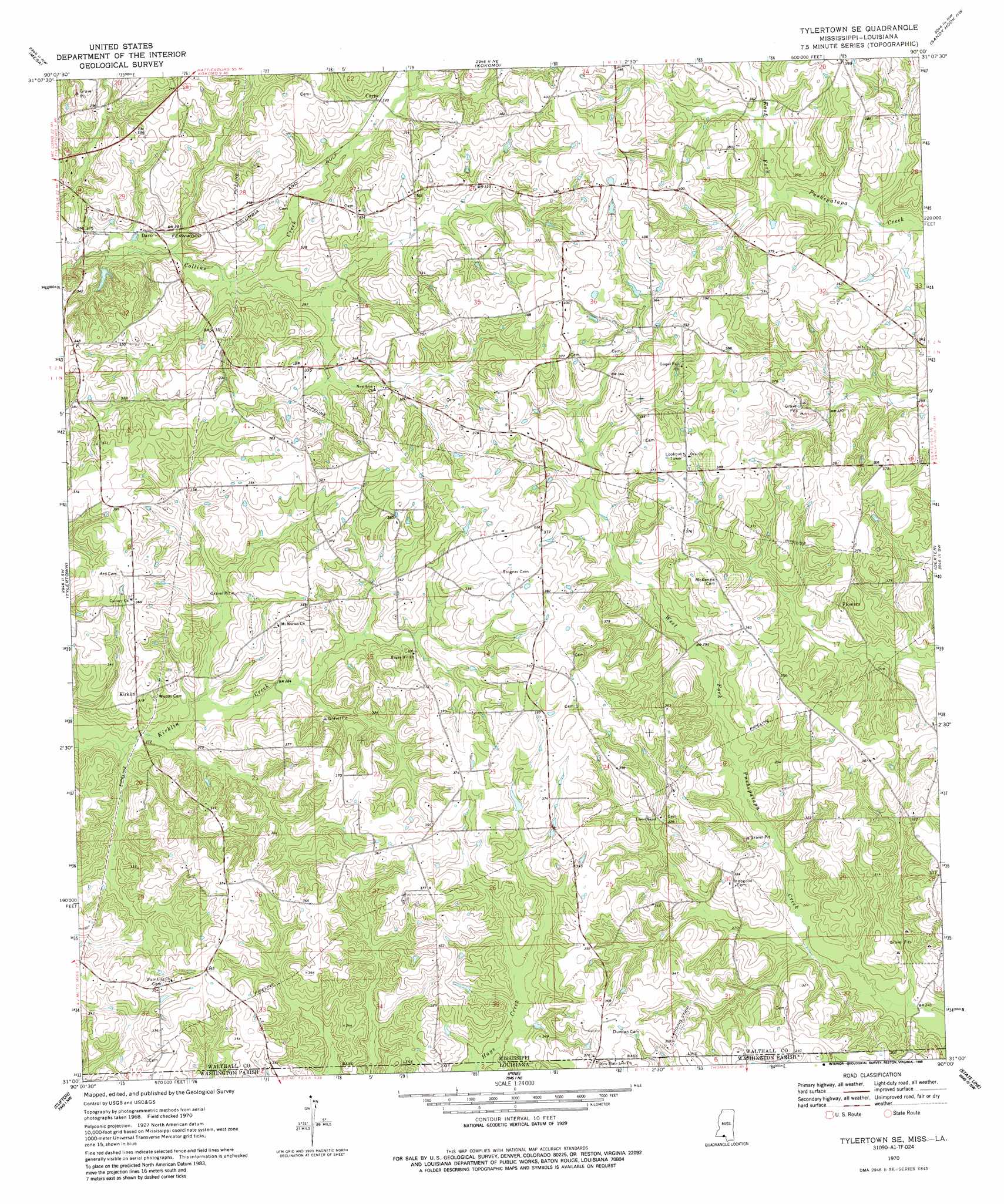
USGS Topo Quad 31090a1 - 1:24,000 scale
| Topo Map Name: | Tylertown Se |
| USGS Topo Quad ID: | 31090a1 |
| Print Size: | ca. 21 1/4" wide x 27" high |
| Southeast Coordinates: | 31° N latitude / 90° W longitude |
| Map Center Coordinates: | 31.0625° N latitude / 90.0625° W longitude |
| U.S. States: | MS, LA |
| Filename: | o31090a1.jpg |
| Download Map JPG Image: | Tylertown Se topo map 1:24,000 scale |
| Map Type: | Topographic |
| Topo Series: | 7.5´ |
| Map Scale: | 1:24,000 |
| Source of Map Images: | United States Geological Survey (USGS) |
| Alternate Map Versions: |
Tylertown SE MS 1970, updated 1972 Download PDF Buy paper map Tylertown SE MS 1970, updated 1988 Download PDF Buy paper map Tylertown SE MS 2012 Download PDF Buy paper map Tylertown SE MS 2015 Download PDF Buy paper map |
1:24,000 Topo Quads surrounding Tylertown Se
Pricedale |
Jayess |
Darbun |
Morgantown |
Columbia North |
Holmesville |
Mesa |
Kokomo |
Sandy Hook Nw |
Columbia South |
Progress |
Tylertown |
Tylertown Se |
Dexter |
Sandy Hook |
Sunny Hill |
Clifton |
Pine |
State Line |
Angie |
Wilmer |
Franklinton |
Sheridan |
Bogalusa West |
Bogalusa East |
> Back to 31090a1 at 1:100,000 scale
> Back to 31090a1 at 1:250,000 scale
> Back to U.S. Topo Maps home
Tylertown Se topo map: Gazetteer
Tylertown Se: Dams
Alton Stogner Lake Dam elevation 89m 291′Tylertown Se: Populated Places
Carto elevation 97m 318′Davo elevation 88m 288′
Flowers elevation 107m 351′
Kirklin elevation 98m 321′
Tylertown Se digital topo map on disk
Buy this Tylertown Se topo map showing relief, roads, GPS coordinates and other geographical features, as a high-resolution digital map file on DVD: