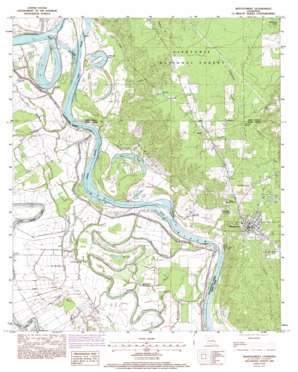
Montgomery Topo Map Louisiana
To zoom in, hover over the map of Montgomery
USGS Topo Quad 31092f8 - 1:24,000 scale
| Topo Map Name: | Montgomery |
| USGS Topo Quad ID: | 31092f8 |
| Print Size: | ca. 21 1/4" wide x 27" high |
| Southeast Coordinates: | 31.625° N latitude / 92.875° W longitude |
| Map Center Coordinates: | 31.6875° N latitude / 92.9375° W longitude |
| U.S. State: | LA |
| Filename: | o31092f8.jpg |
| Download Map JPG Image: | Montgomery topo map 1:24,000 scale |
| Map Type: | Topographic |
| Topo Series: | 7.5´ |
| Map Scale: | 1:24,000 |
| Source of Map Images: | United States Geological Survey (USGS) |
| Alternate Map Versions: |
Montgomery LA 1983, updated 1984 Download PDF Buy paper map Montgomery LA 1983, updated 1993 Download PDF Buy paper map Montgomery LA 2003, updated 2005 Download PDF Buy paper map Montgomery LA 2012 Download PDF Buy paper map Montgomery LA 2015 Download PDF Buy paper map |
| FStopo: | US Forest Service topo Montgomery is available: Download FStopo PDF Download FStopo TIF |
1:24,000 Topo Quads surrounding Montgomery
> Back to 31092e1 at 1:100,000 scale
> Back to 31092a1 at 1:250,000 scale
> Back to U.S. Topo Maps home
Montgomery topo map: Gazetteer
Montgomery: Airports
Robinson Landing Strip elevation 31m 101′Montgomery: Cliffs
Petite Ecore elevation 29m 95′Montgomery: Crossings
Montgomery Ferry (historical) elevation 28m 91′Montgomery: Guts
Bayou Athao elevation 30m 98′Bayou Cadoche elevation 31m 101′
Bayou Cognac elevation 32m 104′
Bayou Cypress elevation 29m 95′
Bayou des Glaizes elevation 31m 101′
Bayou Milieu elevation 30m 98′
Bayou Roseaux elevation 32m 104′
Bayou Seep elevation 30m 98′
Mobly Bayou elevation 27m 88′
Wheeler Bayou elevation 31m 101′
Montgomery: Lakes
Ben Lake elevation 31m 101′Dunn Lake elevation 29m 95′
Saint Maurice Lake elevation 29m 95′
Montgomery: Populated Places
Boley elevation 51m 167′Cockfield (historical) elevation 30m 98′
Cognac (historical) elevation 32m 104′
Crews elevation 52m 170′
Kadesh elevation 43m 141′
Montgomery elevation 47m 154′
Old Montgomery (historical) elevation 41m 134′
Williams Corner (historical) elevation 32m 104′
Montgomery: Springs
Ebenezer Spring elevation 38m 124′Montgomery: Streams
Campground Branch elevation 37m 121′Kadesh Branch elevation 38m 124′
Trestle Branch elevation 31m 101′
Montgomery: Swamps
Quinn Brake elevation 31m 101′Montgomery digital topo map on disk
Buy this Montgomery topo map showing relief, roads, GPS coordinates and other geographical features, as a high-resolution digital map file on DVD:


