Chireno North Topo Map Texas
To zoom in, hover over the map of Chireno North
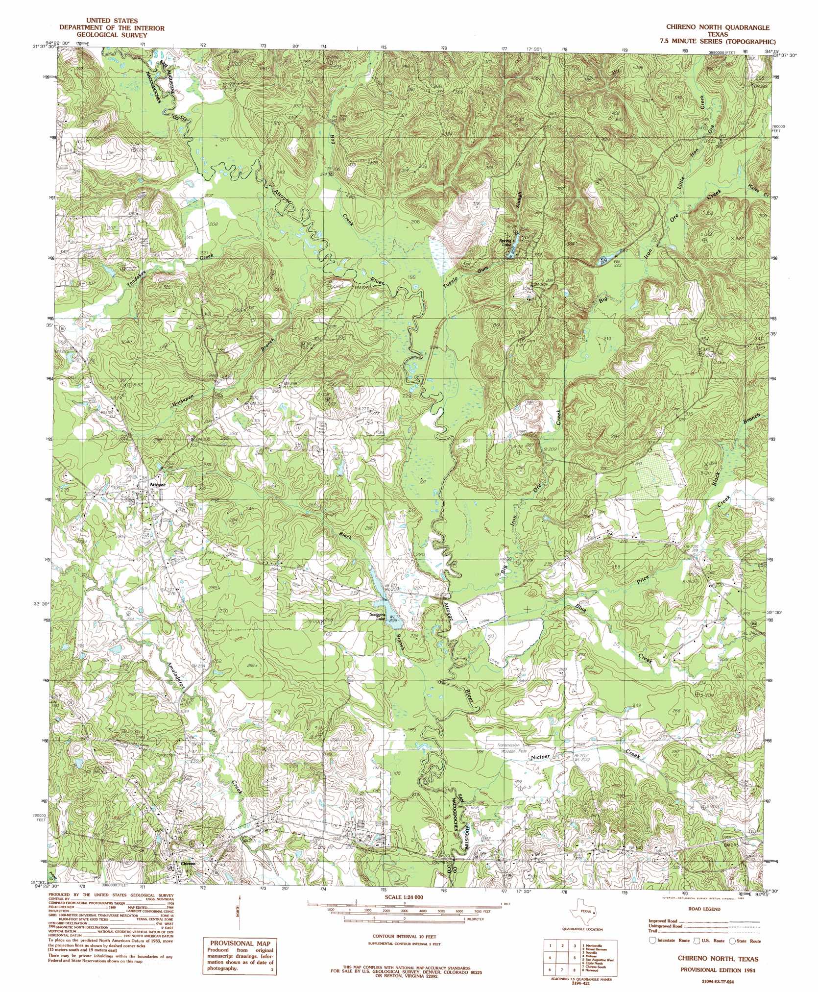
USGS Topo Quad 31094e3 - 1:24,000 scale
| Topo Map Name: | Chireno North |
| USGS Topo Quad ID: | 31094e3 |
| Print Size: | ca. 21 1/4" wide x 27" high |
| Southeast Coordinates: | 31.5° N latitude / 94.25° W longitude |
| Map Center Coordinates: | 31.5625° N latitude / 94.3125° W longitude |
| U.S. State: | TX |
| Filename: | o31094e3.jpg |
| Download Map JPG Image: | Chireno North topo map 1:24,000 scale |
| Map Type: | Topographic |
| Topo Series: | 7.5´ |
| Map Scale: | 1:24,000 |
| Source of Map Images: | United States Geological Survey (USGS) |
| Alternate Map Versions: |
Chireno North TX 1984, updated 1985 Download PDF Buy paper map Chireno North TX 2010 Download PDF Buy paper map Chireno North TX 2013 Download PDF Buy paper map Chireno North TX 2016 Download PDF Buy paper map |
1:24,000 Topo Quads surrounding Chireno North
Garrison West |
Garrison East |
Arcadia |
Center |
Shelbyville |
Appleby |
Martinsville |
Mount Herman |
Neuville |
Hurstown |
Woden |
Melrose |
Chireno North |
San Augustine West |
San Augustine East |
Platt |
Etoile North |
Chireno South |
Norwood |
Chinquapin |
Huntington |
Etoile South |
Broaddus |
Harvey Creek |
Bronson |
> Back to 31094e1 at 1:100,000 scale
> Back to 31094a1 at 1:250,000 scale
> Back to U.S. Topo Maps home
Chireno North topo map: Gazetteer
Chireno North: Dams
Pat Scoggins Dam elevation 64m 209′Spring Lake Dam elevation 73m 239′
Chireno North: Populated Places
Attoyac elevation 94m 308′Camp Worth (historical) elevation 123m 403′
New Hope elevation 69m 226′
Chireno North: Reservoirs
Pat Scoggins Lake elevation 64m 209′Scoggins Lake elevation 64m 209′
Spring Lake elevation 79m 259′
Spring Lake elevation 73m 239′
Chireno North: Streams
Big Iron Ore Creek elevation 58m 190′Black Branch elevation 56m 183′
Black Branch elevation 72m 236′
Blue Creek elevation 58m 190′
Bog Creek elevation 61m 200′
Horsepen Branch elevation 61m 200′
Hulse Creek elevation 70m 229′
Little Iron Ore Creek elevation 68m 223′
Niciper Creek elevation 55m 180′
Price Creek elevation 58m 190′
Tandakee Creek elevation 62m 203′
Tupelo Gum Slough elevation 60m 196′
Chireno North digital topo map on disk
Buy this Chireno North topo map showing relief, roads, GPS coordinates and other geographical features, as a high-resolution digital map file on DVD: