Elkhart Creek Topo Map Texas
To zoom in, hover over the map of Elkhart Creek
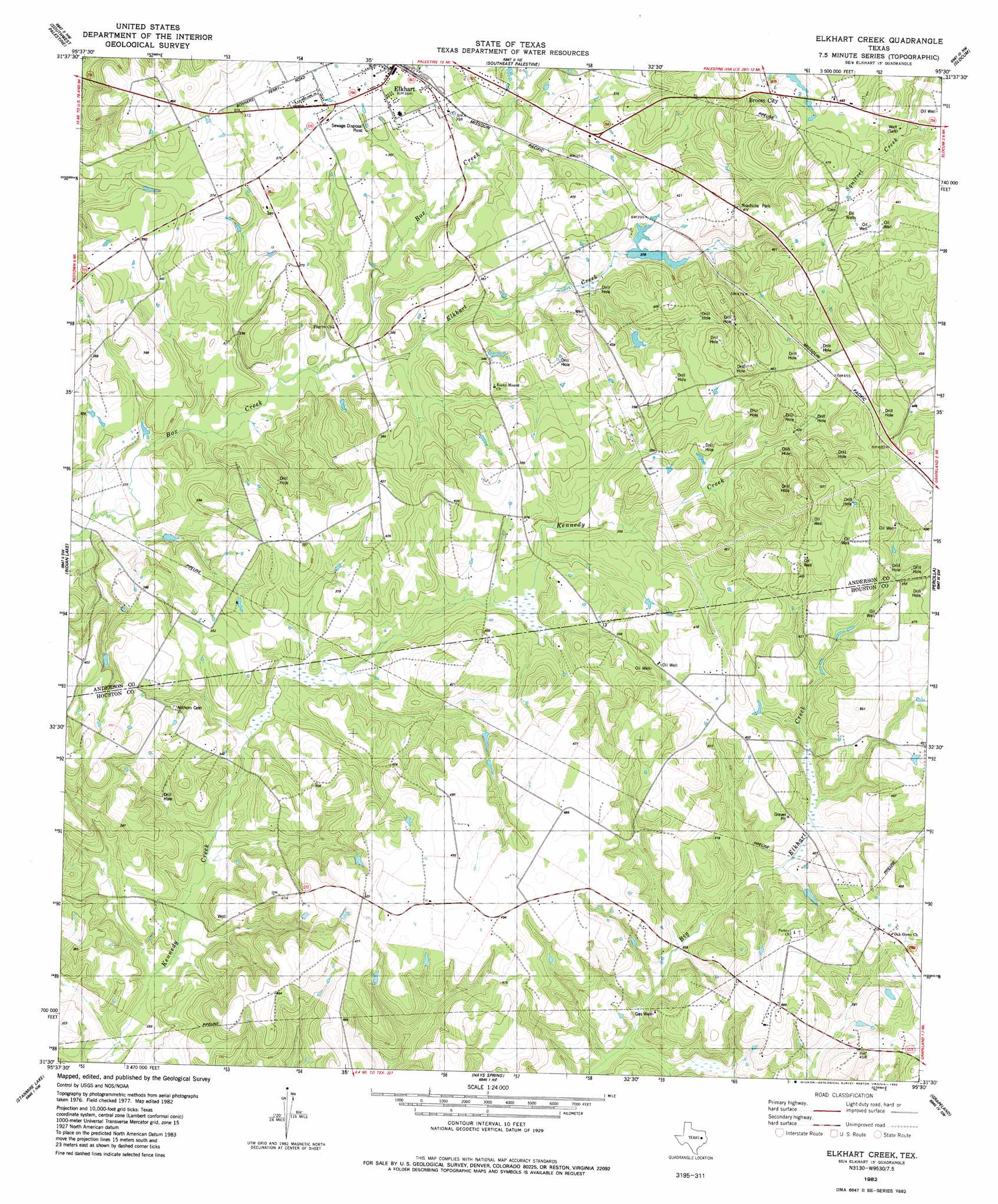
USGS Topo Quad 31095e5 - 1:24,000 scale
| Topo Map Name: | Elkhart Creek |
| USGS Topo Quad ID: | 31095e5 |
| Print Size: | ca. 21 1/4" wide x 27" high |
| Southeast Coordinates: | 31.5° N latitude / 95.5° W longitude |
| Map Center Coordinates: | 31.5625° N latitude / 95.5625° W longitude |
| U.S. State: | TX |
| Filename: | o31095e5.jpg |
| Download Map JPG Image: | Elkhart Creek topo map 1:24,000 scale |
| Map Type: | Topographic |
| Topo Series: | 7.5´ |
| Map Scale: | 1:24,000 |
| Source of Map Images: | United States Geological Survey (USGS) |
| Alternate Map Versions: |
Elkhart Creek TX 1982, updated 1982 Download PDF Buy paper map Elkhart Creek TX 2010 Download PDF Buy paper map Elkhart Creek TX 2013 Download PDF Buy paper map Elkhart Creek TX 2016 Download PDF Buy paper map |
1:24,000 Topo Quads surrounding Elkhart Creek
Tennessee Colony |
Northwest Palestine |
Northeast Palestine |
Neches |
Maydelle |
Long Lake |
Southwest Palestine |
Southeast Palestine |
Slocum |
Denson Springs |
Oakwood |
Indian Lake |
Elkhart Creek |
Percilla |
Augusta |
Lake Leon |
Stanmire Lake |
Hays Spring |
Grapeland |
Crockett Ne |
Eunice |
Halls Bluff |
Porter Springs |
Crockett |
Berea |
> Back to 31095e1 at 1:100,000 scale
> Back to 31094a1 at 1:250,000 scale
> Back to U.S. Topo Maps home
Elkhart Creek topo map: Gazetteer
Elkhart Creek: Springs
Elkhart Creek Springs elevation 137m 449′Elkhart Creek: Streams
Little Creek elevation 96m 314′Elkhart Creek digital topo map on disk
Buy this Elkhart Creek topo map showing relief, roads, GPS coordinates and other geographical features, as a high-resolution digital map file on DVD: