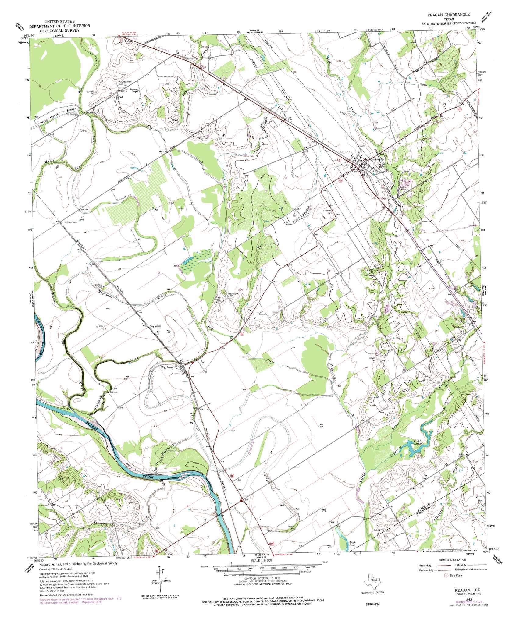
Reagan Topo Map Texas
To zoom in, hover over the map of Reagan
USGS Topo Quad 31096b7 - 1:24,000 scale
| Topo Map Name: | Reagan |
| USGS Topo Quad ID: | 31096b7 |
| Print Size: | ca. 21 1/4" wide x 27" high |
| Southeast Coordinates: | 31.125° N latitude / 96.75° W longitude |
| Map Center Coordinates: | 31.1875° N latitude / 96.8125° W longitude |
| U.S. State: | TX |
| Filename: | o31096b7.jpg |
| Download Map JPG Image: | Reagan topo map 1:24,000 scale |
| Map Type: | Topographic |
| Topo Series: | 7.5´ |
| Map Scale: | 1:24,000 |
| Source of Map Images: | United States Geological Survey (USGS) |
| Alternate Map Versions: |
Reagan TX 1962, updated 1964 Download PDF Buy paper map Reagan TX 1962, updated 1978 Download PDF Buy paper map Reagan TX 2010 Download PDF Buy paper map Reagan TX 2013 Download PDF Buy paper map Reagan TX 2016 Download PDF Buy paper map |
1:24,000 Topo Quads surrounding Reagan
Robinson |
Riesel |
Otto |
Odds |
Thornton |
Chilton |
Marlin |
Mcclanahan |
Kosse West |
Kosse East |
Lott |
Cedar Springs |
Reagan |
Bremond |
Petteway |
Westphalia |
Rosebud |
Baileyville |
Hammond |
Owensville |
Yarrelton |
Ben Arnold |
Maysfield |
Calvert |
Hearne North |
> Back to 31096a1 at 1:100,000 scale
> Back to 31096a1 at 1:250,000 scale
> Back to U.S. Topo Maps home
Reagan topo map: Gazetteer
Reagan: Guts
Big Creek elevation 100m 328′Highbank Slough elevation 98m 321′
Reagan: Lakes
Flag Lake elevation 94m 308′Reagan: Populated Places
Beacon elevation 106m 347′Coymack elevation 98m 321′
Highbank elevation 98m 321′
Reagan elevation 116m 380′
Reagan: Streams
Bee Branch elevation 97m 318′Big Creek elevation 98m 321′
Copperas Creek elevation 94m 308′
Fish Creek elevation 94m 308′
Goose Branch elevation 102m 334′
Highbank Creek elevation 96m 314′
Hog Branch elevation 98m 321′
Spring Branch elevation 89m 291′
Reagan digital topo map on disk
Buy this Reagan topo map showing relief, roads, GPS coordinates and other geographical features, as a high-resolution digital map file on DVD: