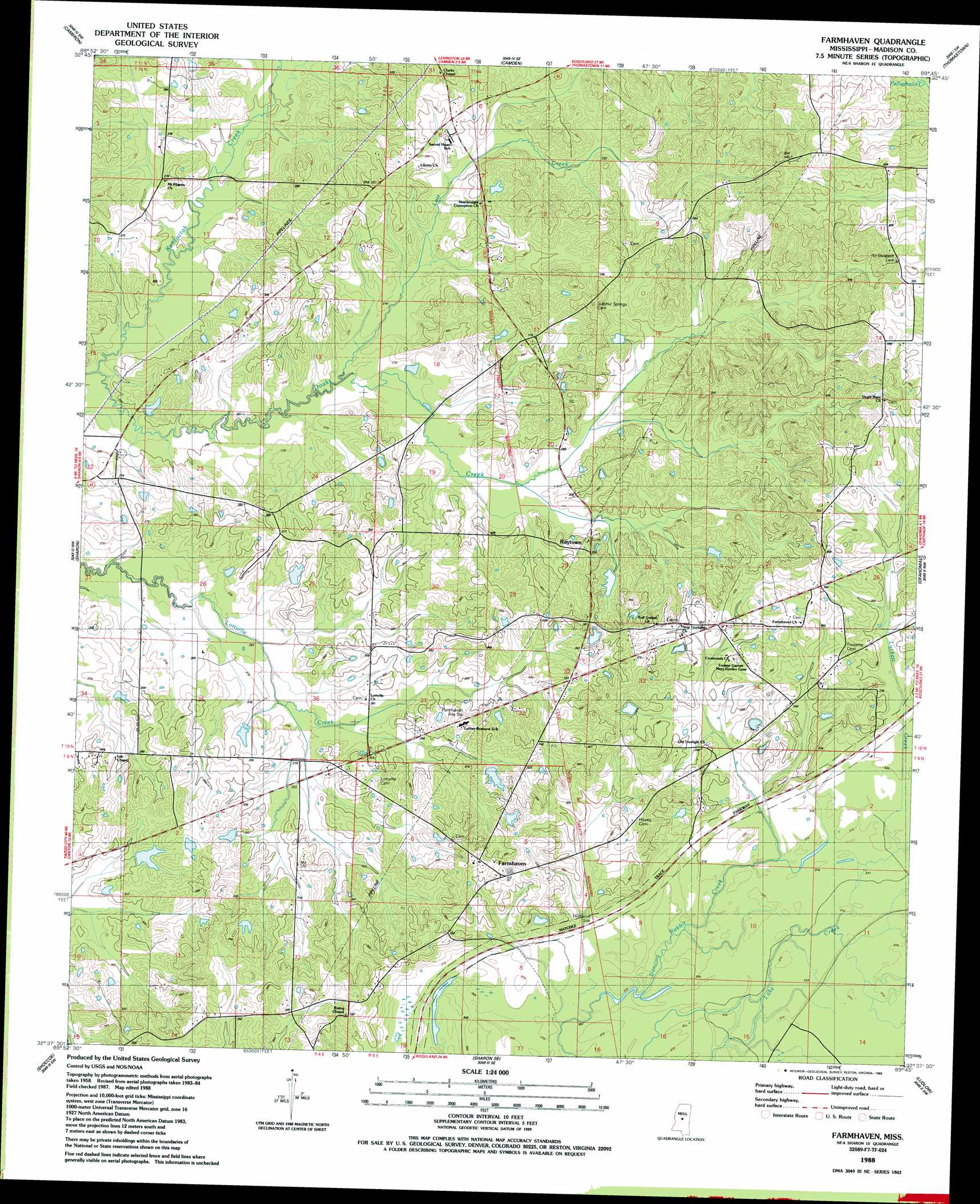
Farmhaven Topo Map Mississippi
To zoom in, hover over the map of Farmhaven
USGS Topo Quad 32089f7 - 1:24,000 scale
| Topo Map Name: | Farmhaven |
| USGS Topo Quad ID: | 32089f7 |
| Print Size: | ca. 21 1/4" wide x 27" high |
| Southeast Coordinates: | 32.625° N latitude / 89.75° W longitude |
| Map Center Coordinates: | 32.6875° N latitude / 89.8125° W longitude |
| U.S. State: | MS |
| Filename: | o32089f7.jpg |
| Download Map JPG Image: | Farmhaven topo map 1:24,000 scale |
| Map Type: | Topographic |
| Topo Series: | 7.5´ |
| Map Scale: | 1:24,000 |
| Source of Map Images: | United States Geological Survey (USGS) |
| Alternate Map Versions: |
Farmhaven MS 1988, updated 1989 Download PDF Buy paper map Farmhaven MS 2012 Download PDF Buy paper map Farmhaven MS 2015 Download PDF Buy paper map |
1:24,000 Topo Quads surrounding Farmhaven
Ebenezer |
Goodman |
Newport |
Joseph |
Singleton |
Vaughan |
Cameron |
Camden |
Thomastown |
Conway |
Way |
Sharon |
Farmhaven |
Ofahoma |
Carthage |
Canton |
Shoccoe |
Sharon Se |
Ludlow |
Lena |
Madison |
Goshen Springs |
Leesburg |
Forkville |
Hillsboro |
> Back to 32089e1 at 1:100,000 scale
> Back to 32088a1 at 1:250,000 scale
> Back to U.S. Topo Maps home
Farmhaven topo map: Gazetteer
Farmhaven: Dams
Bennett Lake Dam elevation 91m 298′Collin Wohner Lake Dam elevation 75m 246′
L L Bennett Pond Dam elevation 97m 318′
Madison County Lake Dam elevation 91m 298′
Farmhaven: Parks
Choctaw Boundary Historical Site elevation 98m 321′Yockanookany Roadside Park elevation 97m 318′
Farmhaven: Populated Places
Farmhaven elevation 114m 374′Havendale elevation 85m 278′
Millville elevation 108m 354′
Raytown elevation 100m 328′
Farmhaven: Post Offices
Doaks Stand Post Office (historical) elevation 105m 344′Farmhaven: Streams
Kentuctah Creek elevation 70m 229′Lott Creek elevation 76m 249′
Luckett Creek elevation 95m 311′
Farmhaven digital topo map on disk
Buy this Farmhaven topo map showing relief, roads, GPS coordinates and other geographical features, as a high-resolution digital map file on DVD:
Gulf Coast (LA, MS, AL, FL) & Southwestern Georgia
Buy digital topo maps: Gulf Coast (LA, MS, AL, FL) & Southwestern Georgia
 & Southwestern Georgia map DVD")