Onward Topo Map Mississippi
To zoom in, hover over the map of Onward
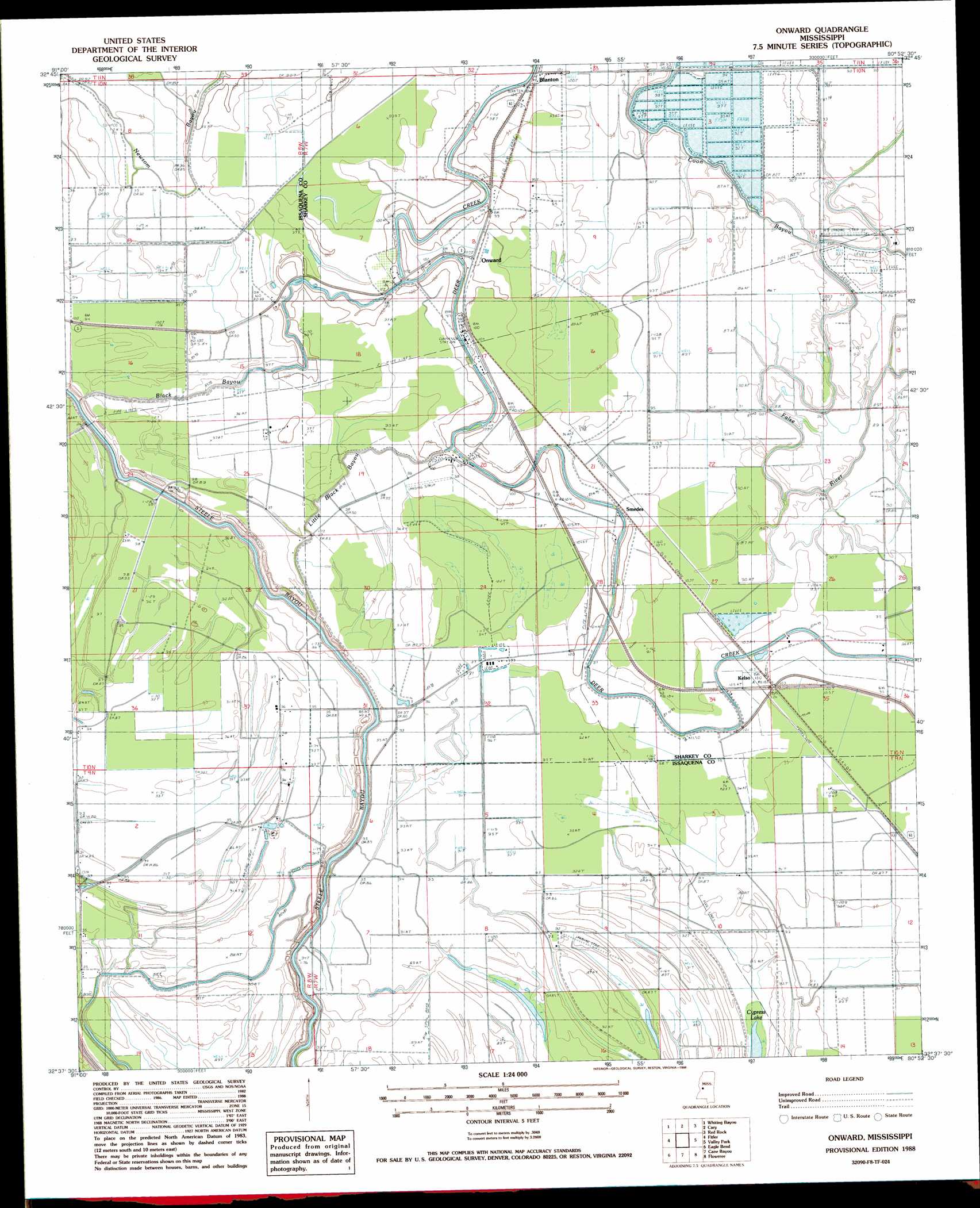
USGS Topo Quad 32090f8 - 1:24,000 scale
| Topo Map Name: | Onward |
| USGS Topo Quad ID: | 32090f8 |
| Print Size: | ca. 21 1/4" wide x 27" high |
| Southeast Coordinates: | 32.625° N latitude / 90.875° W longitude |
| Map Center Coordinates: | 32.6875° N latitude / 90.9375° W longitude |
| U.S. State: | MS |
| Filename: | o32090f8.jpg |
| Download Map JPG Image: | Onward topo map 1:24,000 scale |
| Map Type: | Topographic |
| Topo Series: | 7.5´ |
| Map Scale: | 1:24,000 |
| Source of Map Images: | United States Geological Survey (USGS) |
| Alternate Map Versions: |
Onward MS 1988, updated 1988 Download PDF Buy paper map Onward MS 2012 Download PDF Buy paper map Onward MS 2015 Download PDF Buy paper map |
1:24,000 Topo Quads surrounding Onward
Millikin |
Mayersville |
Rolling Fork West |
Rolling Fork East |
Bayland |
Lake Providence |
Whiting Bayou |
Cary |
Red Rock |
Holly Bluff |
Transylvania |
Fitler |
Onward |
Valley Park |
Lucre |
Sondheimer |
Eagle Bend |
Cane Bayou |
Floweree |
Eldorado |
Tallulah |
Ashly |
Long Lake |
Redwood |
Oak Ridge |
> Back to 32090e1 at 1:100,000 scale
> Back to 32090a1 at 1:250,000 scale
> Back to U.S. Topo Maps home
Onward topo map: Gazetteer
Onward: Airports
Priddy Airport elevation 26m 85′Reality Plantation Airport elevation 29m 95′
Onward: Dams
Bill Moore Planting Company Pond Dam elevation 26m 85′Purddy and Sons Catfish Ponds Dam elevation 25m 82′
Onward: Guts
Black Bayou elevation 27m 88′Onward: Populated Places
Blanton elevation 29m 95′Kelso elevation 27m 88′
Onward elevation 31m 101′
Smedes elevation 28m 91′
Onward: Streams
Coon Bayou elevation 27m 88′Little Black Bayou elevation 29m 95′
Onward digital topo map on disk
Buy this Onward topo map showing relief, roads, GPS coordinates and other geographical features, as a high-resolution digital map file on DVD: