Lisbon Topo Map Louisiana
To zoom in, hover over the map of Lisbon
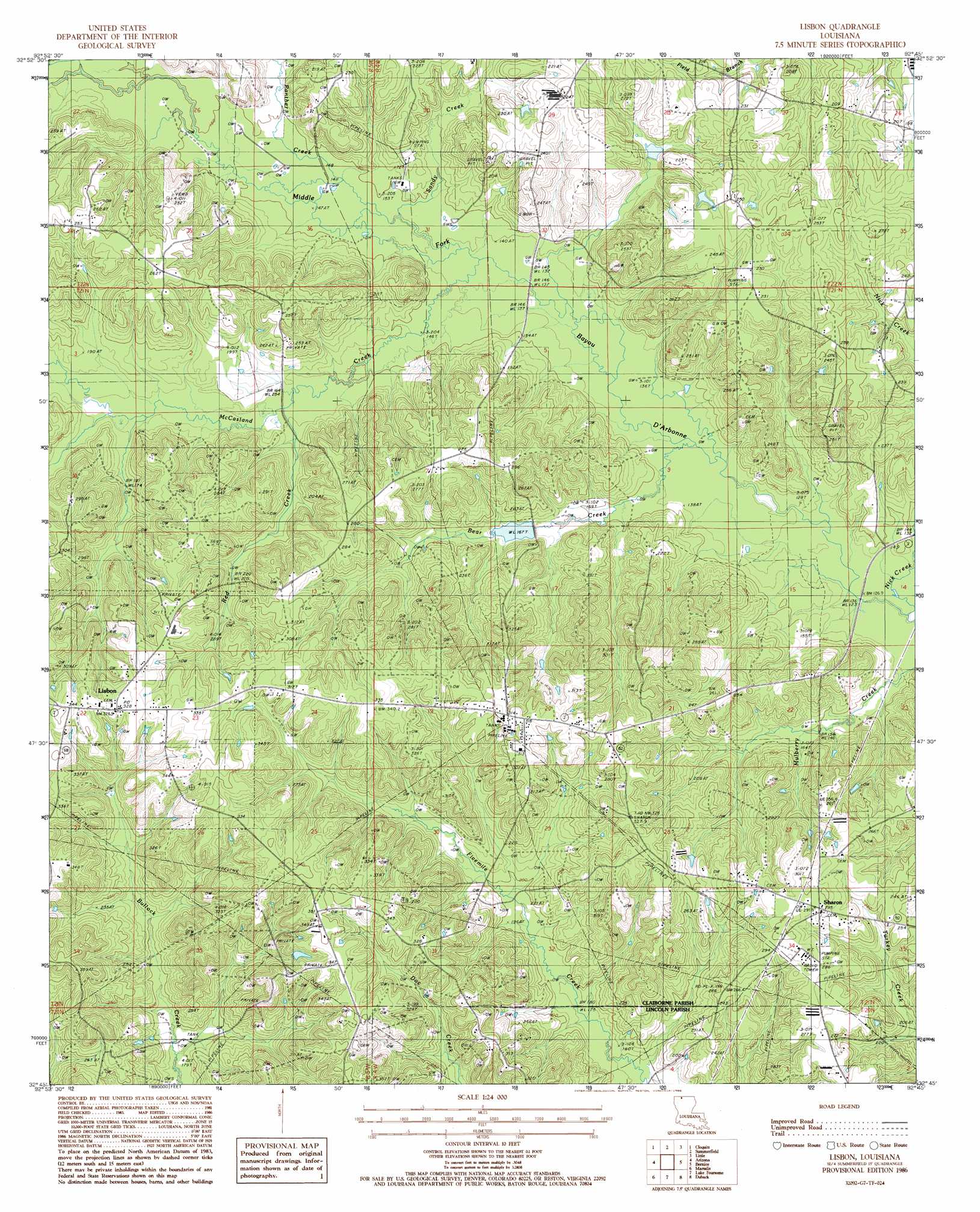
USGS Topo Quad 32092g7 - 1:24,000 scale
| Topo Map Name: | Lisbon |
| USGS Topo Quad ID: | 32092g7 |
| Print Size: | ca. 21 1/4" wide x 27" high |
| Southeast Coordinates: | 32.75° N latitude / 92.75° W longitude |
| Map Center Coordinates: | 32.8125° N latitude / 92.8125° W longitude |
| U.S. State: | LA |
| Filename: | o32092g7.jpg |
| Download Map JPG Image: | Lisbon topo map 1:24,000 scale |
| Map Type: | Topographic |
| Topo Series: | 7.5´ |
| Map Scale: | 1:24,000 |
| Source of Map Images: | United States Geological Survey (USGS) |
| Alternate Map Versions: |
Lisbon LA 1986, updated 1986 Download PDF Buy paper map Lisbon LA 1986, updated 1986 Download PDF Buy paper map Lisbon LA 2012 Download PDF Buy paper map Lisbon LA 2015 Download PDF Buy paper map |
1:24,000 Topo Quads surrounding Lisbon
Emerson Se |
Wesson Sw |
Wesson |
Junction City |
Lockhart |
Haynesville East |
Colquitt |
Summerfield |
Lillie |
Spearsville |
Homer |
Arizona |
Lisbon |
Bernice |
Shiloh |
Athens |
Marsalis |
Lake Foursome |
Dubach |
Cedarton |
Gibsland |
Arcadia |
Simsboro |
Ruston West |
Ruston East |
> Back to 32092e1 at 1:100,000 scale
> Back to 32092a1 at 1:250,000 scale
> Back to U.S. Topo Maps home
Lisbon topo map: Gazetteer
Lisbon: Dams
King Lake Dam elevation 46m 150′Lisbon: Oilfields
Lisbon Oil Field elevation 72m 236′Panther Creek Gas Field elevation 49m 160′
Lisbon: Populated Places
Lisbon elevation 100m 328′Sharon elevation 89m 291′
Lisbon: Post Offices
Lisbon Post Office elevation 100m 328′Lisbon: Streams
Bear Creek elevation 41m 134′McCasland Creek elevation 42m 137′
Panther Creek elevation 44m 144′
Red Creek elevation 48m 157′
Sandy Creek elevation 42m 137′
Lisbon digital topo map on disk
Buy this Lisbon topo map showing relief, roads, GPS coordinates and other geographical features, as a high-resolution digital map file on DVD: