Funston Topo Map Texas
To zoom in, hover over the map of Funston
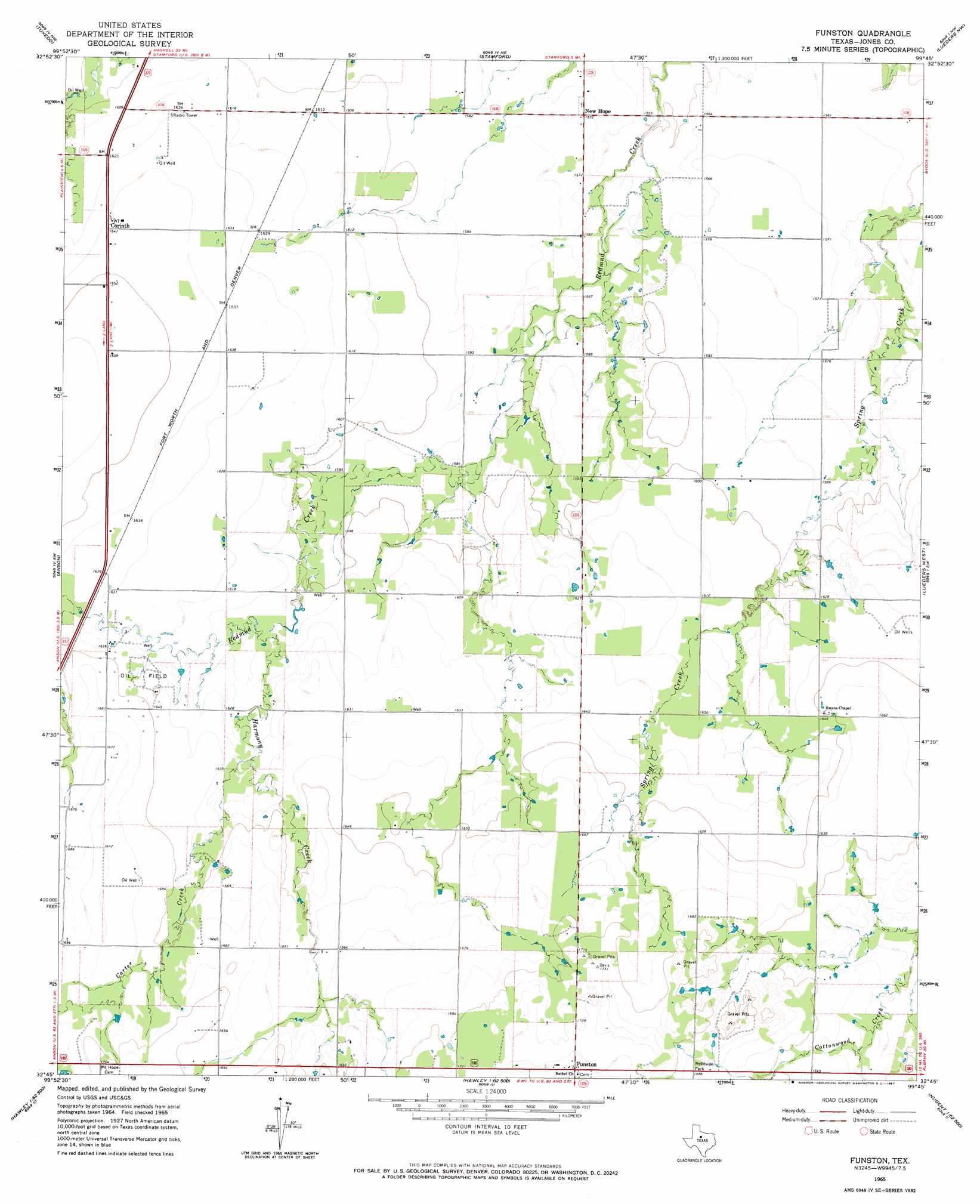
USGS Topo Quad 32099g7 - 1:24,000 scale
| Topo Map Name: | Funston |
| USGS Topo Quad ID: | 32099g7 |
| Print Size: | ca. 21 1/4" wide x 27" high |
| Southeast Coordinates: | 32.75° N latitude / 99.75° W longitude |
| Map Center Coordinates: | 32.8125° N latitude / 99.8125° W longitude |
| U.S. State: | TX |
| Filename: | o32099g7.jpg |
| Download Map JPG Image: | Funston topo map 1:24,000 scale |
| Map Type: | Topographic |
| Topo Series: | 7.5´ |
| Map Scale: | 1:24,000 |
| Source of Map Images: | United States Geological Survey (USGS) |
| Alternate Map Versions: |
Funston TX 1965, updated 1967 Download PDF Buy paper map Funston TX 2010 Download PDF Buy paper map Funston TX 2012 Download PDF Buy paper map Funston TX 2016 Download PDF Buy paper map |
1:24,000 Topo Quads surrounding Funston
Frog Mountain |
Sagerton |
Dudleys Creek |
Lake Stamford West |
Lake Stamford East |
Hamlin Ne |
Tuxedo |
Stamford |
Lueders Nw |
Lueders Ne |
Neinda |
Anson |
Funston |
Lueders West |
Lueders East |
Noodle Ne |
Truby |
Hawley Ne |
Nugent |
Smokey Draw |
Noodle |
Stith |
Hawley |
Hamby |
Flattop |
> Back to 32099e1 at 1:100,000 scale
> Back to 32098a1 at 1:250,000 scale
> Back to U.S. Topo Maps home
Funston topo map: Gazetteer
Funston: Airports
J Bar Wc Ranch Airport elevation 494m 1620′Funston: Populated Places
Corinth elevation 500m 1640′Funston elevation 532m 1745′
New Hope elevation 479m 1571′
Funston: Streams
Carter Creek elevation 494m 1620′Harmony Creek elevation 490m 1607′
Funston digital topo map on disk
Buy this Funston topo map showing relief, roads, GPS coordinates and other geographical features, as a high-resolution digital map file on DVD: