Big Spring South Topo Map Texas
To zoom in, hover over the map of Big Spring South
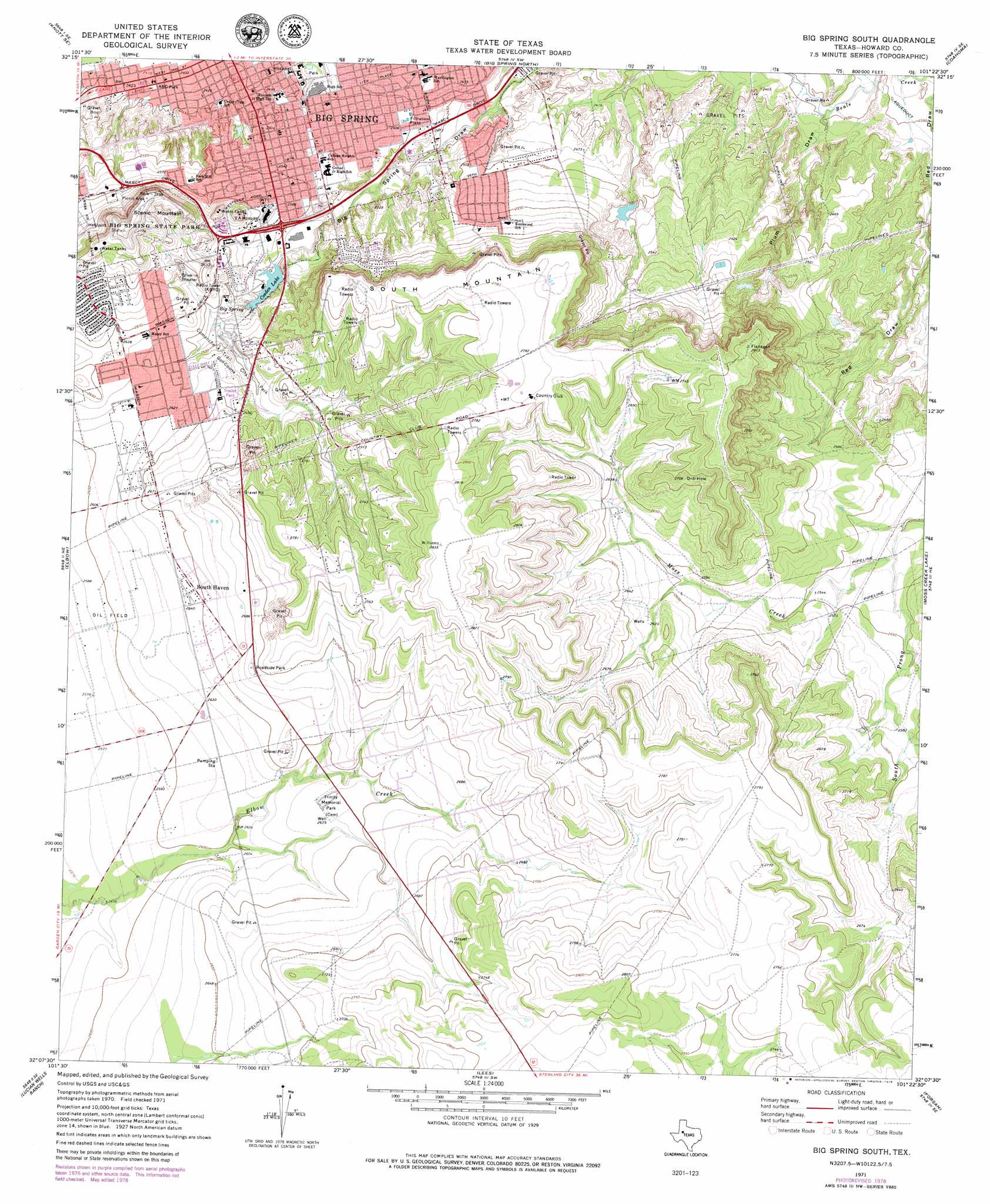
USGS Topo Quad 32101b4 - 1:24,000 scale
| Topo Map Name: | Big Spring South |
| USGS Topo Quad ID: | 32101b4 |
| Print Size: | ca. 21 1/4" wide x 27" high |
| Southeast Coordinates: | 32.125° N latitude / 101.375° W longitude |
| Map Center Coordinates: | 32.1875° N latitude / 101.4375° W longitude |
| U.S. State: | TX |
| Filename: | o32101b4.jpg |
| Download Map JPG Image: | Big Spring South topo map 1:24,000 scale |
| Map Type: | Topographic |
| Topo Series: | 7.5´ |
| Map Scale: | 1:24,000 |
| Source of Map Images: | United States Geological Survey (USGS) |
| Alternate Map Versions: |
Big Spring South TX 1971, updated 1974 Download PDF Buy paper map Big Spring South TX 1971, updated 1979 Download PDF Buy paper map Big Spring South TX 2010 Download PDF Buy paper map Big Spring South TX 2012 Download PDF Buy paper map Big Spring South TX 2016 Download PDF Buy paper map |
1:24,000 Topo Quads surrounding Big Spring South
Knott |
Knott Ne |
Luther |
Big Spring North Ne |
Vincent |
Knott Sw |
Knott Se |
Big Spring North |
Coahoma |
Iatan |
Natural Dam Lake |
Elbow |
Big Spring South |
Moss Creek Lake |
Hyman |
Houston Ranch |
Lucian Wells Ranch |
Lees |
Forsan |
Hayrick Mountain |
Dewey Lake |
Dewey Lake Ne |
Ballinger Ranch |
Garden City Ne |
Sand Bluff Draw |
> Back to 32101a1 at 1:100,000 scale
> Back to 32100a1 at 1:250,000 scale
> Back to U.S. Topo Maps home
Big Spring South topo map: Gazetteer
Big Spring South: Dams
Comanche Lake Dam elevation 776m 2545′Big Spring South: Parks
ABC Park elevation 737m 2417′Big Spring State Park elevation 844m 2769′
Big Spring State Park elevation 838m 2749′
Birdwell Park elevation 755m 2477′
Comanche Trail City Park elevation 795m 2608′
Big Spring South: Populated Places
South Haven elevation 807m 2647′Webb Village elevation 819m 2687′
Big Spring South: Reservoirs
Comanche Lake elevation 776m 2545′Cosden Lake elevation 778m 2552′
Big Spring South: Springs
Big Spring elevation 776m 2545′Big Spring South: Streams
South Prong Moss Creek elevation 761m 2496′Big Spring South: Summits
Scenic Mountain elevation 844m 2769′South Mountain elevation 845m 2772′
Big Spring South: Valleys
Plum Draw elevation 717m 2352′Big Spring South digital topo map on disk
Buy this Big Spring South topo map showing relief, roads, GPS coordinates and other geographical features, as a high-resolution digital map file on DVD: