La Tortuga Butte Topo Map Arizona
To zoom in, hover over the map of La Tortuga Butte
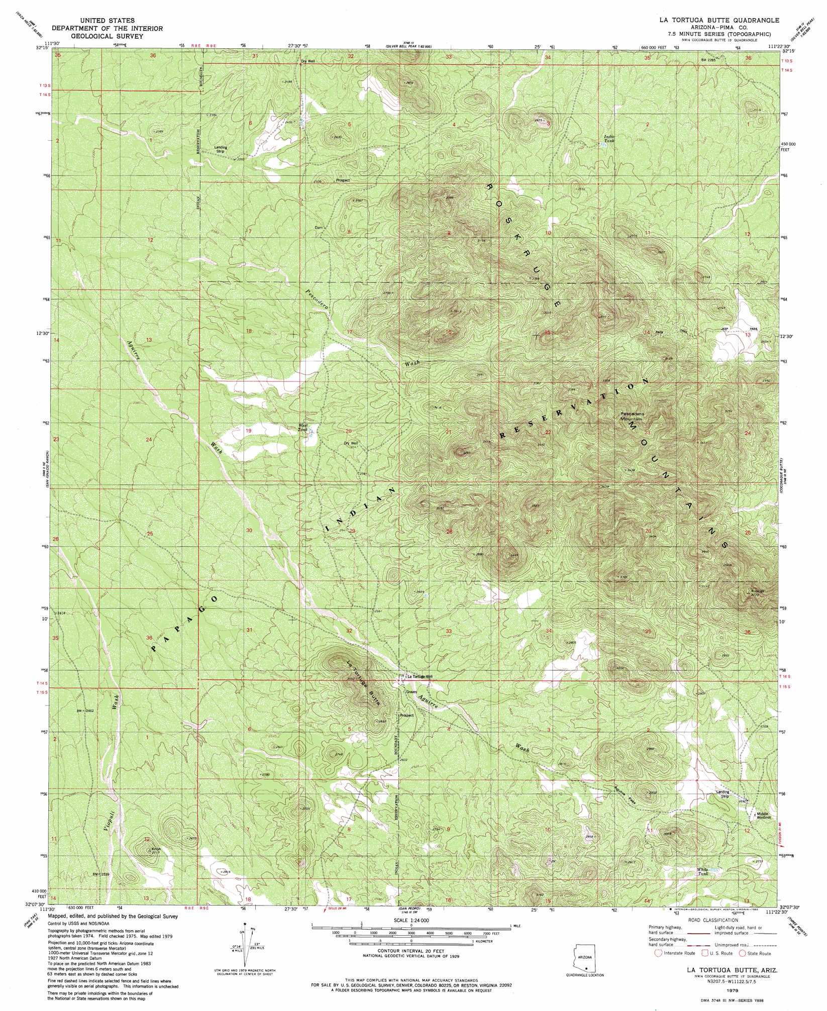
USGS Topo Quad 32111b4 - 1:24,000 scale
| Topo Map Name: | La Tortuga Butte |
| USGS Topo Quad ID: | 32111b4 |
| Print Size: | ca. 21 1/4" wide x 27" high |
| Southeast Coordinates: | 32.125° N latitude / 111.375° W longitude |
| Map Center Coordinates: | 32.1875° N latitude / 111.4375° W longitude |
| U.S. State: | AZ |
| Filename: | o32111b4.jpg |
| Download Map JPG Image: | La Tortuga Butte topo map 1:24,000 scale |
| Map Type: | Topographic |
| Topo Series: | 7.5´ |
| Map Scale: | 1:24,000 |
| Source of Map Images: | United States Geological Survey (USGS) |
| Alternate Map Versions: |
La Tortuga Butte AZ 1979, updated 1979 Download PDF Buy paper map La Tortuga Butte AZ 1979, updated 1982 Download PDF Buy paper map La Tortuga Butte AZ 1996, updated 2002 Download PDF Buy paper map La Tortuga Butte AZ 2011 Download PDF Buy paper map La Tortuga Butte AZ 2014 Download PDF Buy paper map |
1:24,000 Topo Quads surrounding La Tortuga Butte
Gap Tank |
Silver Bell West |
Silver Bell East |
West Of Marana |
Marana |
Queens Well |
Koht Kohl Hill |
Waterman Peak |
West Of Avra |
Avra |
Black Hills |
San Ignacio Ranch |
La Tortuga Butte |
Cocoraque Butte |
Brown Mountain |
Haivana Nakya |
Pan Tak |
San Pedro |
Three Points |
San Xavier Mission Sw |
San Juan Spring |
Kitt Peak |
Palo Alto Ranch |
Stevens Mountain |
Samaniego Peak |
> Back to 32111a1 at 1:100,000 scale
> Back to 32110a1 at 1:250,000 scale
> Back to U.S. Topo Maps home
La Tortuga Butte topo map: Gazetteer
La Tortuga Butte: Gaps
Aguirre Pass elevation 827m 2713′La Tortuga Butte: Ranges
Roskruge Mountains elevation 862m 2828′La Tortuga Butte: Reservoirs
Indio Tank elevation 726m 2381′West Tank elevation 764m 2506′
White Tank elevation 828m 2716′
La Tortuga Butte: Streams
Pescadero Wash elevation 723m 2372′La Tortuga Butte: Summits
La Tortuga Butte elevation 919m 3015′Pescadero Mountain elevation 1106m 3628′
La Tortuga Butte: Wells
La Tortuga Well elevation 787m 2582′La Tortuga Butte digital topo map on disk
Buy this La Tortuga Butte topo map showing relief, roads, GPS coordinates and other geographical features, as a high-resolution digital map file on DVD: