Window Mountain Topo Map Arizona
To zoom in, hover over the map of Window Mountain
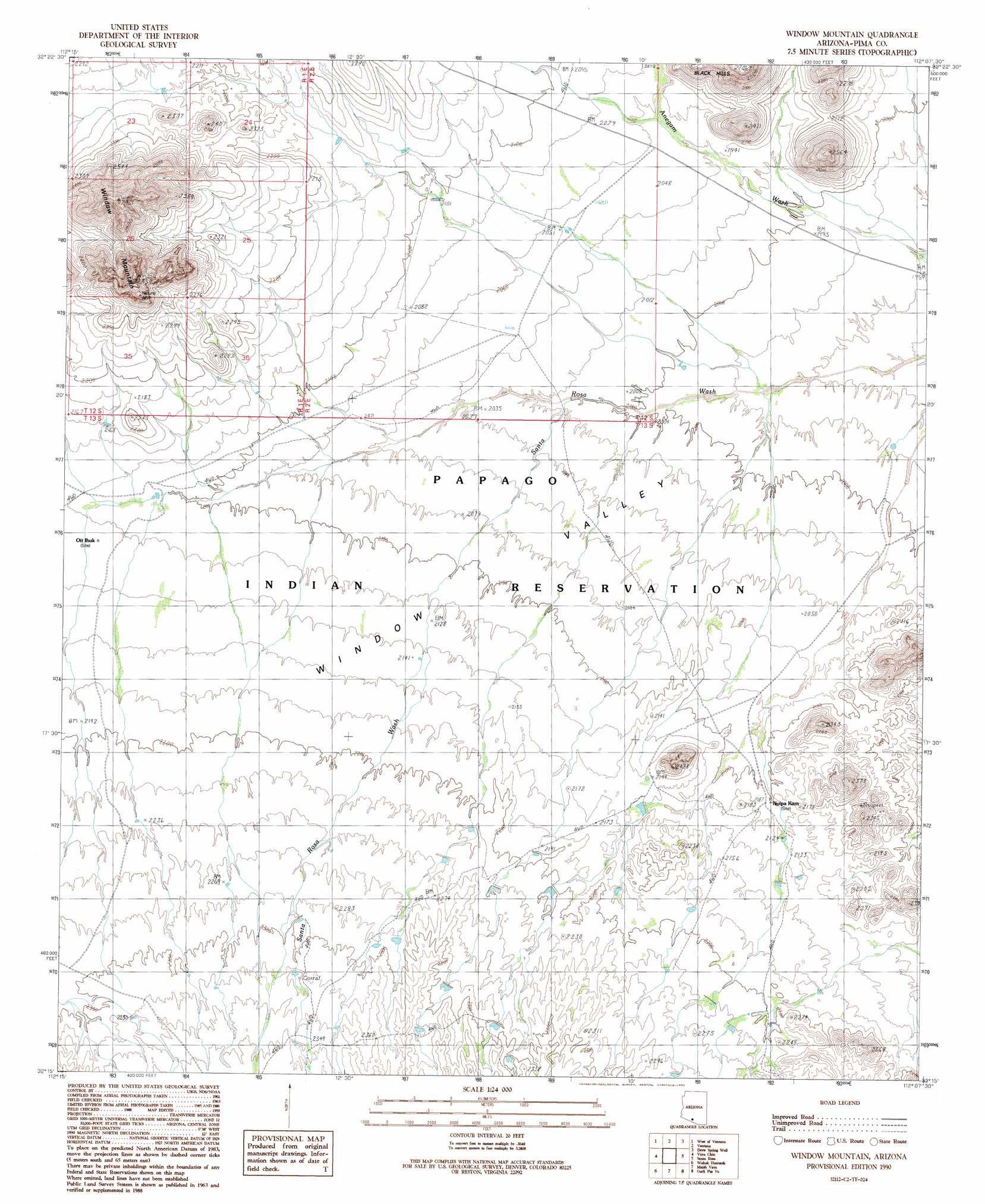
USGS Topo Quad 32112c2 - 1:24,000 scale
| Topo Map Name: | Window Mountain |
| USGS Topo Quad ID: | 32112c2 |
| Print Size: | ca. 21 1/4" wide x 27" high |
| Southeast Coordinates: | 32.25° N latitude / 112.125° W longitude |
| Map Center Coordinates: | 32.3125° N latitude / 112.1875° W longitude |
| U.S. State: | AZ |
| Filename: | o32112c2.jpg |
| Download Map JPG Image: | Window Mountain topo map 1:24,000 scale |
| Map Type: | Topographic |
| Topo Series: | 7.5´ |
| Map Scale: | 1:24,000 |
| Source of Map Images: | United States Geological Survey (USGS) |
| Alternate Map Versions: |
Window Mountain AZ 1990, updated 1990 Download PDF Buy paper map Window Mountain AZ 1996, updated 2001 Download PDF Buy paper map Window Mountain AZ 2011 Download PDF Buy paper map Window Mountain AZ 2014 Download PDF Buy paper map |
1:24,000 Topo Quads surrounding Window Mountain
Moi Vaya |
Kaka |
Copperosity Hills |
Kohatk |
North Komelik |
Cimarron Peak |
West Of Ventana |
Ventana |
Drew Spring Well |
Santa Rosa Mountains Nw |
Hickiwan |
Vaya Chin |
Window Mountain |
Gu Achi |
Santa Rosa Mountains Sw |
West Of Wahak Hotrontk |
Wahak Hotrontk |
Maish Vaya |
Gurli Put Vo |
Sand Wells |
West Of Pisinimo |
Pisinimo |
Ben Nevis Mountain |
Vainom Kug |
Ko Vaya |
> Back to 32112a1 at 1:100,000 scale
> Back to 32112a1 at 1:250,000 scale
> Back to U.S. Topo Maps home
Window Mountain topo map: Gazetteer
Window Mountain: Arches
The Window elevation 828m 2716′Window Mountain: Populated Places
Noipa Kam elevation 643m 2109′Oit Ihuk elevation 648m 2125′
Window Mountain: Summits
Noipa Kam Hills elevation 748m 2454′Window Mountain elevation 896m 2939′
Window Mountain digital topo map on disk
Buy this Window Mountain topo map showing relief, roads, GPS coordinates and other geographical features, as a high-resolution digital map file on DVD: