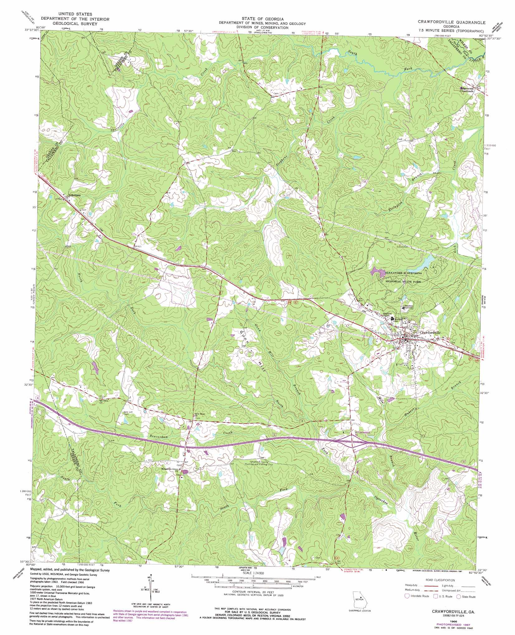
Crawfordville Topo Map Georgia
To zoom in, hover over the map of Crawfordville
USGS Topo Quad 33082e8 - 1:24,000 scale
| Topo Map Name: | Crawfordville |
| USGS Topo Quad ID: | 33082e8 |
| Print Size: | ca. 21 1/4" wide x 27" high |
| Southeast Coordinates: | 33.5° N latitude / 82.875° W longitude |
| Map Center Coordinates: | 33.5625° N latitude / 82.9375° W longitude |
| U.S. State: | GA |
| Filename: | o33082e8.jpg |
| Download Map JPG Image: | Crawfordville topo map 1:24,000 scale |
| Map Type: | Topographic |
| Topo Series: | 7.5´ |
| Map Scale: | 1:24,000 |
| Source of Map Images: | United States Geological Survey (USGS) |
| Alternate Map Versions: |
Crawfordville GA 1966, updated 1967 Download PDF Buy paper map Crawfordville GA 1966, updated 1975 Download PDF Buy paper map Crawfordville GA 1966, updated 1987 Download PDF Buy paper map Crawfordville GA 2011 Download PDF Buy paper map Crawfordville GA 2014 Download PDF Buy paper map |
1:24,000 Topo Quads surrounding Crawfordville
Maxeys |
Lexington |
Rayle |
Celeste |
Tignall |
Penfield |
Woodville |
Philomath |
Washington West |
Washington East |
Greensboro |
Union Point |
Crawfordville |
Sharon |
Cadley |
Liberty |
White Plains |
Sparta Nw |
Sparta Ne |
Warrenton |
Rockville |
Shoulderbone |
Sparta |
Jewell |
Beall Springs |
> Back to 33082e1 at 1:100,000 scale
> Back to 33082a1 at 1:250,000 scale
> Back to U.S. Topo Maps home
Crawfordville topo map: Gazetteer
Crawfordville: Crossings
Interchange 55 elevation 163m 534′Crawfordville: Dams
Alexander Stephens Park Lake Dam elevation 154m 505′Alezander Stephens State Park Dam elevation 163m 534′
Crawfordville: Parks
Alexander H Stephens Memorial State Park elevation 175m 574′Crawfordville: Populated Places
Crawfordville elevation 187m 613′Edgewood Crossroads elevation 158m 518′
Robinson elevation 184m 603′
Crawfordville: Post Offices
Crawfordville Post Office elevation 185m 606′Crawfordville: Reservoirs
Alexander Stephens Park Lake elevation 154m 505′Alexander Stephens State Park Lake elevation 163m 534′
Crawfordville: Streams
Beaverdam Creek elevation 143m 469′Ellington Branch elevation 136m 446′
Gunn Hill Branch elevation 144m 472′
Hubert Branch elevation 153m 501′
Mile Branch elevation 136m 446′
North Fork Little River elevation 129m 423′
North Fork Ogeechee River elevation 141m 462′
Sherrills Creek elevation 139m 456′
South Fork Little River elevation 129m 423′
South Fork Ogeechee River elevation 141m 462′
Stephens Creek elevation 131m 429′
Crawfordville: Summits
Gunn Hill elevation 182m 597′Crawfordville digital topo map on disk
Buy this Crawfordville topo map showing relief, roads, GPS coordinates and other geographical features, as a high-resolution digital map file on DVD:
South Carolina, Western North Carolina & Northeastern Georgia
Buy digital topo maps: South Carolina, Western North Carolina & Northeastern Georgia