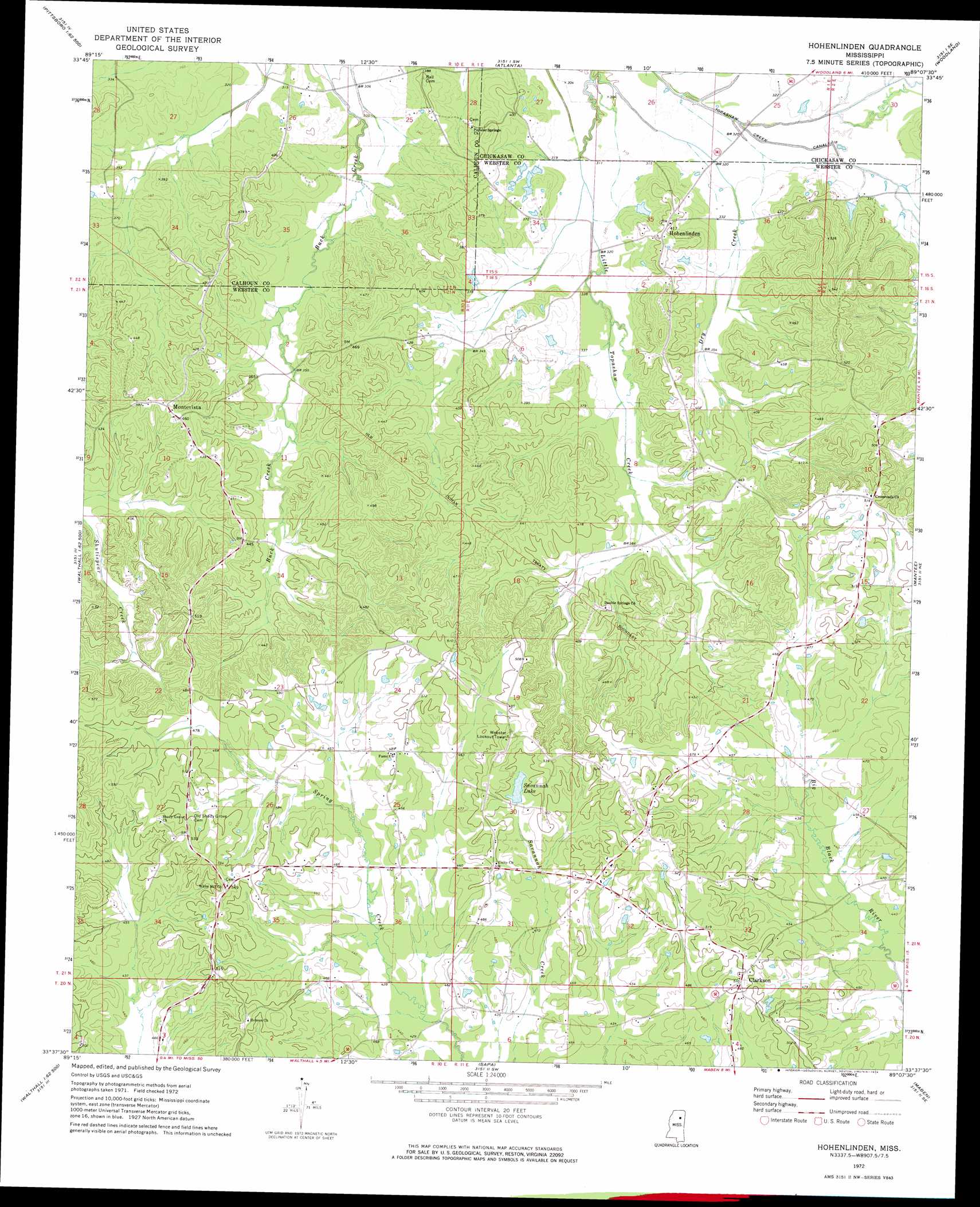
Hohenlinden Topo Map Mississippi
To zoom in, hover over the map of Hohenlinden
USGS Topo Quad 33089f2 - 1:24,000 scale
| Topo Map Name: | Hohenlinden |
| USGS Topo Quad ID: | 33089f2 |
| Print Size: | ca. 21 1/4" wide x 27" high |
| Southeast Coordinates: | 33.625° N latitude / 89.125° W longitude |
| Map Center Coordinates: | 33.6875° N latitude / 89.1875° W longitude |
| U.S. State: | MS |
| Filename: | o33089f2.jpg |
| Download Map JPG Image: | Hohenlinden topo map 1:24,000 scale |
| Map Type: | Topographic |
| Topo Series: | 7.5´ |
| Map Scale: | 1:24,000 |
| Source of Map Images: | United States Geological Survey (USGS) |
| Alternate Map Versions: |
Hohenlinden MS 1972, updated 1974 Download PDF Buy paper map Hohenlinden MS 2012 Download PDF Buy paper map Hohenlinden MS 2015 Download PDF Buy paper map |
1:24,000 Topo Quads surrounding Hohenlinden
Skuna |
Bruce |
Vardaman |
Houston West |
Houston East |
Big Creek |
Calhoun City |
Atlanta |
Woodland |
Sparta |
Cadaretta |
Bellefontaine |
Hohenlinden |
Mantee |
Montpelier |
Little Sand Creek |
Eupora |
Sapa |
Maben |
Pheba |
Stewart |
Tomnolen |
Reform |
Double Springs |
Longview |
> Back to 33089e1 at 1:100,000 scale
> Back to 33088a1 at 1:250,000 scale
> Back to U.S. Topo Maps home
Hohenlinden topo map: Gazetteer
Hohenlinden: Dams
American Legion Lake Dam elevation 148m 485′Pat Gibson Lake Dam elevation 140m 459′
Savannah Lake Dam elevation 146m 479′
Topisaw Watershed Structure Y-27-15 Dam elevation 94m 308′
Hohenlinden: Populated Places
Clarkson elevation 153m 501′Fame elevation 147m 482′
Hohenlinden elevation 127m 416′
Montevista elevation 140m 459′
Hohenlinden: Ranges
Beasley Hills elevation 153m 501′Hohenlinden: Reservoirs
Savannah Lake elevation 146m 479′Hohenlinden: Streams
Dry Creek elevation 91m 298′Hohenlinden digital topo map on disk
Buy this Hohenlinden topo map showing relief, roads, GPS coordinates and other geographical features, as a high-resolution digital map file on DVD: