Bruce Topo Map Mississippi
To zoom in, hover over the map of Bruce
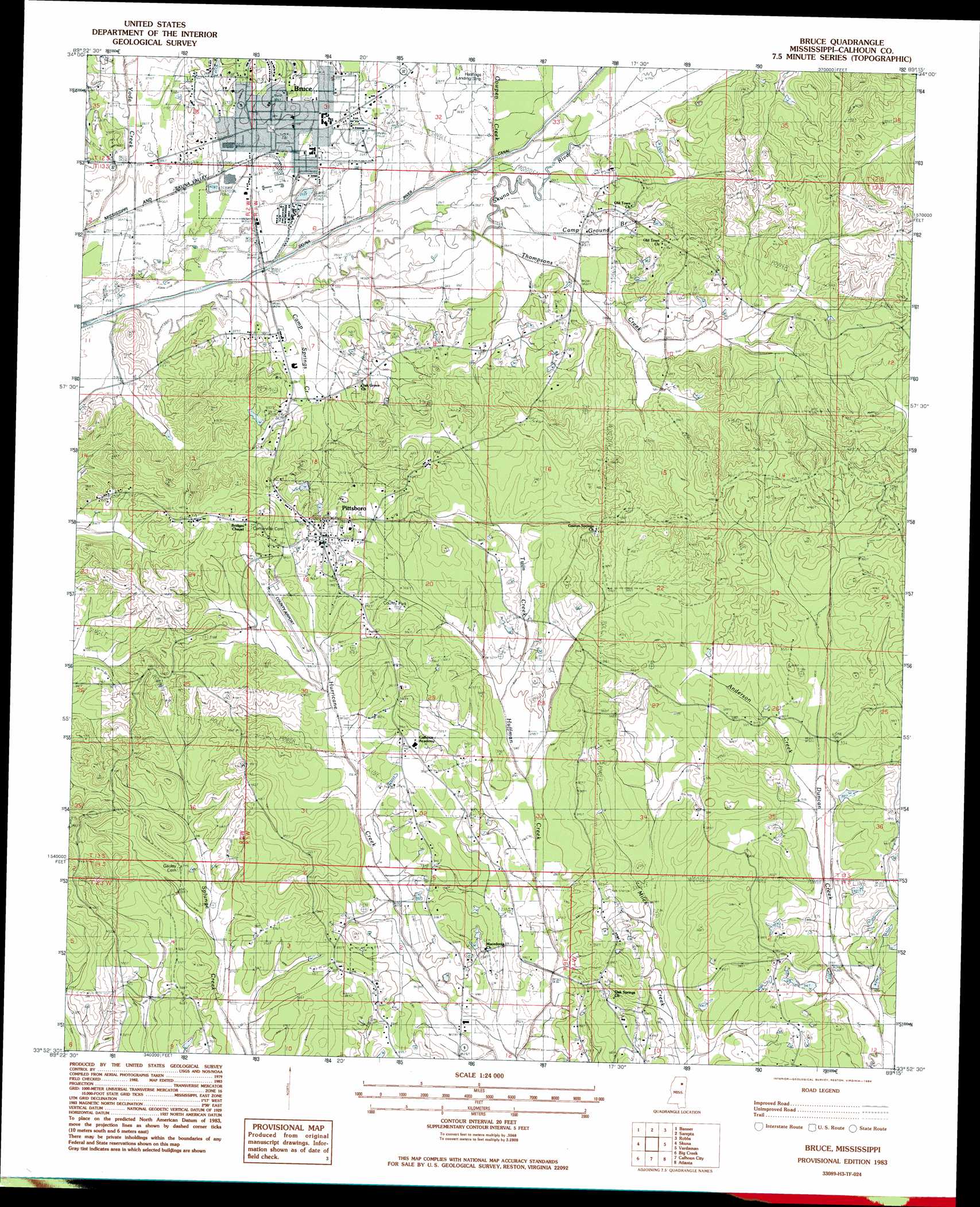
USGS Topo Quad 33089h3 - 1:24,000 scale
| Topo Map Name: | Bruce |
| USGS Topo Quad ID: | 33089h3 |
| Print Size: | ca. 21 1/4" wide x 27" high |
| Southeast Coordinates: | 33.875° N latitude / 89.25° W longitude |
| Map Center Coordinates: | 33.9375° N latitude / 89.3125° W longitude |
| U.S. State: | MS |
| Filename: | o33089h3.jpg |
| Download Map JPG Image: | Bruce topo map 1:24,000 scale |
| Map Type: | Topographic |
| Topo Series: | 7.5´ |
| Map Scale: | 1:24,000 |
| Source of Map Images: | United States Geological Survey (USGS) |
| Alternate Map Versions: |
Pittsboro NE MS 1976, updated 1977 Download PDF Buy paper map Bruce MS 1983, updated 1984 Download PDF Buy paper map Bruce MS 2012 Download PDF Buy paper map Bruce MS 2015 Download PDF Buy paper map |
1:24,000 Topo Quads surrounding Bruce
Water Valley East |
Paris |
Tula |
Randolph |
Southwest Pontotoc |
Pine Valley |
Banner |
Sarepta |
Robbs |
Houlka |
Benwood |
Skuna |
Bruce |
Vardaman |
Houston West |
Gore Springs |
Big Creek |
Calhoun City |
Atlanta |
Woodland |
Sweatman |
Cadaretta |
Bellefontaine |
Hohenlinden |
Mantee |
> Back to 33089e1 at 1:100,000 scale
> Back to 33088a1 at 1:250,000 scale
> Back to U.S. Topo Maps home
Bruce topo map: Gazetteer
Bruce: Airports
Calhoun County Airport elevation 112m 367′Hasting Airpark elevation 79m 259′
Bruce: Dams
Alexander Lake Dam elevation 98m 321′Jess Yancey Lake Dam elevation 82m 269′
Stewart Lake Dam elevation 111m 364′
Bruce: Populated Places
Bruce elevation 84m 275′Pittsboro elevation 116m 380′
Bruce: Streams
Anderson Creek elevation 94m 308′Camp Ground Branch elevation 80m 262′
Camp Springs Creek elevation 78m 255′
Cowpen Creek elevation 78m 255′
Thompsons Creek elevation 80m 262′
Twin Creek elevation 88m 288′
Bruce digital topo map on disk
Buy this Bruce topo map showing relief, roads, GPS coordinates and other geographical features, as a high-resolution digital map file on DVD: