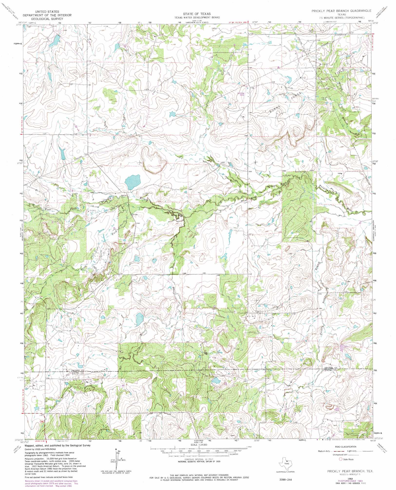
Prickly Pear Branch Topo Map Texas
To zoom in, hover over the map of Prickly Pear Branch
USGS Topo Quad 33098d5 - 1:24,000 scale
| Topo Map Name: | Prickly Pear Branch |
| USGS Topo Quad ID: | 33098d5 |
| Print Size: | ca. 21 1/4" wide x 27" high |
| Southeast Coordinates: | 33.375° N latitude / 98.5° W longitude |
| Map Center Coordinates: | 33.4375° N latitude / 98.5625° W longitude |
| U.S. State: | TX |
| Filename: | o33098d5.jpg |
| Download Map JPG Image: | Prickly Pear Branch topo map 1:24,000 scale |
| Map Type: | Topographic |
| Topo Series: | 7.5´ |
| Map Scale: | 1:24,000 |
| Source of Map Images: | United States Geological Survey (USGS) |
| Alternate Map Versions: |
Prickly Pear Branch TX 1964, updated 1967 Download PDF Buy paper map Prickly Pear Branch TX 1964, updated 1982 Download PDF Buy paper map Prickly Pear Branch TX 2010 Download PDF Buy paper map Prickly Pear Branch TX 2012 Download PDF Buy paper map Prickly Pear Branch TX 2016 Download PDF Buy paper map |
1:24,000 Topo Quads surrounding Prickly Pear Branch
Lake Kickapoo |
Dads Corner |
Archer City Ne |
Scotland |
Deer Creek |
Dundee Se |
Archer City West |
Archer City East |
Windthorst |
Scotland Se |
Lake Olney |
Bobcat Bluff |
Prickly Pear Branch |
Darnell Branch |
Antelope |
Olney |
True |
Loving |
Markley |
Lynn Creek |
Proffitt |
Newcastle |
Lake Eddleman |
Bryson |
Senate |
> Back to 33098a1 at 1:100,000 scale
> Back to 33098a1 at 1:250,000 scale
> Back to U.S. Topo Maps home
Prickly Pear Branch topo map: Gazetteer
Prickly Pear Branch: Airports
Hornady Ranch Airport elevation 352m 1154′Prickly Pear Branch: Dams
Bridwell Lake Dam elevation 323m 1059′McKinney Lake Dam elevation 326m 1069′
Prickly Pear Branch: Oilfields
Burns-Jones Oil Field elevation 339m 1112′Prickly Pear Branch: Reservoirs
Bridwell Lake elevation 323m 1059′McKinney Lake elevation 326m 1069′
Prickly Pear Branch: Streams
Brier Creek elevation 318m 1043′South Fork Trinity River elevation 320m 1049′
Prickly Pear Branch digital topo map on disk
Buy this Prickly Pear Branch topo map showing relief, roads, GPS coordinates and other geographical features, as a high-resolution digital map file on DVD: