Mankins Topo Map Texas
To zoom in, hover over the map of Mankins
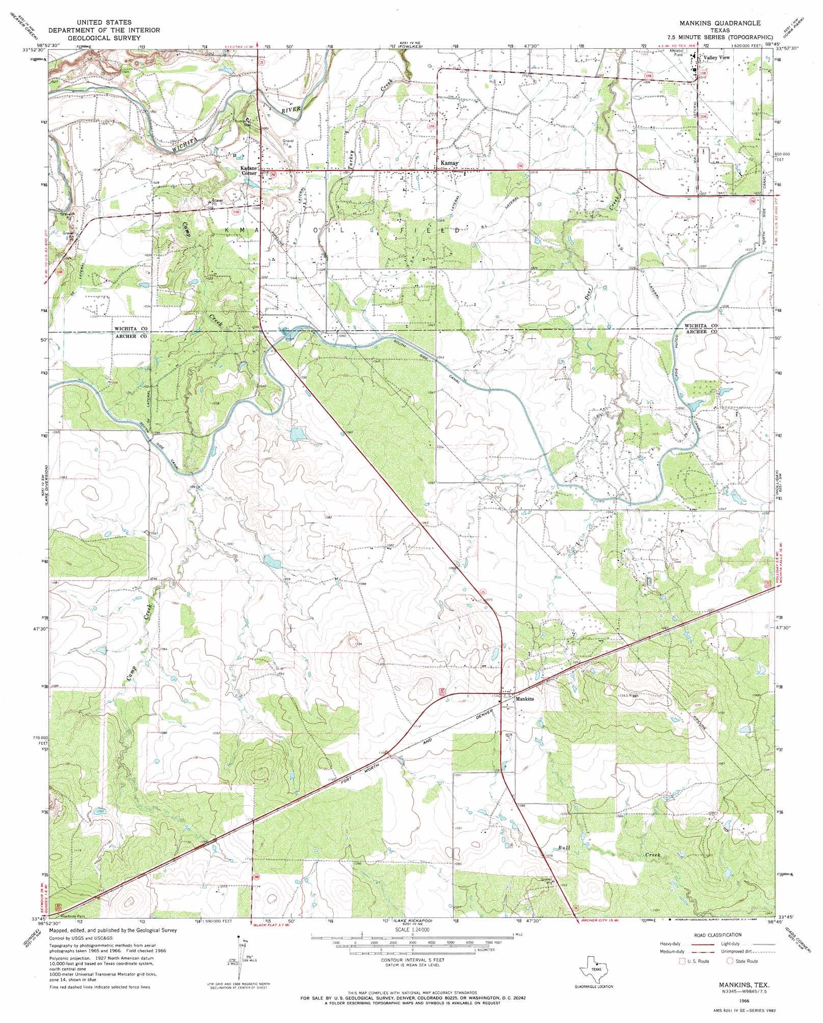
USGS Topo Quad 33098g7 - 1:24,000 scale
| Topo Map Name: | Mankins |
| USGS Topo Quad ID: | 33098g7 |
| Print Size: | ca. 21 1/4" wide x 27" high |
| Southeast Coordinates: | 33.75° N latitude / 98.75° W longitude |
| Map Center Coordinates: | 33.8125° N latitude / 98.8125° W longitude |
| U.S. State: | TX |
| Filename: | o33098g7.jpg |
| Download Map JPG Image: | Mankins topo map 1:24,000 scale |
| Map Type: | Topographic |
| Topo Series: | 7.5´ |
| Map Scale: | 1:24,000 |
| Source of Map Images: | United States Geological Survey (USGS) |
| Alternate Map Versions: |
Mankins TX 1966, updated 1968 Download PDF Buy paper map Mankins TX 2010 Download PDF Buy paper map Mankins TX 2012 Download PDF Buy paper map Mankins TX 2016 Download PDF Buy paper map |
1:24,000 Topo Quads surrounding Mankins
Harrold |
Electra |
Sunshine Hill |
Clara |
Burkburnett |
Lake Electra |
Beaver Creek |
Fowlkes |
Iowa Park |
Wichita Falls West |
Franklin Bend |
Lake Diversion |
Mankins |
Holliday |
Lake Wichita |
Fulda |
Dundee |
Lake Kickapoo |
Dads Corner |
Archer City Ne |
Cope Branch |
Dundee Sw |
Dundee Se |
Archer City West |
Archer City East |
> Back to 33098e1 at 1:100,000 scale
> Back to 33098a1 at 1:250,000 scale
> Back to U.S. Topo Maps home
Mankins topo map: Gazetteer
Mankins: Canals
NB Lateral elevation 309m 1013′SE Lateral elevation 316m 1036′
SF Lateral elevation 316m 1036′
SJ Lateral elevation 313m 1026′
SK Lateral elevation 316m 1036′
SL Lateral elevation 315m 1033′
South Side Canal elevation 316m 1036′
SQ Lateral elevation 312m 1023′
Mankins: Oilfields
K M A Oil Field elevation 314m 1030′Mankins: Populated Places
Kadane Corner elevation 311m 1020′Kamay elevation 315m 1033′
Mankins elevation 339m 1112′
Valley View elevation 307m 1007′
Mankins: Streams
Camp Creek elevation 302m 990′Mankins digital topo map on disk
Buy this Mankins topo map showing relief, roads, GPS coordinates and other geographical features, as a high-resolution digital map file on DVD: