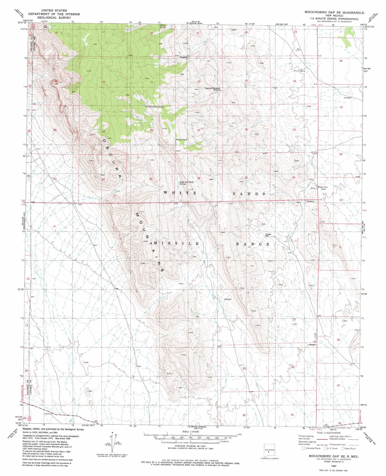
Mockingbird Gap Se Topo Map New Mexico
To zoom in, hover over the map of Mockingbird Gap Se
USGS Topo Quad 33106e3 - 1:24,000 scale
| Topo Map Name: | Mockingbird Gap Se |
| USGS Topo Quad ID: | 33106e3 |
| Print Size: | ca. 21 1/4" wide x 27" high |
| Southeast Coordinates: | 33.5° N latitude / 106.25° W longitude |
| Map Center Coordinates: | 33.5625° N latitude / 106.3125° W longitude |
| U.S. State: | NM |
| Filename: | o33106e3.jpg |
| Download Map JPG Image: | Mockingbird Gap Se topo map 1:24,000 scale |
| Map Type: | Topographic |
| Topo Series: | 7.5´ |
| Map Scale: | 1:24,000 |
| Source of Map Images: | United States Geological Survey (USGS) |
| Alternate Map Versions: |
Mockingbird Gap SE NM 1982, updated 1982 Download PDF Buy paper map Mockingbird Gap SE NM 2010 Download PDF Buy paper map Mockingbird Gap SE NM 2013 Download PDF Buy paper map Mockingbird Gap SE NM 2017 Download PDF Buy paper map |
1:24,000 Topo Quads surrounding Mockingbird Gap Se
Cerro De La Campana Se |
Wrye Peak Sw |
Garden Spring Canyon |
Pink Peak |
Broken Back Crater |
Greens Baber Well |
Trinity Site |
Oscura Peak |
Red Canyon |
Wagon Canyon |
Foster Well |
Mockingbird Gap |
Mockingbird Gap Se |
Bull Gap Sw |
Bull Gap |
Fairview Mountain |
Capitol Peak |
Mound Springs |
Three Rivers Nw |
Oscura |
Salinas Peak |
Sheep Mountain |
Capitol Peak Se |
Three Rivers Sw |
Three Rivers |
> Back to 33106e1 at 1:100,000 scale
> Back to 33106a1 at 1:250,000 scale
> Back to U.S. Topo Maps home
Mockingbird Gap Se topo map: Gazetteer
Mockingbird Gap Se: Reservoirs
Woods Tank elevation 1960m 6430′Mockingbird Gap Se: Springs
Cottonwood Spring elevation 1957m 6420′Keller Spring elevation 1890m 6200′
Kidd elevation 1730m 5675′
Palomas Moonshine Spring elevation 1707m 5600′
Mockingbird Gap Se: Wells
Old Mills Well elevation 1459m 4786′Scholle Well elevation 1549m 5082′
Mockingbird Gap Se digital topo map on disk
Buy this Mockingbird Gap Se topo map showing relief, roads, GPS coordinates and other geographical features, as a high-resolution digital map file on DVD: