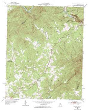
Tallulah Falls Topo Map Georgia
To zoom in, hover over the map of Tallulah Falls
USGS Topo Quad 34083f4 - 1:24,000 scale
| Topo Map Name: | Tallulah Falls |
| USGS Topo Quad ID: | 34083f4 |
| Print Size: | ca. 21 1/4" wide x 27" high |
| Southeast Coordinates: | 34.625° N latitude / 83.375° W longitude |
| Map Center Coordinates: | 34.6875° N latitude / 83.4375° W longitude |
| U.S. State: | GA |
| Filename: | o34083f4.jpg |
| Download Map JPG Image: | Tallulah Falls topo map 1:24,000 scale |
| Map Type: | Topographic |
| Topo Series: | 7.5´ |
| Map Scale: | 1:24,000 |
| Source of Map Images: | United States Geological Survey (USGS) |
| Alternate Map Versions: |
Tallulah Falls GA 1953, updated 1954 Download PDF Buy paper map Tallulah Falls GA 1953, updated 1972 Download PDF Buy paper map Tallulah Falls GA 2011 Download PDF Buy paper map Tallulah Falls GA 2014 Download PDF Buy paper map |
| FStopo: | US Forest Service topo Tallulah Falls is available: Download FStopo PDF Download FStopo TIF |
1:24,000 Topo Quads surrounding Tallulah Falls
> Back to 34083e1 at 1:100,000 scale
> Back to 34082a1 at 1:250,000 scale
> Back to U.S. Topo Maps home
Tallulah Falls topo map: Gazetteer
Tallulah Falls: Dams
Hardman Dam elevation 451m 1479′Lawson Lake Dam elevation 398m 1305′
Lawson Lake Dam Two elevation 389m 1276′
Mathis Lake Dam elevation 425m 1394′
Soquee River Structure 29 Dam elevation 443m 1453′
Soquee River Structure 34 Dam elevation 429m 1407′
Soquee River Structure 36 Dam elevation 439m 1440′
Todd Dam elevation 384m 1259′
Waters Lake Dam elevation 466m 1528′
Tallulah Falls: Falls
Cascade Falls elevation 462m 1515′Tallulah Falls: Gaps
Bear Gap elevation 629m 2063′Worley Gap elevation 625m 2050′
Tallulah Falls: Populated Places
Anandale (historical) elevation 425m 1394′Dixon Crossroads elevation 430m 1410′
Hollywood elevation 468m 1535′
Shirley Grove elevation 538m 1765′
Tallulah Falls elevation 524m 1719′
Tallulah Park (historical) elevation 481m 1578′
Turnerville elevation 475m 1558′
Tallulah Falls: Reservoirs
Hardman Lake elevation 451m 1479′Lawson Lake elevation 389m 1276′
Mathis Lake elevation 425m 1394′
Reservoir 29 elevation 443m 1453′
Reservoir 34 elevation 429m 1407′
Reservoir 36 elevation 439m 1440′
Tallulah Falls Lake elevation 425m 1394′
Todd Lake elevation 384m 1259′
Waters Lake elevation 466m 1528′
Tallulah Falls: Ridges
Demoore Ridge elevation 678m 2224′Piney Ridge elevation 649m 2129′
Tallulah Falls: Streams
Bad Branch elevation 459m 1505′Bear Branch elevation 525m 1722′
Deep Creek elevation 412m 1351′
Fry Branch elevation 417m 1368′
Glade Creek elevation 399m 1309′
Horse Creek elevation 358m 1174′
Liberty Creek elevation 411m 1348′
Little Panther Creek elevation 377m 1236′
Roberts Branch elevation 424m 1391′
Slaughter Pen Branch elevation 461m 1512′
Walker Branch elevation 368m 1207′
Wheeler Branch elevation 368m 1207′
Wheeler Branch elevation 341m 1118′
Tallulah Falls: Summits
Apple Pie Mountain elevation 588m 1929′Big Shoal Mountain elevation 459m 1505′
Buck Mountain elevation 660m 2165′
Crow Mountain elevation 642m 2106′
Fry Mountain elevation 637m 2089′
Hickory Nut Mountain elevation 721m 2365′
Pigeon Mountain elevation 795m 2608′
Pigeon Mountain elevation 862m 2828′
Stony Mountain elevation 817m 2680′
Tallulah Mountain elevation 712m 2335′
Tallulah Falls digital topo map on disk
Buy this Tallulah Falls topo map showing relief, roads, GPS coordinates and other geographical features, as a high-resolution digital map file on DVD:
South Carolina, Western North Carolina & Northeastern Georgia
Buy digital topo maps: South Carolina, Western North Carolina & Northeastern Georgia


