Hooper Topo Map Oklahoma
To zoom in, hover over the map of Hooper
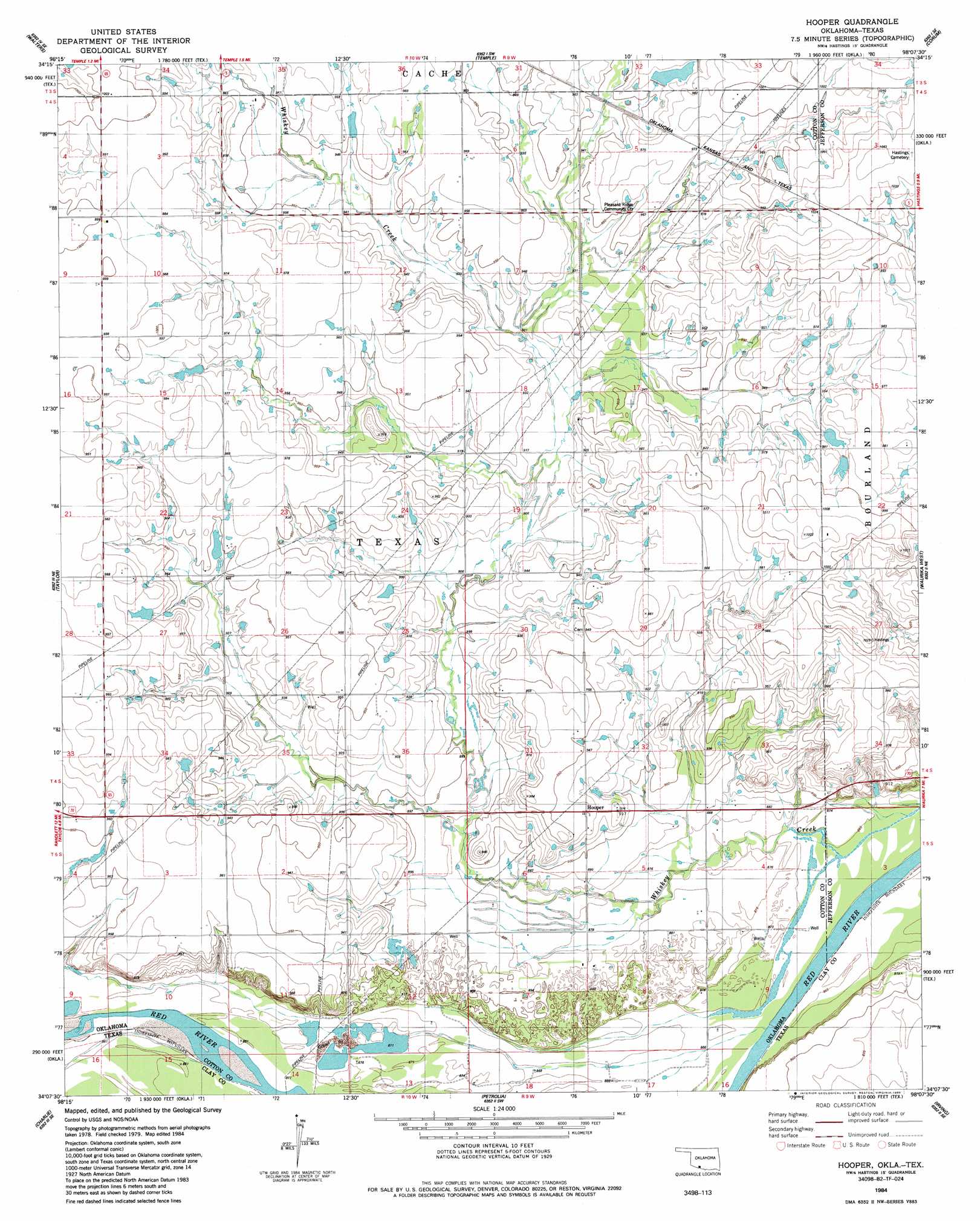
USGS Topo Quad 34098b2 - 1:24,000 scale
| Topo Map Name: | Hooper |
| USGS Topo Quad ID: | 34098b2 |
| Print Size: | ca. 21 1/4" wide x 27" high |
| Southeast Coordinates: | 34.125° N latitude / 98.125° W longitude |
| Map Center Coordinates: | 34.1875° N latitude / 98.1875° W longitude |
| U.S. States: | OK, TX |
| Filename: | o34098b2.jpg |
| Download Map JPG Image: | Hooper topo map 1:24,000 scale |
| Map Type: | Topographic |
| Topo Series: | 7.5´ |
| Map Scale: | 1:24,000 |
| Source of Map Images: | United States Geological Survey (USGS) |
| Alternate Map Versions: |
Hooper OK 1984, updated 1985 Download PDF Buy paper map Hooper OK 2010 Download PDF Buy paper map Hooper OK 2012 Download PDF Buy paper map Hooper OK 2016 Download PDF Buy paper map |
1:24,000 Topo Quads surrounding Hooper
Geronimo |
Walters Ne |
Temple Nw |
Empire City |
Duncan South |
Cookietown |
Walters |
Temple |
Corum |
Comanche |
Randlett |
Taylor |
Hooper |
Waurika West |
Waurika East |
Thornberry |
Charlie |
Byers |
Irving |
Ryan |
Wichita Falls East |
Dean |
Hurnville |
Riverland Cemetery |
Terral |
> Back to 34098a1 at 1:100,000 scale
> Back to 34098a1 at 1:250,000 scale
> Back to U.S. Topo Maps home
Hooper topo map: Gazetteer
Hooper: Dams
Oknoname 033002 Dam elevation 293m 961′Oknoname 033003 Dam elevation 291m 954′
Hooper: Populated Places
Hooper elevation 287m 941′Hooper: Reservoirs
Oknoname 033002 Reservoir elevation 293m 961′Oknoname 033033 Reservoir elevation 291m 954′
Hooper: Streams
Whiskey Creek elevation 263m 862′Hooper digital topo map on disk
Buy this Hooper topo map showing relief, roads, GPS coordinates and other geographical features, as a high-resolution digital map file on DVD: