Day Canyon Topo Map New Mexico
To zoom in, hover over the map of Day Canyon
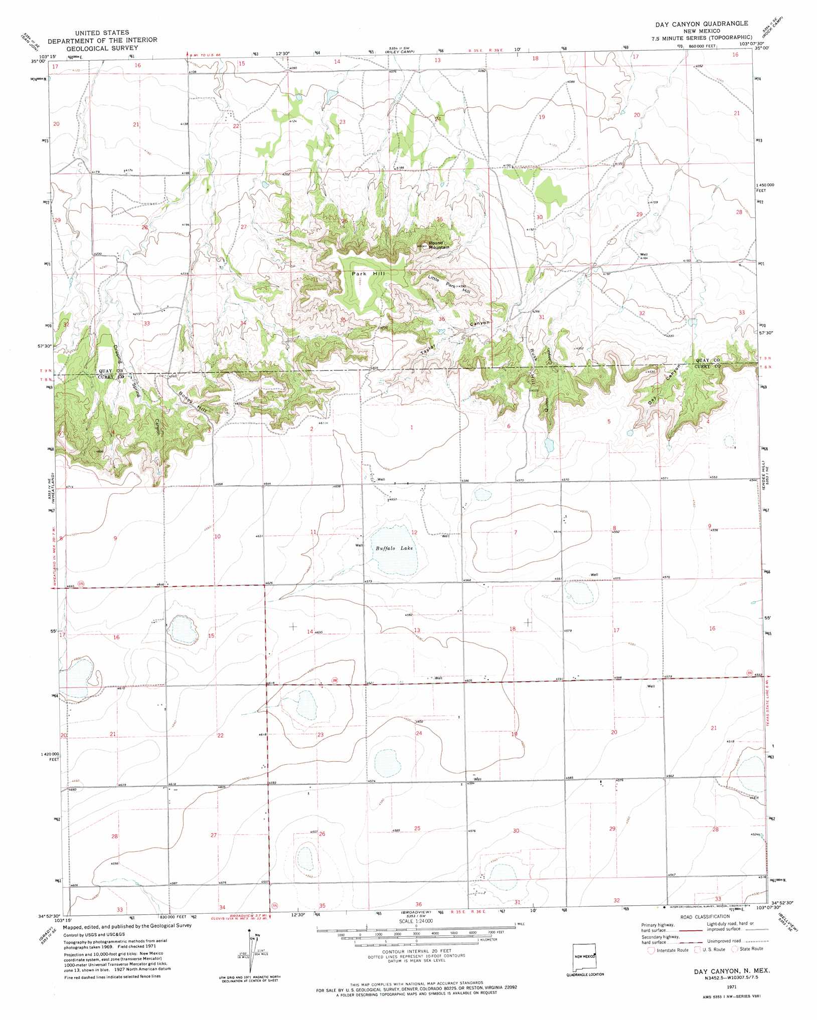
USGS Topo Quad 34103h2 - 1:24,000 scale
| Topo Map Name: | Day Canyon |
| USGS Topo Quad ID: | 34103h2 |
| Print Size: | ca. 21 1/4" wide x 27" high |
| Southeast Coordinates: | 34.875° N latitude / 103.125° W longitude |
| Map Center Coordinates: | 34.9375° N latitude / 103.1875° W longitude |
| U.S. State: | NM |
| Filename: | o34103h2.jpg |
| Download Map JPG Image: | Day Canyon topo map 1:24,000 scale |
| Map Type: | Topographic |
| Topo Series: | 7.5´ |
| Map Scale: | 1:24,000 |
| Source of Map Images: | United States Geological Survey (USGS) |
| Alternate Map Versions: |
Day Canyon NM 1971, updated 1974 Download PDF Buy paper map Day Canyon NM 2010 Download PDF Buy paper map Day Canyon NM 2013 Download PDF Buy paper map Day Canyon NM 2017 Download PDF Buy paper map |
1:24,000 Topo Quads surrounding Day Canyon
San Jon Nw |
Porter |
Bard |
Glenrio |
Moser Ranch |
Bedford Hill |
San Jon |
Riley Camp |
Rock Camp |
Sand Point |
Apache Canyon |
Wheatland |
Day Canyon |
Endee Hill |
Mustang Lake |
Grady Sw |
Grady |
Broadview |
Bellview |
Garcia Lake |
Hammond Ranch |
Smith Ranch |
Pleasant Hill Nw |
Pleasant Hill Ne |
Rhea |
> Back to 34103e1 at 1:100,000 scale
> Back to 34102a1 at 1:250,000 scale
> Back to U.S. Topo Maps home
Day Canyon topo map: Gazetteer
Day Canyon: Lakes
Buffalo Lake elevation 1381m 4530′Day Canyon: Summits
Boney Hill elevation 1362m 4468′Little Park Hill elevation 1399m 4589′
Park Hill elevation 1422m 4665′
Round Mountain elevation 1406m 4612′
Rusk Hill elevation 1329m 4360′
Day Canyon: Valleys
Day Canyon elevation 1286m 4219′Dripping Spring Canyon elevation 1299m 4261′
Queen Canyon elevation 1290m 4232′
Taylor Canyon elevation 1288m 4225′
Day Canyon: Wells
10200 Water Well elevation 1387m 4550′10201 Water Well elevation 1396m 4580′
10203 Water Well elevation 1396m 4580′
10205 Water Well elevation 1388m 4553′
10209 Water Well elevation 1399m 4589′
10210 Water Well elevation 1398m 4586′
10247 Water Well elevation 1402m 4599′
10901 Water Well elevation 1398m 4586′
Day Canyon digital topo map on disk
Buy this Day Canyon topo map showing relief, roads, GPS coordinates and other geographical features, as a high-resolution digital map file on DVD: