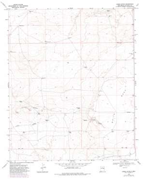
Lomas Gatos Topo Map New Mexico
To zoom in, hover over the map of Lomas Gatos
USGS Topo Quad 34104c1 - 1:24,000 scale
| Topo Map Name: | Lomas Gatos |
| USGS Topo Quad ID: | 34104c1 |
| Print Size: | ca. 21 1/4" wide x 27" high |
| Southeast Coordinates: | 34.25° N latitude / 104° W longitude |
| Map Center Coordinates: | 34.3125° N latitude / 104.0625° W longitude |
| U.S. State: | NM |
| Filename: | o34104c1.jpg |
| Download Map JPG Image: | Lomas Gatos topo map 1:24,000 scale |
| Map Type: | Topographic |
| Topo Series: | 7.5´ |
| Map Scale: | 1:24,000 |
| Source of Map Images: | United States Geological Survey (USGS) |
| Alternate Map Versions: |
Lomas Gatos NM 1968, updated 1971 Download PDF Buy paper map Lomas Gatos NM 1968, updated 1982 Download PDF Buy paper map Lomas Gatos NM 2010 Download PDF Buy paper map Lomas Gatos NM 2013 Download PDF Buy paper map Lomas Gatos NM 2017 Download PDF Buy paper map |
1:24,000 Topo Quads surrounding Lomas Gatos
> Back to 34104a1 at 1:100,000 scale
> Back to 34104a1 at 1:250,000 scale
> Back to U.S. Topo Maps home
Lomas Gatos topo map: Gazetteer
Lomas Gatos: Reservoirs
Dry Tank elevation 1281m 4202′East Tank elevation 1244m 4081′
Hopper Tank elevation 1260m 4133′
North Tank elevation 1257m 4124′
Red Fry Tank elevation 1292m 4238′
Twin Tanks elevation 1262m 4140′
Lomas Gatos: Summits
Lomas Gatos elevation 1288m 4225′Sand Hill elevation 1275m 4183′
Lomas Gatos: Wells
Bonner Well elevation 1247m 4091′Canyon Well elevation 1308m 4291′
East Headquarters Well elevation 1269m 4163′
East Well elevation 1253m 4110′
Hanibus Well elevation 1340m 4396′
Hutten Well elevation 1332m 4370′
Lena Lewis Well elevation 1311m 4301′
Lone Tree Well elevation 1287m 4222′
Sand Hill Well elevation 1272m 4173′
Sanders Well elevation 1272m 4173′
South Sand Hill Well elevation 1291m 4235′
West Headquarters Well elevation 1266m 4153′
Lomas Gatos digital topo map on disk
Buy this Lomas Gatos topo map showing relief, roads, GPS coordinates and other geographical features, as a high-resolution digital map file on DVD:


