Tolar Se Topo Map New Mexico
To zoom in, hover over the map of Tolar Se
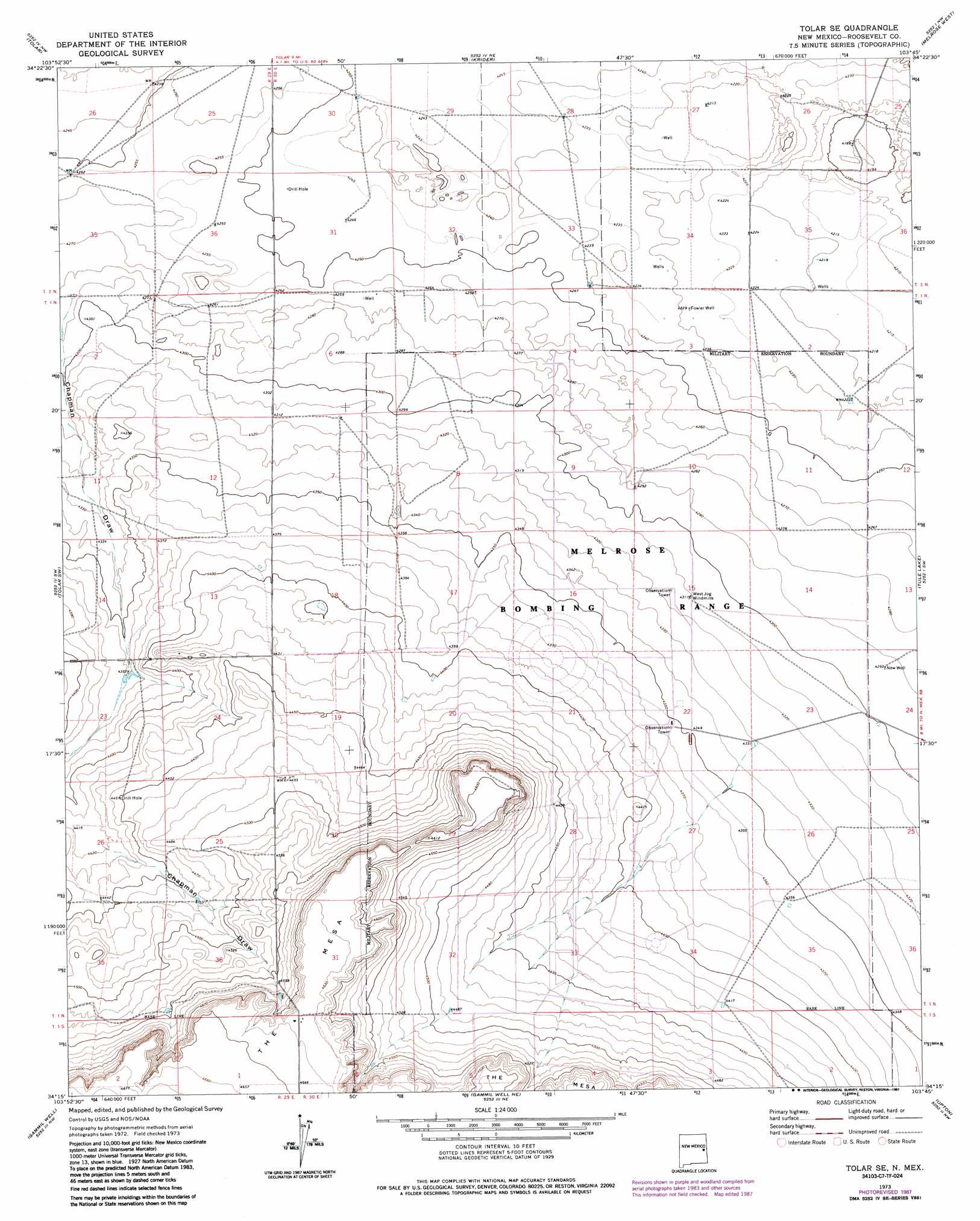
USGS Topo Quad 34103c7 - 1:24,000 scale
| Topo Map Name: | Tolar Se |
| USGS Topo Quad ID: | 34103c7 |
| Print Size: | ca. 21 1/4" wide x 27" high |
| Southeast Coordinates: | 34.25° N latitude / 103.75° W longitude |
| Map Center Coordinates: | 34.3125° N latitude / 103.8125° W longitude |
| U.S. State: | NM |
| Filename: | o34103c7.jpg |
| Download Map JPG Image: | Tolar Se topo map 1:24,000 scale |
| Map Type: | Topographic |
| Topo Series: | 7.5´ |
| Map Scale: | 1:24,000 |
| Source of Map Images: | United States Geological Survey (USGS) |
| Alternate Map Versions: |
Tolar SE NM 1973, updated 1976 Download PDF Buy paper map Tolar SE NM 1973, updated 1987 Download PDF Buy paper map Tolar SE NM 2010 Download PDF Buy paper map Tolar SE NM 2013 Download PDF Buy paper map Tolar SE NM 2017 Download PDF Buy paper map |
1:24,000 Topo Quads surrounding Tolar Se
Candy Mesa |
Peach Canyon |
House Se |
Field Sw |
Field Se |
Taiban |
Tolar |
Krider |
Melrose West |
Melrose East |
Lomas Gatos |
Tolar Sw |
Tolar Se |
Tule Lake |
Melrose Se |
Watts Hill |
Gammil Well |
Gammil Well Ne |
Upton |
Floyd |
Howell Ranch |
Rippee Ranch |
Gammil Well Se |
Lewiston Lake |
Floyd Se |
> Back to 34103a1 at 1:100,000 scale
> Back to 34102a1 at 1:250,000 scale
> Back to U.S. Topo Maps home
Tolar Se topo map: Gazetteer
Tolar Se: Valleys
Chapman Draw elevation 1307m 4288′Tolar Se: Wells
Fowler Well elevation 1290m 4232′New Well elevation 1309m 4294′
Tolar Se digital topo map on disk
Buy this Tolar Se topo map showing relief, roads, GPS coordinates and other geographical features, as a high-resolution digital map file on DVD: