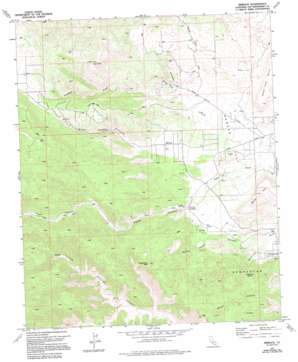
Rimrock Topo Map California
To zoom in, hover over the map of Rimrock
USGS Topo Quad 34116b5 - 1:24,000 scale
| Topo Map Name: | Rimrock |
| USGS Topo Quad ID: | 34116b5 |
| Print Size: | ca. 21 1/4" wide x 27" high |
| Southeast Coordinates: | 34.125° N latitude / 116.5° W longitude |
| Map Center Coordinates: | 34.1875° N latitude / 116.5625° W longitude |
| U.S. State: | CA |
| Filename: | o34116b5.jpg |
| Download Map JPG Image: | Rimrock topo map 1:24,000 scale |
| Map Type: | Topographic |
| Topo Series: | 7.5´ |
| Map Scale: | 1:24,000 |
| Source of Map Images: | United States Geological Survey (USGS) |
| Alternate Map Versions: |
Rimrock CA 1972, updated 1975 Download PDF Buy paper map Rimrock CA 1972, updated 1994 Download PDF Buy paper map Rimrock CA 2012 Download PDF Buy paper map Rimrock CA 2015 Download PDF Buy paper map |
| FStopo: | US Forest Service topo Rimrock is available: Download FStopo PDF Download FStopo TIF |
1:24,000 Topo Quads surrounding Rimrock
> Back to 34116a1 at 1:100,000 scale
> Back to 34116a1 at 1:250,000 scale
> Back to U.S. Topo Maps home
Rimrock topo map: Gazetteer
Rimrock: Flats
Bowden Flat elevation 1273m 4176′Rimrock: Gaps
Devils Gate Pass elevation 1681m 5515′Rimrock: Populated Places
Rimrock elevation 1382m 4534′Rimrock: Reservoirs
Bobo Springs Reservoir (historical) elevation 1257m 4124′Rimrock: Springs
Burns Spring elevation 1516m 4973′Chaparrosa Spring elevation 1293m 4242′
Rimrock: Streams
Antelope Creek elevation 1360m 4461′Antelope Wash elevation 1233m 4045′
Rimrock: Summits
Black Lava Butte elevation 1441m 4727′Black Mountain elevation 1871m 6138′
Chaparrosa Peak elevation 1679m 5508′
Sawtooths elevation 1434m 4704′
Rimrock: Valleys
Burns Canyon elevation 1233m 4045′Gamma Gulch elevation 1384m 4540′
Pipes Canyon elevation 1356m 4448′
Sorrel Horse Canyon elevation 1219m 3999′
Rimrock digital topo map on disk
Buy this Rimrock topo map showing relief, roads, GPS coordinates and other geographical features, as a high-resolution digital map file on DVD:


