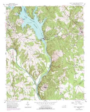
Mount Gilead West Topo Map North Carolina
To zoom in, hover over the map of Mount Gilead West
USGS Topo Quad 35080b1 - 1:24,000 scale
| Topo Map Name: | Mount Gilead West |
| USGS Topo Quad ID: | 35080b1 |
| Print Size: | ca. 21 1/4" wide x 27" high |
| Southeast Coordinates: | 35.125° N latitude / 80° W longitude |
| Map Center Coordinates: | 35.1875° N latitude / 80.0625° W longitude |
| U.S. State: | NC |
| Filename: | o35080b1.jpg |
| Download Map JPG Image: | Mount Gilead West topo map 1:24,000 scale |
| Map Type: | Topographic |
| Topo Series: | 7.5´ |
| Map Scale: | 1:24,000 |
| Source of Map Images: | United States Geological Survey (USGS) |
| Alternate Map Versions: |
Mount Gilead West NC 1956, updated 1957 Download PDF Buy paper map Mount Gilead West NC 1956, updated 1957 Download PDF Buy paper map Mount Gilead West NC 1956, updated 1987 Download PDF Buy paper map Mount Gilead West NC 2002, updated 2003 Download PDF Buy paper map Mount Gilead West NC 2010 Download PDF Buy paper map Mount Gilead West NC 2013 Download PDF Buy paper map Mount Gilead West NC 2016 Download PDF Buy paper map |
1:24,000 Topo Quads surrounding Mount Gilead West
> Back to 35080a1 at 1:100,000 scale
> Back to 35080a1 at 1:250,000 scale
> Back to U.S. Topo Maps home
Mount Gilead West topo map: Gazetteer
Mount Gilead West: Bridges
Lily Bridge elevation 84m 275′Mount Gilead West: Dams
Norwood Dam elevation 82m 269′Springer Lake Dam elevation 88m 288′
Mount Gilead West: Islands
Buzzard Island elevation 63m 206′Mount Gilead West: Populated Places
Cedar Hill elevation 101m 331′Mount Gilead elevation 123m 403′
Norwood elevation 119m 390′
Norwood Beach elevation 91m 298′
Mount Gilead West: Reservoirs
Lake Tillery elevation 82m 269′Springer Lake elevation 88m 288′
Mount Gilead West: Ridges
Fork Section elevation 85m 278′Mount Gilead West: Streams
Big Branch elevation 80m 262′Big Cedar Creek elevation 63m 206′
Bunny Creek elevation 84m 275′
Camp Branch elevation 60m 196′
Clarks Creek elevation 62m 203′
Little Cedar Creek elevation 64m 209′
Lower Richland Creek elevation 84m 275′
North Prong Buffalo Creek elevation 77m 252′
Richland Creek elevation 84m 275′
Rocky River elevation 58m 190′
South Prong Buffalo Creek elevation 76m 249′
West Prong Hamer Creek elevation 75m 246′
Mount Gilead West: Summits
Morgan Mountain elevation 131m 429′Mount Gilead West digital topo map on disk
Buy this Mount Gilead West topo map showing relief, roads, GPS coordinates and other geographical features, as a high-resolution digital map file on DVD:
South Carolina, Western North Carolina & Northeastern Georgia
Buy digital topo maps: South Carolina, Western North Carolina & Northeastern Georgia


