Vian Topo Map Oklahoma
To zoom in, hover over the map of Vian
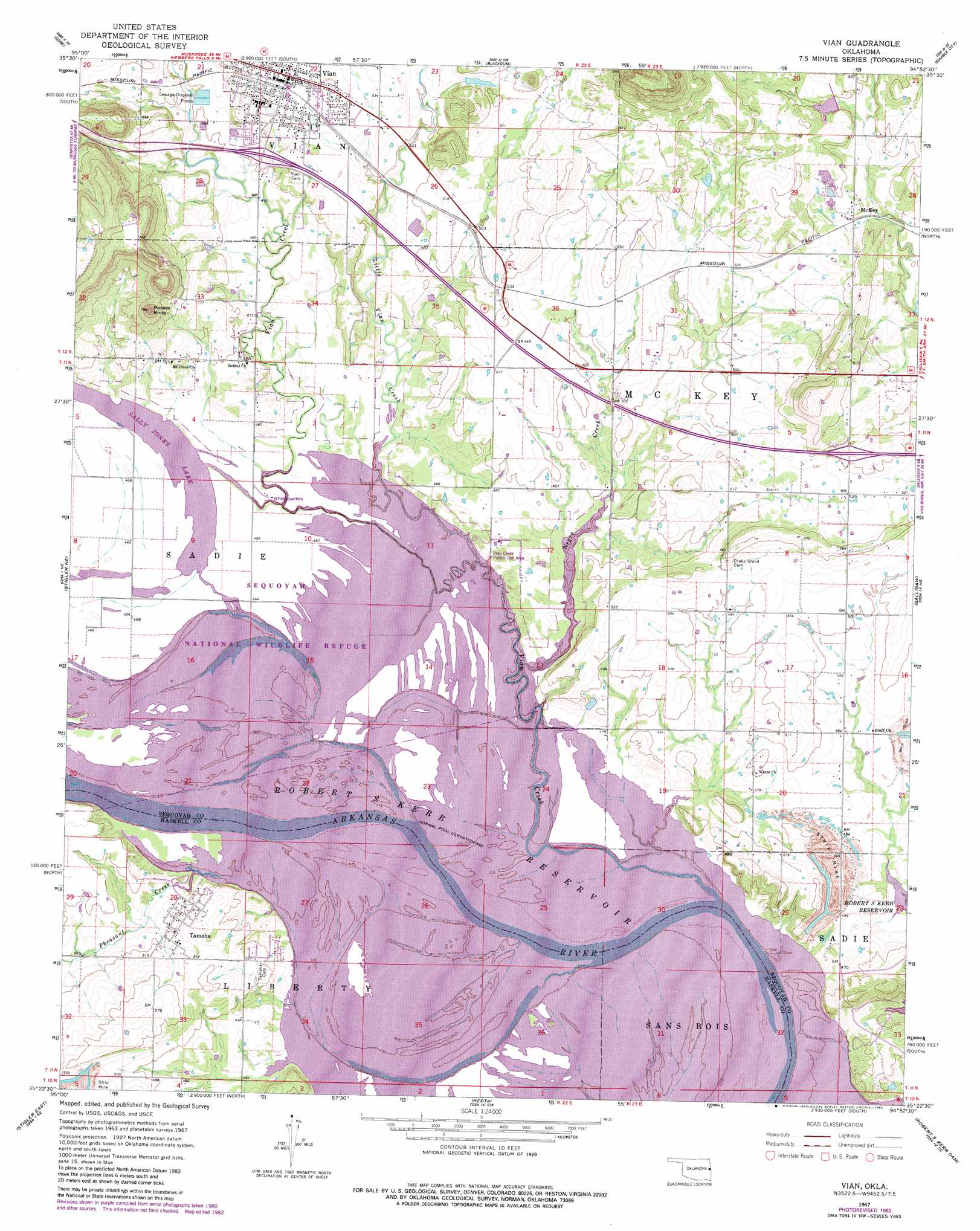
USGS Topo Quad 35094d8 - 1:24,000 scale
| Topo Map Name: | Vian |
| USGS Topo Quad ID: | 35094d8 |
| Print Size: | ca. 21 1/4" wide x 27" high |
| Southeast Coordinates: | 35.375° N latitude / 94.875° W longitude |
| Map Center Coordinates: | 35.4375° N latitude / 94.9375° W longitude |
| U.S. State: | OK |
| Filename: | o35094d8.jpg |
| Download Map JPG Image: | Vian topo map 1:24,000 scale |
| Map Type: | Topographic |
| Topo Series: | 7.5´ |
| Map Scale: | 1:24,000 |
| Source of Map Images: | United States Geological Survey (USGS) |
| Alternate Map Versions: |
Vian OK 1967, updated 1968 Download PDF Buy paper map Vian OK 1967, updated 1975 Download PDF Buy paper map Vian OK 1967, updated 1979 Download PDF Buy paper map Vian OK 1967, updated 1983 Download PDF Buy paper map Vian OK 2010 Download PDF Buy paper map Vian OK 2012 Download PDF Buy paper map Vian OK 2016 Download PDF Buy paper map |
1:24,000 Topo Quads surrounding Vian
Braggs |
Qualls |
Cookson |
Bunch |
Greasy |
Webbers Falls |
Gore |
Blackgum |
Marble City |
Brushy |
Holt Mountain |
Stigler Ne |
Vian |
Sallisaw |
Gans |
Stigler West |
Stigler East |
Keota |
Robert S Kerr Dam |
Muldrow Sw |
Sans Bois |
Lafayette |
Mccurtain |
Bokoshe |
Panama |
> Back to 35094a1 at 1:100,000 scale
> Back to 35094a1 at 1:250,000 scale
> Back to U.S. Topo Maps home
Vian topo map: Gazetteer
Vian: Airports
Neversweat Too Airport elevation 168m 551′Vian: Bends
Sandtown Bottom elevation 140m 459′Saylor Bottom elevation 140m 459′
Vian: Dams
Sallisaw Creek Site 2 Dam elevation 164m 538′Vian: Parks
Vian Creek Public Use Area elevation 143m 469′Vian: Populated Places
McKey elevation 160m 524′Tamaha elevation 153m 501′
Vian elevation 165m 541′
Vian: Reservoirs
Sallisaw Creek Site 2 Reservoir elevation 164m 538′Vian: Streams
Little Vian Creek elevation 140m 459′Negro Creek elevation 140m 459′
Pheasant Creek elevation 140m 459′
Vian Creek elevation 140m 459′
Vian: Summits
Potato Knob elevation 233m 764′Wolf Mountain elevation 260m 853′
Vian digital topo map on disk
Buy this Vian topo map showing relief, roads, GPS coordinates and other geographical features, as a high-resolution digital map file on DVD: