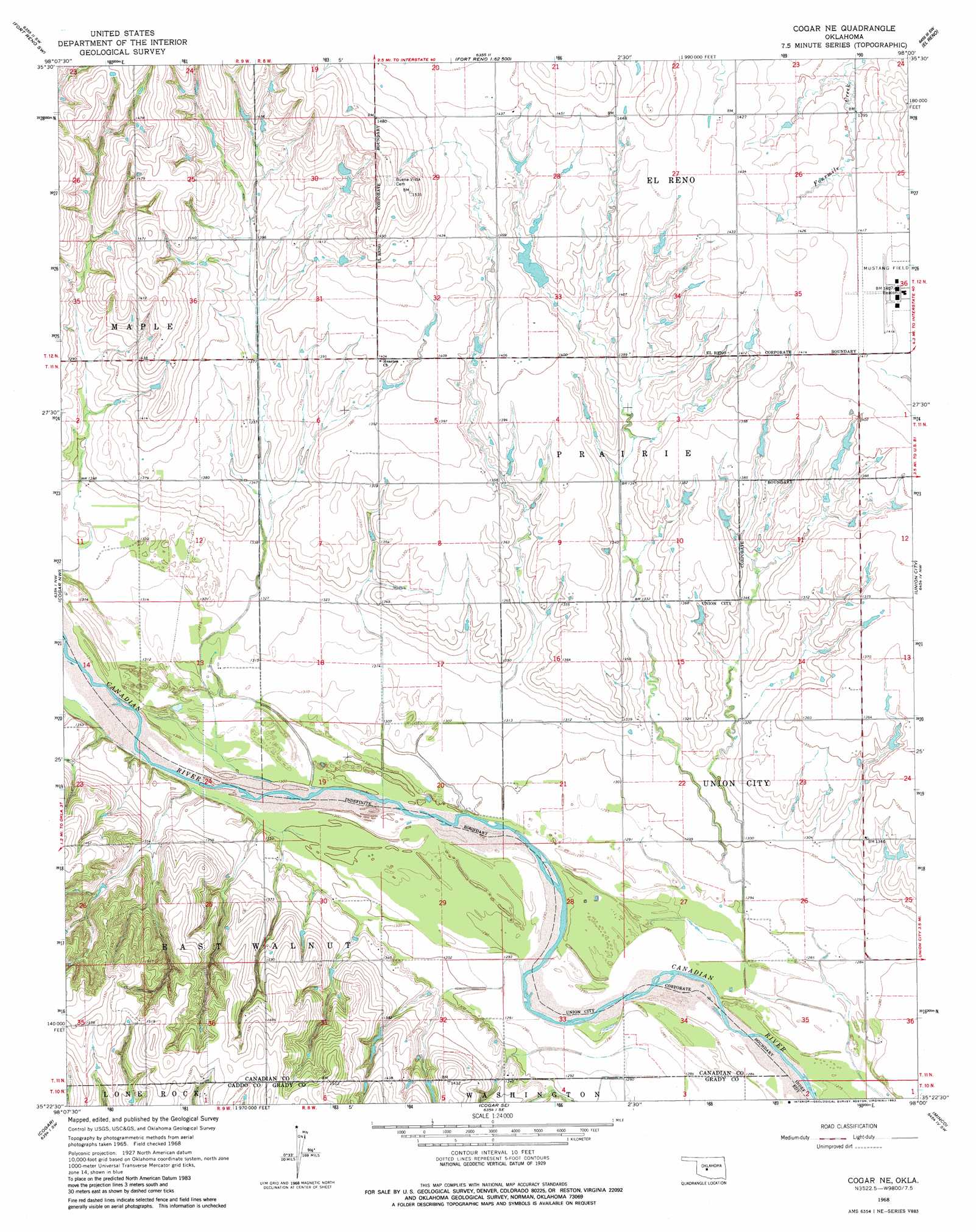
Cogar Ne Topo Map Oklahoma
To zoom in, hover over the map of Cogar Ne
USGS Topo Quad 35098d1 - 1:24,000 scale
| Topo Map Name: | Cogar Ne |
| USGS Topo Quad ID: | 35098d1 |
| Print Size: | ca. 21 1/4" wide x 27" high |
| Southeast Coordinates: | 35.375° N latitude / 98° W longitude |
| Map Center Coordinates: | 35.4375° N latitude / 98.0625° W longitude |
| U.S. State: | OK |
| Filename: | o35098d1.jpg |
| Download Map JPG Image: | Cogar Ne topo map 1:24,000 scale |
| Map Type: | Topographic |
| Topo Series: | 7.5´ |
| Map Scale: | 1:24,000 |
| Source of Map Images: | United States Geological Survey (USGS) |
| Alternate Map Versions: |
Cogar NE OK 1968, updated 1969 Download PDF Buy paper map Cogar NE OK 2009 Download PDF Buy paper map Cogar NE OK 2012 Download PDF Buy paper map Cogar NE OK 2016 Download PDF Buy paper map |
1:24,000 Topo Quads surrounding Cogar Ne
Geary North |
Porcupine Butte |
Fort Reno Ne |
Okarche |
El Reno Ne |
Geary South |
Fort Reno Sw |
Fort Reno |
El Reno |
Richland |
Hinton |
Cogar Nw |
Cogar Ne |
Union City |
Minco Ne |
Binger |
Cogar |
Cogar Se |
Minco |
Tuttle |
Gracemont |
Anadarko Nw |
Anadarko Ne |
Pocasset |
Chickasha Ne |
> Back to 35098a1 at 1:100,000 scale
> Back to 35098a1 at 1:250,000 scale
> Back to U.S. Topo Maps home
Cogar Ne topo map: Gazetteer
Cogar Ne: Airports
El Reno Municipal Air Park elevation 431m 1414′Cogar Ne: Dams
Dave Richardson Number 1 Dam elevation 440m 1443′Wayne Reuter Dam elevation 432m 1417′
Cogar Ne: Reservoirs
Dave Richardson Number 1 Reservoir elevation 440m 1443′Wayne Reuter Reservoir elevation 432m 1417′
Cogar Ne digital topo map on disk
Buy this Cogar Ne topo map showing relief, roads, GPS coordinates and other geographical features, as a high-resolution digital map file on DVD: