Grimes Topo Map Oklahoma
To zoom in, hover over the map of Grimes
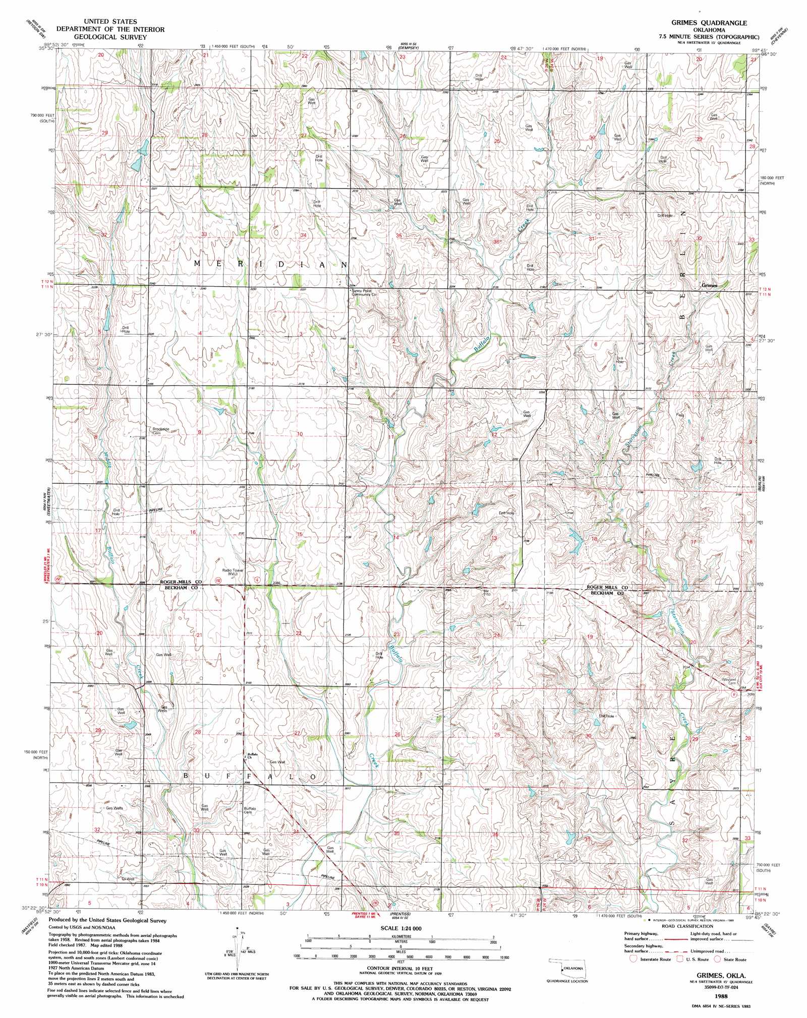
USGS Topo Quad 35099d7 - 1:24,000 scale
| Topo Map Name: | Grimes |
| USGS Topo Quad ID: | 35099d7 |
| Print Size: | ca. 21 1/4" wide x 27" high |
| Southeast Coordinates: | 35.375° N latitude / 99.75° W longitude |
| Map Center Coordinates: | 35.4375° N latitude / 99.8125° W longitude |
| U.S. State: | OK |
| Filename: | o35099d7.jpg |
| Download Map JPG Image: | Grimes topo map 1:24,000 scale |
| Map Type: | Topographic |
| Topo Series: | 7.5´ |
| Map Scale: | 1:24,000 |
| Source of Map Images: | United States Geological Survey (USGS) |
| Alternate Map Versions: |
Grimes OK 1988, updated 1989 Download PDF Buy paper map Grimes OK 2010 Download PDF Buy paper map Grimes OK 2012 Download PDF Buy paper map Grimes OK 2016 Download PDF Buy paper map |
1:24,000 Topo Quads surrounding Grimes
Hackberry Creek |
Reydon |
Mackie |
Cheyenne Nw |
Strong City |
Allison |
Reydon Sw |
Dempsey |
Cheyenne |
Herring |
Kelton |
Sweetwater |
Grimes |
Berlin |
Baker Lake |
Kelton Se |
Mayfield |
Prentiss |
Sayre |
Doxey |
Fuller |
Texola |
Erick |
Dehli |
Carter West |
> Back to 35099a1 at 1:100,000 scale
> Back to 35098a1 at 1:250,000 scale
> Back to U.S. Topo Maps home
Grimes topo map: Gazetteer
Grimes: Dams
Fuchs Dam elevation 656m 2152′McLaury Number 2 Dam elevation 608m 1994′
Oknoname 129009 Dam elevation 640m 2099′
Shirley Thompson Dam elevation 665m 2181′
Grimes: Populated Places
Grimes elevation 689m 2260′Grimes: Reservoirs
Fuchs Reservoir elevation 656m 2152′McLaury Number 2 Reservoir elevation 608m 1994′
Oknoname 129009 Reservoir elevation 640m 2099′
Shirley Thompson Reservoir elevation 665m 2181′
Grimes digital topo map on disk
Buy this Grimes topo map showing relief, roads, GPS coordinates and other geographical features, as a high-resolution digital map file on DVD: