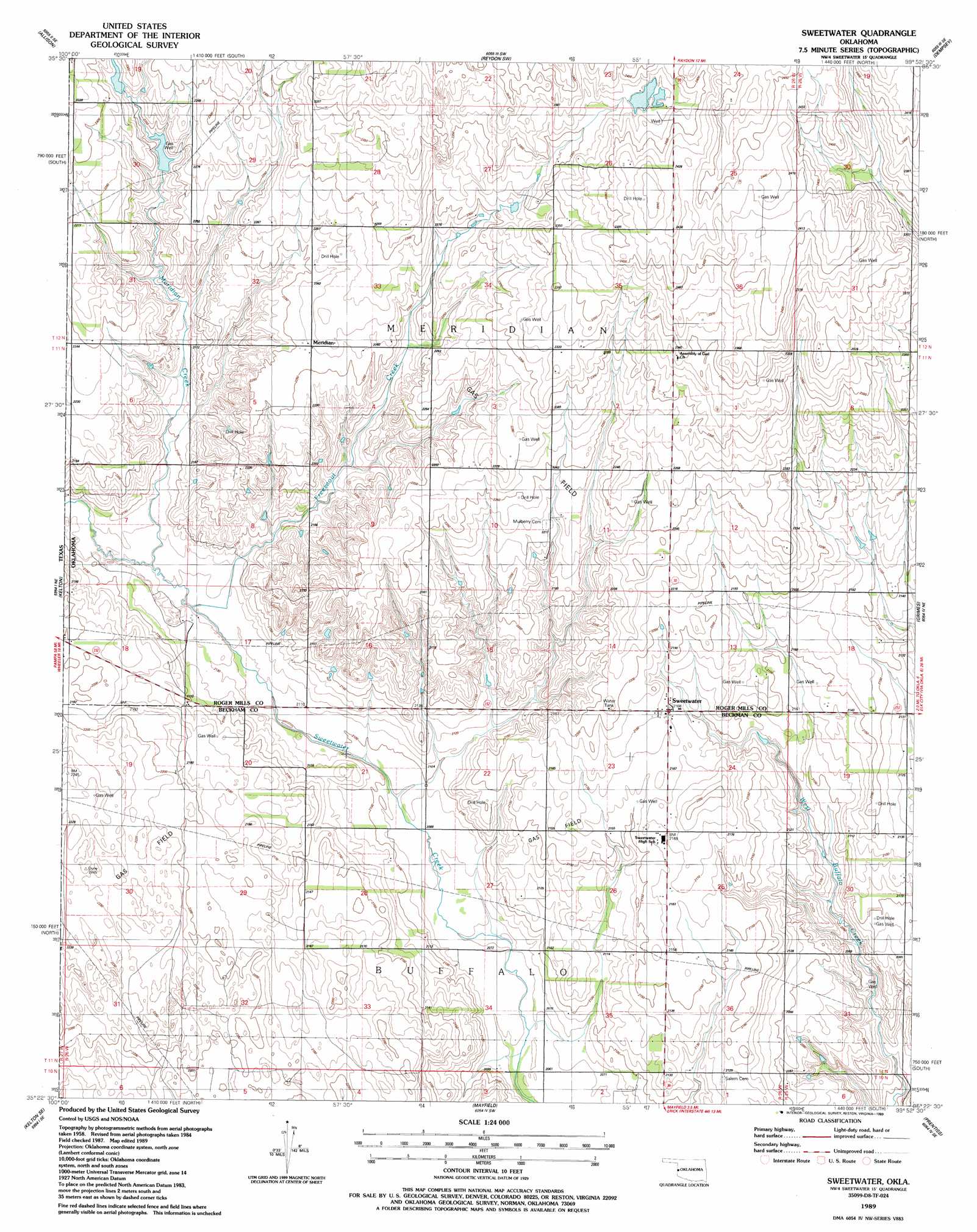
Sweetwater Topo Map Oklahoma
To zoom in, hover over the map of Sweetwater
USGS Topo Quad 35099d8 - 1:24,000 scale
| Topo Map Name: | Sweetwater |
| USGS Topo Quad ID: | 35099d8 |
| Print Size: | ca. 21 1/4" wide x 27" high |
| Southeast Coordinates: | 35.375° N latitude / 99.875° W longitude |
| Map Center Coordinates: | 35.4375° N latitude / 99.9375° W longitude |
| U.S. State: | OK |
| Filename: | o35099d8.jpg |
| Download Map JPG Image: | Sweetwater topo map 1:24,000 scale |
| Map Type: | Topographic |
| Topo Series: | 7.5´ |
| Map Scale: | 1:24,000 |
| Source of Map Images: | United States Geological Survey (USGS) |
| Alternate Map Versions: |
Sweetwater OK 1989, updated 1989 Download PDF Buy paper map Sweetwater OK 2010 Download PDF Buy paper map Sweetwater OK 2012 Download PDF Buy paper map Sweetwater OK 2016 Download PDF Buy paper map |
1:24,000 Topo Quads surrounding Sweetwater
Lake June |
Hackberry Creek |
Reydon |
Mackie |
Cheyenne Nw |
Allison Sw |
Allison |
Reydon Sw |
Dempsey |
Cheyenne |
Kelton Nw |
Kelton |
Sweetwater |
Grimes |
Berlin |
Twitty |
Kelton Se |
Mayfield |
Prentiss |
Sayre |
Shamrock East |
Fuller |
Texola |
Erick |
Dehli |
> Back to 35099a1 at 1:100,000 scale
> Back to 35098a1 at 1:250,000 scale
> Back to U.S. Topo Maps home
Sweetwater topo map: Gazetteer
Sweetwater: Dams
Davis Number 1 Dam elevation 693m 2273′Davis Number 2 Dam elevation 687m 2253′
Sweetwater: Oilfields
Sweetwater Gas Field elevation 662m 2171′Sweetwater NW Gas Field elevation 682m 2237′
Sweetwater West Gas Field elevation 675m 2214′
Sweetwater: Populated Places
Meridian elevation 689m 2260′Sweetwater elevation 662m 2171′
Sweetwater: Reservoirs
Davis Number 2 Reservoir elevation 687m 2253′Davis Reservoir elevation 693m 2273′
Sweetwater: Streams
Freezeout Creek elevation 643m 2109′Meridian Creek elevation 646m 2119′
Sweetwater digital topo map on disk
Buy this Sweetwater topo map showing relief, roads, GPS coordinates and other geographical features, as a high-resolution digital map file on DVD: