Rainsville Topo Map New Mexico
To zoom in, hover over the map of Rainsville
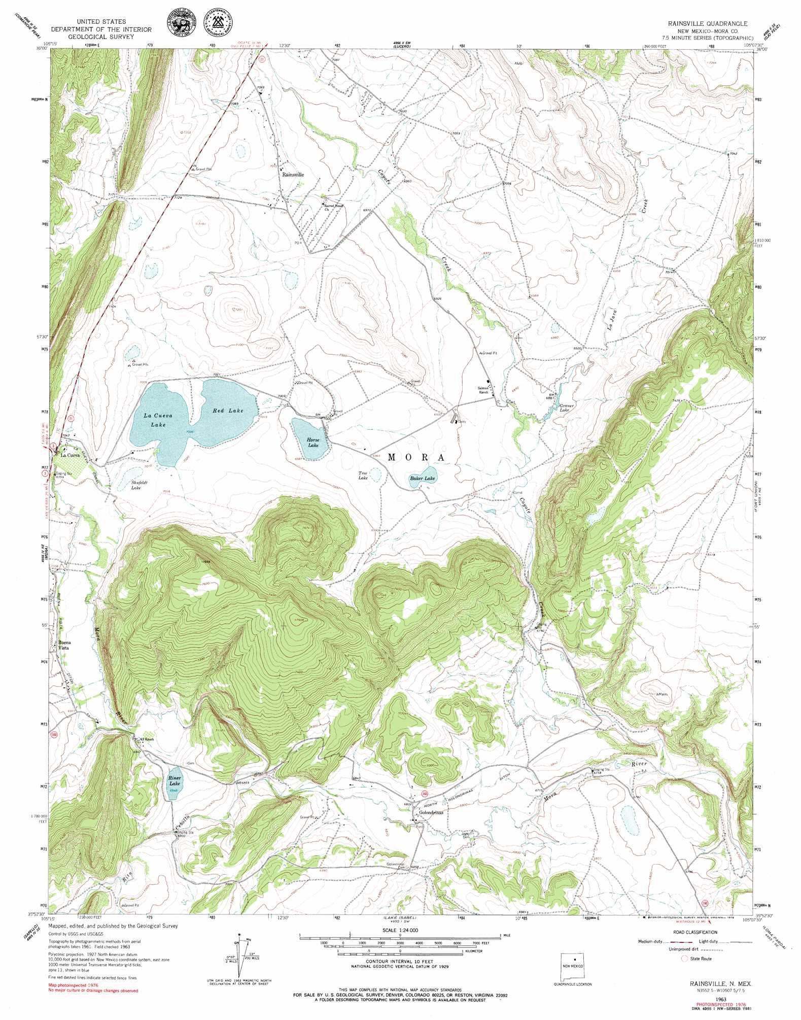
USGS Topo Quad 35105h2 - 1:24,000 scale
| Topo Map Name: | Rainsville |
| USGS Topo Quad ID: | 35105h2 |
| Print Size: | ca. 21 1/4" wide x 27" high |
| Southeast Coordinates: | 35.875° N latitude / 105.125° W longitude |
| Map Center Coordinates: | 35.9375° N latitude / 105.1875° W longitude |
| U.S. State: | NM |
| Filename: | o35105h2.jpg |
| Download Map JPG Image: | Rainsville topo map 1:24,000 scale |
| Map Type: | Topographic |
| Topo Series: | 7.5´ |
| Map Scale: | 1:24,000 |
| Source of Map Images: | United States Geological Survey (USGS) |
| Alternate Map Versions: |
Rainsville NM 1963, updated 1965 Download PDF Buy paper map Rainsville NM 1963, updated 1979 Download PDF Buy paper map Rainsville NM 2010 Download PDF Buy paper map Rainsville NM 2013 Download PDF Buy paper map Rainsville NM 2017 Download PDF Buy paper map |
1:24,000 Topo Quads surrounding Rainsville
Cerro Vista |
Chacon |
Guadalupita |
Ocate |
Mora Ranch |
Holman |
Comanche Peak |
Lucero |
Ojo Feliz |
Cerro Negro |
Gascon |
Mora |
Rainsville |
Fort Union |
Maxson Crater |
Rociada |
Sapello |
Lake Isabel |
Loma Parda |
Watrous |
El Porvenir |
Montezuma |
Las Vegas Nw |
Onava |
Goetsch Lake |
> Back to 35105e1 at 1:100,000 scale
> Back to 35104a1 at 1:250,000 scale
> Back to U.S. Topo Maps home
Rainsville topo map: Gazetteer
Rainsville: Canals
Buena Vista Ditch elevation 2127m 6978′La Cueva Canal elevation 2142m 7027′
North Golondrinas Ditch elevation 2080m 6824′
Rainsville: Dams
La Cueva Dam Number One elevation 2137m 7011′Red Lake La Cueva Dam Number Two elevation 2138m 7014′
Rainsville: Gaps
Puerto del Venado Alazán elevation 2183m 7162′Rainsville: Lakes
Baker Lake elevation 2109m 6919′La Cueva Lake elevation 2137m 7011′
Shufeldt Lake elevation 2137m 7011′
Tree Lake elevation 2120m 6955′
Rainsville: Populated Places
Buena Vista elevation 2130m 6988′Golondrinas elevation 2079m 6820′
La Cueva elevation 2141m 7024′
Rainsville elevation 2147m 7043′
Rainsville: Post Offices
Buena Vista Post Office (historical) elevation 2130m 6988′La Cueva Post Office (historical) elevation 2141m 7024′
Rainsville Post Office elevation 2147m 7043′
Rainsville: Reservoirs
Grauer Lake elevation 2096m 6876′Horse Lake elevation 2129m 6984′
La Cueva Reservoir elevation 2137m 7011′
Red Lake elevation 2137m 7011′
Riner Lake elevation 2122m 6961′
Rainsville: Streams
Coyote Creek elevation 2048m 6719′La Jara Creek elevation 2090m 6856′
Rito Cebolla elevation 2090m 6856′
Rainsville digital topo map on disk
Buy this Rainsville topo map showing relief, roads, GPS coordinates and other geographical features, as a high-resolution digital map file on DVD: