Price Topo Map Virginia
To zoom in, hover over the map of Price
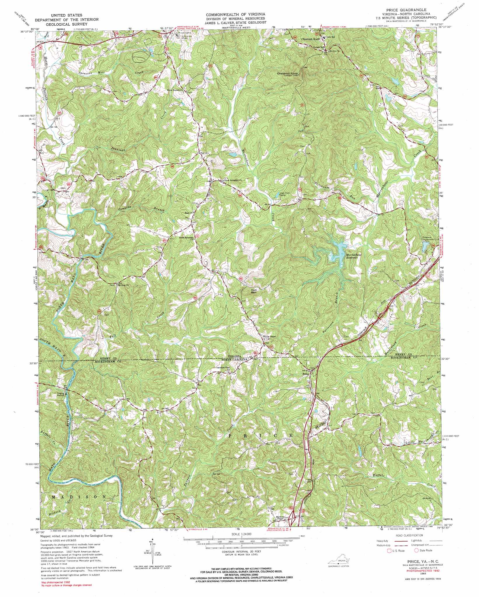
USGS Topo Quad 36079e8 - 1:24,000 scale
| Topo Map Name: | Price |
| USGS Topo Quad ID: | 36079e8 |
| Print Size: | ca. 21 1/4" wide x 27" high |
| Southeast Coordinates: | 36.5° N latitude / 79.875° W longitude |
| Map Center Coordinates: | 36.5625° N latitude / 79.9375° W longitude |
| U.S. States: | VA, NC |
| Filename: | o36079e8.jpg |
| Download Map JPG Image: | Price topo map 1:24,000 scale |
| Map Type: | Topographic |
| Topo Series: | 7.5´ |
| Map Scale: | 1:24,000 |
| Source of Map Images: | United States Geological Survey (USGS) |
| Alternate Map Versions: |
Price NC 1964, updated 1966 Download PDF Buy paper map Price NC 1964, updated 1985 Download PDF Buy paper map Price NC 2011 Download PDF Buy paper map Price NC 2013 Download PDF Buy paper map Price NC 2016 Download PDF Buy paper map |
1:24,000 Topo Quads surrounding Price
Charity |
Philpott Reservoir |
Bassett |
Snow Creek |
Mountain Valley |
Patrick Springs |
Sanville |
Martinsville West |
Martinsville East |
Axton |
Nettleridge |
Spencer |
Price |
Northwest Eden |
Northeast Eden |
Danbury |
Ayersville |
Mayodan |
Southwest Eden |
Southeast Eden |
Walnut Cove |
Belews Lake |
Ellisboro |
Bethany |
Reidsville |
> Back to 36079e1 at 1:100,000 scale
> Back to 36078a1 at 1:250,000 scale
> Back to U.S. Topo Maps home
Price topo map: Gazetteer
Price: Airports
Pace Airport elevation 232m 761′Price: Bridges
Anglins Bridge elevation 224m 734′Price: Dams
Marrowbone Creek Number One Dam elevation 241m 790′Price: Populated Places
Chestnut Knob elevation 341m 1118′Lakewood Forest elevation 347m 1138′
Price elevation 319m 1046′
Price: Reservoirs
Marrowbone Reservoir elevation 248m 813′Price: Streams
Buffalo Creek elevation 208m 682′Fall Creek elevation 234m 767′
Hickory Creek elevation 204m 669′
Horse Pasture Creek elevation 248m 813′
Jennings Creek elevation 249m 816′
Jumping Branch elevation 252m 826′
Muddy Creek elevation 253m 830′
North Mayo River elevation 238m 780′
North Mayo River elevation 238m 780′
Patterson Branch elevation 238m 780′
South Mayo River elevation 234m 767′
Spencers Mill Creek elevation 248m 813′
Stillhouse Run elevation 233m 764′
Price: Summits
Chestnut Knob elevation 448m 1469′Holt Mountain elevation 372m 1220′
Price digital topo map on disk
Buy this Price topo map showing relief, roads, GPS coordinates and other geographical features, as a high-resolution digital map file on DVD:
Western Virginia & Southern West Virginia
Buy digital topo maps: Western Virginia & Southern West Virginia