Bottom Topo Map North Carolina
To zoom in, hover over the map of Bottom
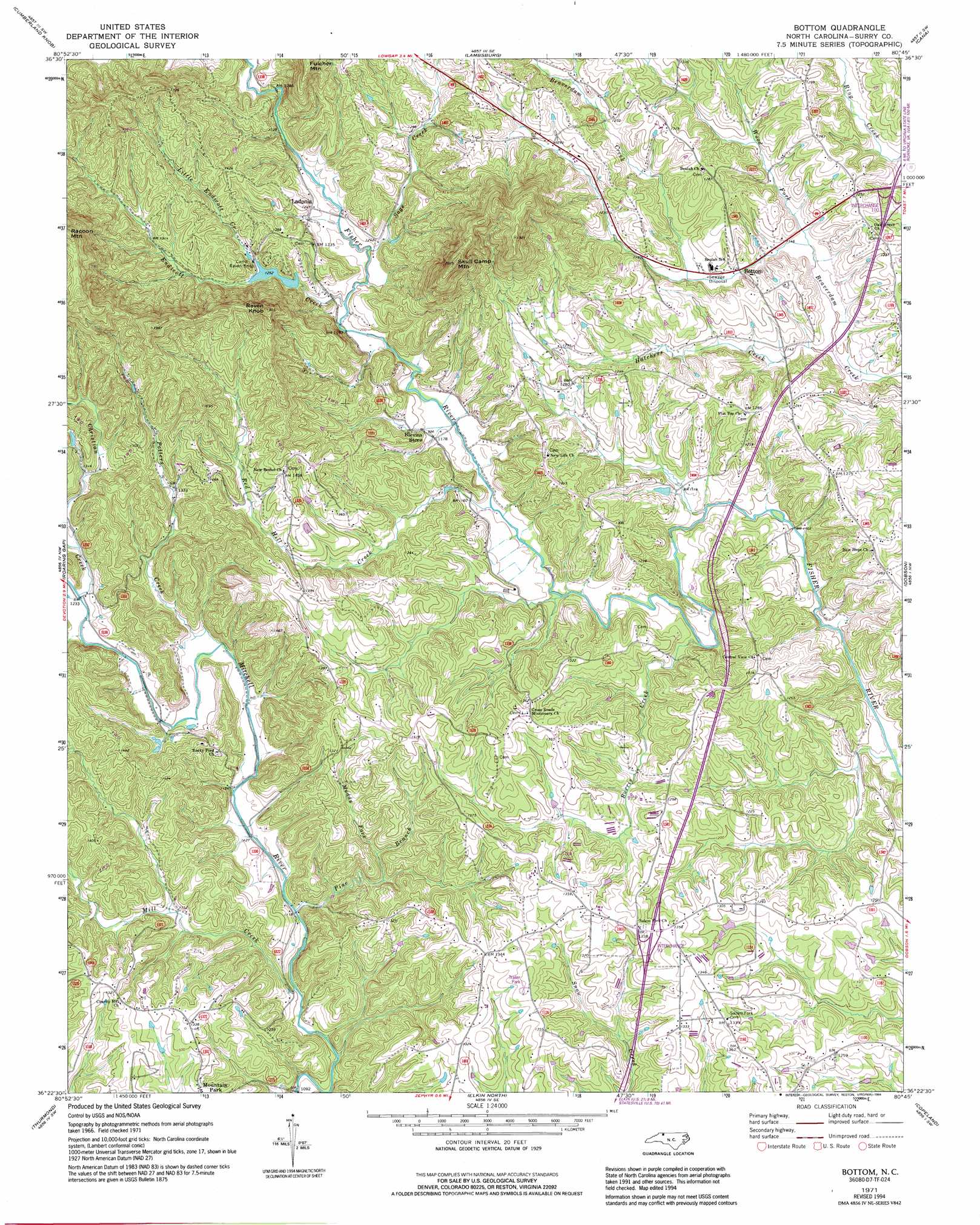
USGS Topo Quad 36080d7 - 1:24,000 scale
| Topo Map Name: | Bottom |
| USGS Topo Quad ID: | 36080d7 |
| Print Size: | ca. 21 1/4" wide x 27" high |
| Southeast Coordinates: | 36.375° N latitude / 80.75° W longitude |
| Map Center Coordinates: | 36.4375° N latitude / 80.8125° W longitude |
| U.S. State: | NC |
| Filename: | o36080d7.jpg |
| Download Map JPG Image: | Bottom topo map 1:24,000 scale |
| Map Type: | Topographic |
| Topo Series: | 7.5´ |
| Map Scale: | 1:24,000 |
| Source of Map Images: | United States Geological Survey (USGS) |
| Alternate Map Versions: |
Bottom NC 1971, updated 1973 Download PDF Buy paper map Bottom NC 1971, updated 1992 Download PDF Buy paper map Bottom NC 1971, updated 1994 Download PDF Buy paper map Bottom NC 2000, updated 2003 Download PDF Buy paper map Bottom NC 2010 Download PDF Buy paper map Bottom NC 2013 Download PDF Buy paper map Bottom NC 2016 Download PDF Buy paper map |
1:24,000 Topo Quads surrounding Bottom
Brierpatch Mountain |
Galax |
Woodlawn |
Fancy Gap |
Laurel Fork |
Sparta East |
Cumberland Knob |
Lambsburg |
Cana |
Mount Airy North |
Glade Valley |
Roaring Gap |
Bottom |
Dobson |
Mount Airy South |
Traphill |
Thurmond |
Elkin North |
Copeland |
Siloam |
Roaring River |
Ronda |
Elkin South |
Yadkinville |
East Bend |
> Back to 36080a1 at 1:100,000 scale
> Back to 36080a1 at 1:250,000 scale
> Back to U.S. Topo Maps home
Bottom topo map: Gazetteer
Bottom: Dams
Chryson Lake Dam elevation 433m 1420′Raven Knob Park Lake Dam elevation 389m 1276′
Bottom: Populated Places
Bottom elevation 348m 1141′Ladonia elevation 379m 1243′
Oak Grove elevation 380m 1246′
Salemfork elevation 408m 1338′
Bottom: Reservoirs
Chryson Lake elevation 433m 1420′Raven Knob Park Lake elevation 389m 1276′
Bottom: Streams
Burris Creek elevation 342m 1122′Christian Creek elevation 373m 1223′
Endicott Creek elevation 361m 1184′
Flat Branch elevation 349m 1145′
Hatchers Creek elevation 335m 1099′
Little Endicott Creek elevation 378m 1240′
Mill Creek elevation 332m 1089′
Muddy Fork elevation 359m 1177′
Pine Branch elevation 335m 1099′
Potters Creek elevation 354m 1161′
Red Hill Creek elevation 352m 1154′
Sage Creek elevation 364m 1194′
Wood Fork elevation 341m 1118′
Bottom: Summits
Fulcher Mountain elevation 540m 1771′Raven Knob elevation 578m 1896′
Skull Camp Mountain elevation 632m 2073′
Warrior Mountain elevation 596m 1955′
Bottom digital topo map on disk
Buy this Bottom topo map showing relief, roads, GPS coordinates and other geographical features, as a high-resolution digital map file on DVD:
Western Virginia & Southern West Virginia
Buy digital topo maps: Western Virginia & Southern West Virginia