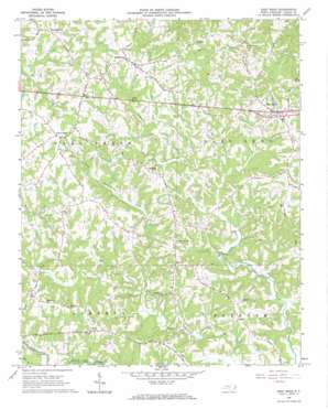
East Bend Topo Map North Carolina
To zoom in, hover over the map of East Bend
USGS Topo Quad 36080b5 - 1:24,000 scale
| Topo Map Name: | East Bend |
| USGS Topo Quad ID: | 36080b5 |
| Print Size: | ca. 21 1/4" wide x 27" high |
| Southeast Coordinates: | 36.125° N latitude / 80.5° W longitude |
| Map Center Coordinates: | 36.1875° N latitude / 80.5625° W longitude |
| U.S. State: | NC |
| Filename: | o36080b5.jpg |
| Download Map JPG Image: | East Bend topo map 1:24,000 scale |
| Map Type: | Topographic |
| Topo Series: | 7.5´ |
| Map Scale: | 1:24,000 |
| Source of Map Images: | United States Geological Survey (USGS) |
| Alternate Map Versions: |
East Bend NC 1966, updated 1967 Download PDF Buy paper map East Bend NC 2010 Download PDF Buy paper map East Bend NC 2013 Download PDF Buy paper map East Bend NC 2016 Download PDF Buy paper map |
1:24,000 Topo Quads surrounding East Bend
> Back to 36080a1 at 1:100,000 scale
> Back to 36080a1 at 1:250,000 scale
> Back to U.S. Topo Maps home
East Bend topo map: Gazetteer
East Bend: Airports
Yadkin County Airport elevation 280m 918′East Bend: Dams
Brown Lake Dam elevation 286m 938′Phillips Pond Dam elevation 242m 793′
East Bend: Populated Places
Baltimore elevation 275m 902′East Bend elevation 324m 1062′
Five Forks elevation 338m 1108′
Forbush elevation 312m 1023′
Poindexter elevation 342m 1122′
Richmond Hill elevation 330m 1082′
Shady Grove elevation 278m 912′
Smithtown elevation 336m 1102′
Sugartown elevation 301m 987′
Union Cross elevation 316m 1036′
Union Grove elevation 329m 1079′
East Bend: Post Offices
Tracadia Post Office (historical) elevation 275m 902′East Bend: Reservoirs
Brown Lake elevation 286m 938′Phillips Pond elevation 242m 793′
East Bend: Streams
Little Forbush Creek elevation 234m 767′Loney Creek elevation 222m 728′
Mill Branch elevation 218m 715′
East Bend digital topo map on disk
Buy this East Bend topo map showing relief, roads, GPS coordinates and other geographical features, as a high-resolution digital map file on DVD:
Western Virginia & Southern West Virginia
Buy digital topo maps: Western Virginia & Southern West Virginia


